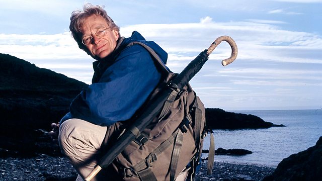
Greenville Collins Map Man
Similar Content
Browse content similar to Greenville Collins. Check below for episodes and series from the same categories and more!
Transcript
| Line | From | To | |
|---|---|---|---|
This is the Lizard, the most southerly point of mainland Britain. | 0:00:03 | 0:00:07 | |
For sailors on the high seas, this was the one piece of land | 0:00:07 | 0:00:11 | |
they could reliably pick out as they tried to head up the English Channel. | 0:00:11 | 0:00:15 | |
But this tranquil beauty spot was also a death trap. | 0:00:15 | 0:00:19 | |
To avoid being wrecked, you have to know where you are. | 0:00:21 | 0:00:25 | |
Think what it was like in the 1600s when you only had sketchy charts | 0:00:25 | 0:00:30 | |
and when ships could be lured onto rocks by wreckers. | 0:00:30 | 0:00:34 | |
Then, in 1693, along came Greenville Collins' "Coasting Pilot", | 0:00:34 | 0:00:38 | |
the first complete survey of British coasts, | 0:00:38 | 0:00:40 | |
their harbours and those treacherous rocks. | 0:00:40 | 0:00:43 | |
But how did Collins do it? Over the next few days, | 0:00:48 | 0:00:51 | |
I'll be sailing along the hazardous Cornish coast in the kind of ship Collins used. | 0:00:51 | 0:00:56 | |
I want to find out the secrets of his achievement. | 0:00:56 | 0:00:59 | |
How did he avoid shipwreck himself? | 0:00:59 | 0:01:02 | |
And can I use his charts to navigate some of the most dangerous rocks and reefs in the world? | 0:01:02 | 0:01:08 | |
What Greenville Collins did was to show the captains of great ships | 0:01:35 | 0:01:39 | |
exactly where they were on the open sea. | 0:01:39 | 0:01:42 | |
The rum lines which crisscrossed his maps | 0:01:42 | 0:01:45 | |
provided the compass bearings needed to set an accurate course. | 0:01:45 | 0:01:49 | |
For the first time, men who'd been in constant danger of shipwreck | 0:01:49 | 0:01:53 | |
could work out the exact route they should take, the rocks to avoid | 0:01:53 | 0:01:57 | |
and the directions to safe anchorages. | 0:01:57 | 0:02:00 | |
It was the best possible guide to Britain's sea coast and harbours, | 0:02:00 | 0:02:04 | |
and it revolutionised British chart-making. | 0:02:04 | 0:02:08 | |
To find out how Collins did it, I've come to Cornwall, | 0:02:10 | 0:02:15 | |
whose coast he mapped in the first year of his survey. | 0:02:15 | 0:02:18 | |
I'll be sailing on the Phoenix | 0:02:18 | 0:02:20 | |
from here at Charlestown to Falmouth, | 0:02:20 | 0:02:23 | |
down to the Lizard, then from there | 0:02:23 | 0:02:25 | |
to one of the deadliest offshore rocks, the Eddystone. | 0:02:25 | 0:02:28 | |
The kind of place that sends a tingle of fear down your spine, | 0:02:28 | 0:02:32 | |
not least because I'll be trying to sail there | 0:02:32 | 0:02:36 | |
using techniques and instruments that Collins used 300 years ago. | 0:02:36 | 0:02:40 | |
Back in the late 17th century, Britain was a huge sea power | 0:02:54 | 0:02:58 | |
and all her imports and exports had to go by sea. | 0:02:58 | 0:03:03 | |
But before Collins, the only published charts were Dutch | 0:03:03 | 0:03:07 | |
and they lacked detail. | 0:03:07 | 0:03:09 | |
At the time, the diarist Samuel Pepys was secretary to the Navy. | 0:03:09 | 0:03:13 | |
He realised that British sailors were in desperate need | 0:03:13 | 0:03:17 | |
of a new, much more accurate survey. | 0:03:17 | 0:03:20 | |
Greenville Collins was given the task. | 0:03:20 | 0:03:24 | |
Collins was chosen because he was a highly experienced Naval officer. | 0:03:24 | 0:03:29 | |
He'd sailed as a captain in the South Seas, | 0:03:29 | 0:03:32 | |
he'd fought Turkish pirates in the Mediterranean | 0:03:32 | 0:03:35 | |
and, on a voyage of discovery to find a northwest passage to China, | 0:03:35 | 0:03:39 | |
he'd been shipwrecked in the Arctic for two months. | 0:03:39 | 0:03:42 | |
And he'd also produced maps of the South American coast, | 0:03:42 | 0:03:46 | |
of the Mediterranean and of Falmouth. He was a man who was up for the job. | 0:03:46 | 0:03:51 | |
Collins began with the English Channel, | 0:03:52 | 0:03:57 | |
the most dangerous stretch of British coastal water. | 0:03:57 | 0:04:00 | |
Britain was then at war with the Dutch. | 0:04:00 | 0:04:04 | |
The Channel was their battlefield. | 0:04:04 | 0:04:07 | |
Dutch privateers, the state-sponsored terrorists of the day, roamed the Channel | 0:04:07 | 0:04:11 | |
looking for ships they could capture and hold to ransom. | 0:04:11 | 0:04:15 | |
And, even close to shore, you could be attacked by Barbary pirates | 0:04:15 | 0:04:20 | |
or drawn onto the rocks by wreckers who used fake warning lights | 0:04:20 | 0:04:25 | |
to wreck your ship and steal your cargo. | 0:04:25 | 0:04:28 | |
These were good reasons for plotting your course with care. | 0:04:28 | 0:04:32 | |
But calculating your position at sea was fraught with difficulty. | 0:04:32 | 0:04:36 | |
There was no reliable way of determining longitude, | 0:04:36 | 0:04:40 | |
so you couldn't tell with accuracy how far east or west you were. | 0:04:40 | 0:04:44 | |
And most ships, at some point on their voyage, got it wrong. | 0:04:44 | 0:04:48 | |
It would be nearly a century | 0:04:48 | 0:04:50 | |
before ships could fix their exact position mid-ocean. | 0:04:50 | 0:04:54 | |
In the meantime, most ships tried to sail close to land, | 0:04:54 | 0:04:58 | |
which gave them landmarks they could recognise. | 0:04:58 | 0:05:01 | |
But it also increased the risk of shipwreck. | 0:05:01 | 0:05:04 | |
Collins was convinced that accurate maps were the answer. | 0:05:10 | 0:05:14 | |
He spent seven years | 0:05:14 | 0:05:16 | |
producing 140 manuscript charts of the British coast. | 0:05:16 | 0:05:20 | |
Question number one is how did you map a coast in the 1680s? | 0:05:20 | 0:05:25 | |
Collins carried out a running traverse. So, what's that? | 0:05:27 | 0:05:32 | |
Well, it means plotting coastal features from two angles. | 0:05:32 | 0:05:37 | |
Put a cross where they intersect and that's the position of the feature. | 0:05:37 | 0:05:42 | |
Join up the crosses and there's your coastline. | 0:05:42 | 0:05:45 | |
With the help of first mate Luca Melzer, | 0:05:45 | 0:05:48 | |
I'm going to have a go. First, I have to fix the position of the ship | 0:05:48 | 0:05:52 | |
by taking a bearing from the ship to that headland over there. | 0:05:52 | 0:05:56 | |
And I make that...to be... | 0:05:56 | 0:05:59 | |
330 degrees from here. | 0:05:59 | 0:06:02 | |
-So, Luca, should we transfer that bearing onto the sketch map? -Yes. | 0:06:02 | 0:06:07 | |
We do that by lying the ruler on the chart | 0:06:07 | 0:06:11 | |
from the headland back towards our position. | 0:06:11 | 0:06:14 | |
We read off 330 degrees, draw the line. | 0:06:14 | 0:06:17 | |
I would say the distance from here to that headland is about... | 0:06:17 | 0:06:22 | |
-half a mile. -That's about right. | 0:06:22 | 0:06:24 | |
'The distance from the coast doesn't have to be precise, | 0:06:24 | 0:06:27 | |
'because what really matters is getting the exact position of the coastal features right.' | 0:06:27 | 0:06:34 | |
This is a perfect example of a piece of coast that needs mapping, | 0:06:34 | 0:06:37 | |
because you've got a port sitting between two very dangerous capes | 0:06:37 | 0:06:41 | |
and, off those capes, an even more lethal set of rocks. | 0:06:41 | 0:06:46 | |
Next, I'm going to take a sequence of compass bearings radiating out from the ship | 0:06:46 | 0:06:51 | |
at various points on the land that are essential to be mapped | 0:06:51 | 0:06:55 | |
if a ship is going to sail along this coastline safely. | 0:06:55 | 0:06:58 | |
If I start at the cape we've taken a bearing onto... So, 330... | 0:06:58 | 0:07:03 | |
-Then I can see a bay at 310 degrees. -310 degrees, yes. | 0:07:03 | 0:07:08 | |
Swivelling round, I can see a number of rocks. | 0:07:08 | 0:07:11 | |
-The first one's at...292. -292. | 0:07:11 | 0:07:15 | |
A real monster sticking up. | 0:07:15 | 0:07:18 | |
'This is a fantastically detailed exercise, | 0:07:18 | 0:07:21 | |
'particularly with the ship bobbing around. | 0:07:21 | 0:07:25 | |
'And these are nigh-on perfect conditions. Imagine doing this in a big swell!' | 0:07:25 | 0:07:30 | |
-How about using the first house? -On the cliff? | 0:07:30 | 0:07:34 | |
The left-hand end of the harbour wall we should have, shouldn't we...? | 0:07:34 | 0:07:39 | |
-225. -225, you say? | 0:07:39 | 0:07:42 | |
225, yes. | 0:07:42 | 0:07:44 | |
Then we've got rocks like crests. I'll start at the left-hand side. | 0:07:44 | 0:07:49 | |
2... | 0:07:49 | 0:07:51 | |
-215. -215. | 0:07:51 | 0:07:54 | |
-In the middle, the highest point sticking up, even above high tide, is 210. -210. | 0:07:54 | 0:08:01 | |
So that's the full round. Next thing to do is to lift the anchor | 0:08:01 | 0:08:06 | |
and sail in a dead straight line along the coast, | 0:08:06 | 0:08:09 | |
measuring the distance we cover. | 0:08:09 | 0:08:11 | |
-Easy. -Easy. | 0:08:16 | 0:08:18 | |
'And that poses another challenge. | 0:08:18 | 0:08:20 | |
'For the chart to be accurate, I have to know the exact distance I travel | 0:08:20 | 0:08:25 | |
'between the two fixed anchorages. And how do I work THAT out?' | 0:08:25 | 0:08:30 | |
There are two measurements we have to make. | 0:08:30 | 0:08:32 | |
The first is to record the time taken for the ship to sail between its two fixed points. | 0:08:32 | 0:08:38 | |
For that, we'll use an hourglass. | 0:08:38 | 0:08:40 | |
The second measurement we'll take is the ship's speed. | 0:08:40 | 0:08:44 | |
For that, we use this - a ship's log. | 0:08:44 | 0:08:46 | |
It's a wooden plate which acts like a brake in the water | 0:08:46 | 0:08:50 | |
and is attached to a line with knots in it. Hence "knot" for nautical speed. | 0:08:50 | 0:08:54 | |
I sling this in the water... and I feed the line out till I get to the first knot. | 0:08:54 | 0:09:00 | |
These knots are spaced so that a ten-second runner will give us a speed in nautical miles per hour. | 0:09:00 | 0:09:05 | |
If I hold this knot here and we start the ten-second timer now, | 0:09:05 | 0:09:09 | |
and I release the line... | 0:09:09 | 0:09:11 | |
and I count the knots as they run through my hands... One knot... | 0:09:11 | 0:09:16 | |
We must be approaching ten seconds. | 0:09:17 | 0:09:19 | |
-Here's a second knot... -Ten seconds. | 0:09:19 | 0:09:22 | |
Two nautical miles per hour. | 0:09:22 | 0:09:24 | |
I know how fast we're travelling. | 0:09:24 | 0:09:27 | |
Now I'll wait to see how long it's taken us to travel between the two fixed points. | 0:09:27 | 0:09:32 | |
I'll then know what the distance between those two points is. | 0:09:32 | 0:09:36 | |
Well, we've dropped anchor at the second of two fixed points | 0:09:40 | 0:09:44 | |
and now I have to identify all the same landmarks on the coast | 0:09:44 | 0:09:48 | |
and take the bearing to each of them. | 0:09:48 | 0:09:50 | |
Right, let's get the first headland in sight... | 0:09:52 | 0:09:55 | |
'We've sailed for half an hour, so the distance between the two anchorages | 0:09:55 | 0:10:00 | |
'is one nautical mile. | 0:10:00 | 0:10:02 | |
'If I put that calculation together with the two sets of bearings, | 0:10:02 | 0:10:06 | |
'I should get my coastline.' | 0:10:06 | 0:10:08 | |
Well, this is the moment of truth. We've got both anchorages mapped. | 0:10:08 | 0:10:13 | |
Here's our first anchorage... Second here. Radiating out from each | 0:10:13 | 0:10:17 | |
are all the bearings I took from both. | 0:10:17 | 0:10:20 | |
Now, where these radiating lines intersect - here, here and here - | 0:10:20 | 0:10:24 | |
those are my landmarks. | 0:10:24 | 0:10:26 | |
So, in theory, if I join up all these intersecting rays, | 0:10:26 | 0:10:30 | |
I should get the coastline that we're moored just off. | 0:10:30 | 0:10:35 | |
That's one headland...two headlands, then around the coast are rocks... | 0:10:35 | 0:10:40 | |
Now, here's the inlet, | 0:10:40 | 0:10:43 | |
the sheltered haven. Then it comes round here | 0:10:43 | 0:10:47 | |
and the coast comes all the way out towards the far headland. | 0:10:47 | 0:10:52 | |
Then there's one other very important feature to map - the rocks. | 0:10:52 | 0:10:57 | |
There they are. | 0:10:57 | 0:10:59 | |
I've managed to map one nautical mile | 0:10:59 | 0:11:02 | |
but it's taken the best part of a day in perfect conditions. | 0:11:02 | 0:11:06 | |
No wonder it took Collins seven years to map the entire British coastline! | 0:11:06 | 0:11:11 | |
I think I deserve a drink after all that. | 0:11:11 | 0:11:14 | |
That means a quick trip ashore. | 0:11:14 | 0:11:17 | |
Imagine you're a sea captain coming in out of the Atlantic in a gale. | 0:11:28 | 0:11:32 | |
You've rounded the Lizard and you urgently need a safe haven. | 0:11:32 | 0:11:36 | |
You look at Collins's chart of the English Channel and see | 0:11:36 | 0:11:39 | |
there is a place called Falmouth, | 0:11:39 | 0:11:42 | |
so you turn to the Falmouth page in the Coasting Pilot...and here it is, | 0:11:42 | 0:11:46 | |
and what you find is a beautiful large-scale map | 0:11:46 | 0:11:50 | |
of the Falmouth anchorage | 0:11:50 | 0:11:52 | |
with everything you need to know marked on it. | 0:11:52 | 0:11:54 | |
I'm coming in from the south | 0:11:54 | 0:11:57 | |
and the hazards are all laid out very clearly for me. | 0:11:57 | 0:12:00 | |
For example, rocks - little black crosses, showing you where not to go. | 0:12:00 | 0:12:04 | |
He's got the sandbanks and mudbanks | 0:12:04 | 0:12:07 | |
marked with stippled areas, so I can't take my ship there. | 0:12:07 | 0:12:10 | |
And the numbers all over this map refer to depths in fathoms, | 0:12:10 | 0:12:14 | |
all over the main sailing areas. | 0:12:14 | 0:12:17 | |
They range from 18 fathoms here to only half a fathom up here. | 0:12:17 | 0:12:22 | |
So we know where the hazards are... Where do you drop anchor? | 0:12:22 | 0:12:26 | |
Well, Collins has helped by putting | 0:12:26 | 0:12:29 | |
little anchor symbols in the places where it's best to drop anchor. | 0:12:29 | 0:12:32 | |
Around Carrock Road are anchors | 0:12:32 | 0:12:34 | |
where you can safely moor up for the night. | 0:12:34 | 0:12:37 | |
Look at this incredibly beautiful cartouche in the top left-hand corner | 0:12:37 | 0:12:41 | |
of the Falmouth map. | 0:12:41 | 0:12:43 | |
In this cartouche are people going about their normal Cornish business. | 0:12:43 | 0:12:47 | |
For example, there are two tin miners or lead miners. | 0:12:47 | 0:12:51 | |
There's a fisherman picking up fish. | 0:12:51 | 0:12:53 | |
There are two men putting what look like herrings in a pickling barrel. | 0:12:53 | 0:12:57 | |
It was very difficult making money from the land and the sea then, | 0:12:57 | 0:13:01 | |
so most of these characters were supplementing their income | 0:13:01 | 0:13:04 | |
from another means - smuggling. | 0:13:04 | 0:13:07 | |
'Well, it's been a long day, | 0:13:08 | 0:13:10 | |
'but now I have a good idea of how Collins did his meticulous survey | 0:13:10 | 0:13:15 | |
'and tomorrow I want to answer two more questions | 0:13:15 | 0:13:18 | |
'about Collins's chart. | 0:13:18 | 0:13:20 | |
'Can I really use it today to sail into Falmouth Harbour? | 0:13:20 | 0:13:24 | |
'And was it any help in catching those smugglers? | 0:13:24 | 0:13:27 | |
'Heading off to Falmouth now, | 0:13:35 | 0:13:38 | |
'Collins's chart of Falmouth Harbour looks like an absolute masterpiece. | 0:13:38 | 0:13:43 | |
'So, with the extra help of his written instructions, | 0:13:43 | 0:13:46 | |
'can I navigate our way in?' Collins says the first thing to look out for | 0:13:46 | 0:13:51 | |
is "Pendennis Castle, which standeth on a hill | 0:13:51 | 0:13:54 | |
"on the west side of the harbour's mouth." | 0:13:54 | 0:13:57 | |
He's also provided a shore profile | 0:13:57 | 0:13:59 | |
which marks Pendennis Castle here, | 0:13:59 | 0:14:02 | |
standing on a very pronounced hill | 0:14:02 | 0:14:04 | |
to the left of the harbour entrance, | 0:14:04 | 0:14:06 | |
which is just here, and he's written, | 0:14:06 | 0:14:08 | |
"Thus showeth the going into Falmouth | 0:14:08 | 0:14:11 | |
"when Pendennis Castle beareth north-west by north at two leagues." | 0:14:11 | 0:14:15 | |
Two leagues is about six miles. | 0:14:15 | 0:14:17 | |
We'll be coming into Falmouth at much closer in than two leagues, | 0:14:17 | 0:14:20 | |
but the view should be the same. All we've got to do | 0:14:20 | 0:14:23 | |
is spot Pendennis Castle on the shore | 0:14:23 | 0:14:25 | |
and line ourselves up for a north, north-west approach. | 0:14:25 | 0:14:28 | |
The Phoenix has reached exactly the right location. | 0:14:47 | 0:14:51 | |
I can see all the features that Collins told me to look for. | 0:14:51 | 0:14:54 | |
Here's Pendennis Castle, with its round tower, and there it is there. | 0:14:54 | 0:14:58 | |
The hill profile's the same, although Collins exaggerated the sloping | 0:14:58 | 0:15:01 | |
so it would catch seafarers' eyes. | 0:15:01 | 0:15:04 | |
To the right of it, the harbour entrance, | 0:15:04 | 0:15:07 | |
and above it is a wood that I can see | 0:15:07 | 0:15:09 | |
300 years after Collins drew his charts. | 0:15:09 | 0:15:12 | |
He warns us also of a rock | 0:15:12 | 0:15:15 | |
"which lieth in the harbour's mouth | 0:15:15 | 0:15:17 | |
"and lieth nearer the west shore than the east shore." | 0:15:17 | 0:15:20 | |
It's called Falmouth Rock and it's incredibly dangerous | 0:15:20 | 0:15:23 | |
because it's invisible at high tide. | 0:15:23 | 0:15:25 | |
Well, over there, I can see what looks like | 0:15:25 | 0:15:28 | |
a danger beacon on top of some sort of submerged obstable | 0:15:28 | 0:15:31 | |
and I think that's the rock. | 0:15:31 | 0:15:34 | |
Collins indicates that the best route in is on the east side of this rock. | 0:15:36 | 0:15:42 | |
"You may sail up the fairway keeping your lead," he says, | 0:15:42 | 0:15:46 | |
but how do you keep your lead? | 0:15:46 | 0:15:49 | |
Time to learn a bit about checking sea depths with a lead weight. | 0:15:50 | 0:15:53 | |
This looks like a child's skipping rope covered in coloured tassles. | 0:15:53 | 0:15:57 | |
Can you reassure me that it's actually a navigational instrument? | 0:15:57 | 0:16:01 | |
I can indeed. It's actually, if you look at it, | 0:16:01 | 0:16:04 | |
-got markings all the way round... -Oh, yes. -This is a half marking - | 0:16:04 | 0:16:08 | |
half a fathom, which is three feet, | 0:16:08 | 0:16:10 | |
-and the further we go down... -That's one fathom. -One fathom, | 0:16:10 | 0:16:14 | |
which is six foot. As we go down again, we'll find another fathom, | 0:16:14 | 0:16:17 | |
with another six foot between it. What these would be used for... | 0:16:17 | 0:16:21 | |
During the day, we wouldn't even have to haul it back up. | 0:16:21 | 0:16:24 | |
We would be able to tell from which tassle was at the surface | 0:16:24 | 0:16:27 | |
what our depth was | 0:16:27 | 0:16:29 | |
and at night-time we'd pull the material out and put it in our mouth | 0:16:29 | 0:16:33 | |
and you could tell the difference between the wool, cotton or leather | 0:16:33 | 0:16:37 | |
-and get some idea of how deep it is. -Brilliant. | 0:16:37 | 0:16:41 | |
The Phoenix needs at least three fathoms, or 18 feet, | 0:16:41 | 0:16:45 | |
to sail into harbour safely, so exactly how much water is down there? | 0:16:45 | 0:16:49 | |
The trick is to throw this without the coils getting tangled... | 0:16:49 | 0:16:53 | |
This is called swinging lead? | 0:16:53 | 0:16:56 | |
Swinging the lead, indeed. | 0:16:56 | 0:16:58 | |
One...two... | 0:16:58 | 0:17:01 | |
three! | 0:17:01 | 0:17:02 | |
-Good throw, even if I say it myself. -Yeah. Excellent. | 0:17:02 | 0:17:06 | |
-I felt it hit the bottom. -Did you? | 0:17:06 | 0:17:08 | |
Wait till it gets to you. Haul it in until it's taut. There we go. | 0:17:08 | 0:17:12 | |
Is that...? | 0:17:12 | 0:17:14 | |
That's it there. | 0:17:14 | 0:17:16 | |
-So we count from the cloth mark to the lead weight? -Yes. | 0:17:16 | 0:17:19 | |
-That's one fathom... -Yeah. | 0:17:19 | 0:17:21 | |
..two... | 0:17:23 | 0:17:24 | |
..three... | 0:17:27 | 0:17:29 | |
..four... | 0:17:30 | 0:17:31 | |
-It's five fathoms. -Five fathoms. Exactly. | 0:17:32 | 0:17:35 | |
'Five fathoms - about 30 feet. | 0:17:35 | 0:17:38 | |
'That's perfect. | 0:17:38 | 0:17:40 | |
'Incredible to think that using Collins's chart and directions | 0:17:40 | 0:17:44 | |
'and a lead weight on a bit of rope, | 0:17:44 | 0:17:46 | |
'we've navigated our way into Falmouth harbour - | 0:17:46 | 0:17:49 | |
'more evidence that Collins's work is valuable today, | 0:17:49 | 0:17:52 | |
'just as it was in the 1690s. | 0:17:52 | 0:17:55 | |
'So, what about those smugglers? | 0:17:59 | 0:18:02 | |
'I want to find some of the places they hid their contraband | 0:18:03 | 0:18:07 | |
'when the Customs and Excise men were chasing them.' | 0:18:07 | 0:18:10 | |
Line. | 0:18:10 | 0:18:12 | |
Thank you. | 0:18:12 | 0:18:13 | |
'Helford Sound is famous for its smuggling history. | 0:18:13 | 0:18:17 | |
'Collins shows it as an inlet, | 0:18:17 | 0:18:19 | |
'far too shallow for the Phoenix, | 0:18:19 | 0:18:21 | |
'so if I'm going to investigate the accuracy of this part of the chart, | 0:18:21 | 0:18:25 | |
'I'll have to find another way in.' | 0:18:25 | 0:18:28 | |
-Hello, Chris. -Hello. All right? | 0:18:30 | 0:18:32 | |
'Chris Bean was born and brought up on the Helford. | 0:18:32 | 0:18:36 | |
'An experienced local fisherman, | 0:18:36 | 0:18:38 | |
'he knows the estuary like the back of his hand.' | 0:18:38 | 0:18:42 | |
So, does Collins's 300-year-old version of Helford | 0:18:42 | 0:18:45 | |
match your modern mental map? | 0:18:45 | 0:18:47 | |
Yes, I think from the point of view | 0:18:47 | 0:18:50 | |
of an ocean-going sailing ship, | 0:18:50 | 0:18:53 | |
the approaches are good. | 0:18:53 | 0:18:55 | |
I think that the creeks | 0:18:55 | 0:18:57 | |
are poorly indicated, | 0:18:57 | 0:19:00 | |
but the smugglers would be quite happy to... | 0:19:00 | 0:19:04 | |
see the lack of information on the places that really matter! | 0:19:04 | 0:19:07 | |
-He left scope for Cornish smugglers. -Yeah. Maybe he's on the payroll. | 0:19:07 | 0:19:12 | |
'The backwaters of the Helford are notoriously tricky | 0:19:12 | 0:19:15 | |
'and far too dangerous for big ships, | 0:19:15 | 0:19:18 | |
'so did the smugglers have a free run of it?' | 0:19:18 | 0:19:21 | |
This is Frenchman's Creek, the most famous smugglers' creek in England. | 0:19:21 | 0:19:25 | |
-Yes, I suppose it is. -Through Daphne Du Maurier's novel. | 0:19:25 | 0:19:29 | |
Well, if you look around, you can see the little niches | 0:19:29 | 0:19:32 | |
and hideaway places. You could see a vessel tied up under the bank... | 0:19:32 | 0:19:37 | |
You could pull a rowing boat up under the boughs of the trees | 0:19:37 | 0:19:40 | |
-and it would disappear instantly. -That's right. | 0:19:40 | 0:19:43 | |
Especially at this time of year, with good foliage on the trees. | 0:19:43 | 0:19:47 | |
Lots of camouflage for a smuggler's boat. | 0:19:47 | 0:19:49 | |
It's such a long way from the main river that by the time you come up around these doglegs, | 0:19:49 | 0:19:55 | |
nobody would know you're here. | 0:19:55 | 0:19:57 | |
So this was both unmapped and a no-go area for the Customs and Excise? | 0:19:57 | 0:20:02 | |
Yes, around these creeks | 0:20:02 | 0:20:04 | |
there are footpaths and little bridle tracks | 0:20:04 | 0:20:08 | |
back to the landowners and the local villages, | 0:20:08 | 0:20:11 | |
so it would be easy enough to move stuff away by packhorse. | 0:20:11 | 0:20:15 | |
Spirit barrels away... Feels like an Amazonian backwater. It doesn't feel as if we're in Britain. | 0:20:15 | 0:20:20 | |
It's a lost world. | 0:20:20 | 0:20:22 | |
Onto the next leg of my journey. I want to sail down to the Lizard. | 0:20:38 | 0:20:42 | |
It was vital to sight the Lizard to get into the Channel. | 0:20:42 | 0:20:46 | |
Too far south and you could run onto the rocks of Brittany. | 0:20:46 | 0:20:50 | |
Too far north and you could be wrecked off Land's End. | 0:20:50 | 0:20:53 | |
The Lizard is also the obvious place | 0:20:53 | 0:20:56 | |
to start my really serious test of Collins's work. | 0:20:56 | 0:21:00 | |
I want to see whether I can sail | 0:21:00 | 0:21:02 | |
from the Lizard, off our starboard bow, all the way to Eddystone Rock, | 0:21:02 | 0:21:07 | |
38 nautical miles over there. | 0:21:07 | 0:21:09 | |
The Phoenix is bound for a single, lethal rock, out of sight beyond the horizon, | 0:21:09 | 0:21:14 | |
but on the way I'm going to put 17th-century methods of navigation, | 0:21:14 | 0:21:19 | |
and Collins's chart, to the test. | 0:21:19 | 0:21:21 | |
To make it a bit more of a challenge, | 0:21:24 | 0:21:26 | |
we're setting off just as the sun sets, | 0:21:26 | 0:21:29 | |
so the journey will involve sailing overnight. | 0:21:29 | 0:21:32 | |
To navigate, | 0:21:32 | 0:21:33 | |
the process we'll be using all the way to Eddystone | 0:21:33 | 0:21:36 | |
is called "dead reckoning". | 0:21:36 | 0:21:39 | |
Dead reckoning means keeping a record of the speed and the distance | 0:21:44 | 0:21:48 | |
you've sailed, but to do that you have to allow for the way the wind and tide can push you off course, | 0:21:48 | 0:21:53 | |
because none of us want to end up as another wreck on Eddystone Rock. | 0:21:53 | 0:21:57 | |
Of course, the other traditional navigational tool | 0:21:59 | 0:22:03 | |
on a clear night...is the stars, | 0:22:03 | 0:22:05 | |
but what do they tell you? | 0:22:05 | 0:22:07 | |
Can they really put you on an accurate course in the dead of night? | 0:22:07 | 0:22:12 | |
We've left the mainland behind. | 0:22:15 | 0:22:18 | |
We're sailing out to sea. It's a beautiful, clear night. | 0:22:18 | 0:22:21 | |
The sky's stuffed with stars, but where do you start? | 0:22:21 | 0:22:24 | |
Um...the best way to start would be probably with the Plough, | 0:22:24 | 0:22:28 | |
-which is part of the constellation of Great Bear... -Yeah. | 0:22:28 | 0:22:32 | |
..the most conspicuous constellation in the northern hemisphere. | 0:22:32 | 0:22:36 | |
You see you've got those two pointers, | 0:22:36 | 0:22:40 | |
-the last two stars in the blade... -On the end of the plough? | 0:22:40 | 0:22:44 | |
That's right. And they point | 0:22:44 | 0:22:46 | |
straight towards Polaris, the North Star or the Pole Star. | 0:22:46 | 0:22:50 | |
The Pole Star's standing up there all on its own, very clearly. | 0:22:50 | 0:22:55 | |
It's in the constellation of the Little Plough. | 0:22:55 | 0:22:58 | |
What does the Pole Star tell you? | 0:22:58 | 0:23:00 | |
The Pole Star tells you | 0:23:00 | 0:23:02 | |
the geographical pole, | 0:23:02 | 0:23:04 | |
so if you are heading towards the Pole Star, you'll be heading north, | 0:23:04 | 0:23:08 | |
and the other important bit is | 0:23:08 | 0:23:10 | |
if you imagine the arc between the horizon and the Pole Star, | 0:23:10 | 0:23:15 | |
that should give you a latitude, your latitude. | 0:23:15 | 0:23:18 | |
So that one star will tell you | 0:23:18 | 0:23:21 | |
your compass direction and how far north or south you are on the globe. | 0:23:21 | 0:23:25 | |
That's right. | 0:23:25 | 0:23:27 | |
'We could be in the 1600s. | 0:23:29 | 0:23:32 | |
'This is sailing as Collins knew it. | 0:23:32 | 0:23:35 | |
'A still night, steering by the stars... | 0:23:35 | 0:23:40 | |
'the biggest map of all. | 0:23:40 | 0:23:42 | |
'Magical!' | 0:23:42 | 0:23:44 | |
We've been sailing all night on our dead-reckoning course, | 0:23:56 | 0:24:00 | |
but I'm wondering now how much we've been pushed sideways | 0:24:00 | 0:24:03 | |
by the wind and tide. Keith, are we on course or not? | 0:24:03 | 0:24:06 | |
I think we're close to course. | 0:24:06 | 0:24:08 | |
We've allowed for five degrees leeway for the effect of the wind. | 0:24:08 | 0:24:11 | |
The tides we can't be so sure of. | 0:24:11 | 0:24:14 | |
All this looks the same to me. | 0:24:14 | 0:24:16 | |
We're in a huge expanse of open sea. I can't tell one bit from another. | 0:24:16 | 0:24:20 | |
Have we got any way of double-checking our position? | 0:24:20 | 0:24:23 | |
Yes, we have here an instrument which Collins would have had, | 0:24:23 | 0:24:27 | |
which is a Davis quadrant. | 0:24:27 | 0:24:28 | |
Is this a later version of the old-fashioned cross-staff | 0:24:28 | 0:24:31 | |
-which used to burn out the eyes of navigators? -That's right, | 0:24:31 | 0:24:35 | |
but this one works on the basis of using the shadow of the sun. | 0:24:35 | 0:24:40 | |
-You stand with your back to the sun? -Correct. -OK. How do you use it? | 0:24:40 | 0:24:44 | |
-Hold it in your right hand... -Is this the eyehole you look through? | 0:24:44 | 0:24:48 | |
-Yes, which you line up with the horizon... -Got it. | 0:24:48 | 0:24:52 | |
I can see the shadow. | 0:24:52 | 0:24:55 | |
-Got the shadow on the slot... -And line up the slot with the horizon. | 0:24:55 | 0:24:58 | |
This slides up and down this calibrated scale. | 0:24:58 | 0:25:01 | |
OK, the shadow's meeting the slot meeting the horizon, | 0:25:01 | 0:25:05 | |
so I now take readings off this scale. OK. | 0:25:05 | 0:25:08 | |
-And add it to the scale on that side. -It says we've got | 0:25:08 | 0:25:11 | |
49 degrees...55 minutes. | 0:25:11 | 0:25:14 | |
And that would be reasonable. | 0:25:14 | 0:25:17 | |
-Is that our latitude? -Yeah. -And is that the right bit of sea? | 0:25:17 | 0:25:20 | |
-There or thereabouts. -I hope so. | 0:25:20 | 0:25:23 | |
Don't want to hit the rocks. | 0:25:23 | 0:25:25 | |
'Well, Keith seems confident, but I'm not so sure. | 0:25:28 | 0:25:32 | |
'I'm going to take a look up top. | 0:25:32 | 0:25:34 | |
'Strewth! | 0:25:37 | 0:25:39 | |
'This is not for the faint-hearted. | 0:25:39 | 0:25:41 | |
'One slip here and you're on the deck or in the sea. | 0:25:42 | 0:25:46 | |
'Still no sign. We're obviously some way off. | 0:25:50 | 0:25:54 | |
'Truth is I'm used to maps that show you exactly where you are. | 0:25:54 | 0:25:59 | |
'Sailing to Eddystone 17th-century-style | 0:25:59 | 0:26:03 | |
'seems a bit more hit-and-miss. | 0:26:03 | 0:26:05 | |
'And I don't just want to see the rock. I want to land on it. | 0:26:06 | 0:26:10 | |
'15 hours. It's been such a long haul. | 0:26:16 | 0:26:19 | |
'We've just trimmed the sails to increase our speed | 0:26:19 | 0:26:23 | |
'and I'm checking our course every five minutes. | 0:26:23 | 0:26:26 | |
'We must surely be very near now.' | 0:26:26 | 0:26:29 | |
There it is! Eddystone Rock. | 0:26:35 | 0:26:37 | |
38 miles and 16 hours after leaving the Lizard, we've got here! | 0:26:37 | 0:26:41 | |
OK, going for it... | 0:26:54 | 0:26:56 | |
Going for it... | 0:26:56 | 0:26:58 | |
Eddystone is the site | 0:27:02 | 0:27:04 | |
of the world's first lighthouse to be built on an offshore rock. | 0:27:04 | 0:27:08 | |
Work started here in 1696, | 0:27:08 | 0:27:10 | |
just three years after Collins' Coasting Pilot was published. | 0:27:10 | 0:27:14 | |
I got here! | 0:27:14 | 0:27:16 | |
The extraordinary thing about Collins's life | 0:27:42 | 0:27:46 | |
is that after all of his efforts | 0:27:46 | 0:27:48 | |
the establishment turned its back on him and his ideas, | 0:27:48 | 0:27:51 | |
alleging that his charts were not accurate enough. | 0:27:51 | 0:27:55 | |
History has decided differently. | 0:27:55 | 0:27:57 | |
Despite the establishment's dismissive attitude to his work, | 0:28:00 | 0:28:04 | |
Collins's charts proved a huge success. | 0:28:04 | 0:28:06 | |
They're a landmark in maritime history. | 0:28:06 | 0:28:09 | |
They safely brought home ships and sailors for over a century | 0:28:09 | 0:28:13 | |
and the charts we use today are their direct descendants - | 0:28:13 | 0:28:16 | |
Collins updated, if you like. | 0:28:16 | 0:28:18 | |
The Coasting Pilot confirmed Greenville Collins | 0:28:18 | 0:28:21 | |
as a pioneer of modern hydrography, | 0:28:21 | 0:28:24 | |
one of the greatest British map-makers of all time. | 0:28:24 | 0:28:27 | |
Subtitles by Audrey Flynn and Suzanne Macdonald BBC Broadcast 2004 | 0:28:27 | 0:28:34 | |
E-mail us at [email protected] | 0:28:34 | 0:28:38 |