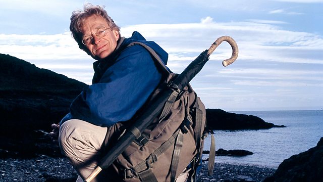
William Roy's Military Survey of Scotland Map Man
Similar Content
Browse content similar to William Roy's Military Survey of Scotland. Check below for episodes and series from the same categories and more!
Transcript
| Line | From | To | |
|---|---|---|---|
In Mapman I test historical maps. | 0:00:02 | 0:00:04 | |
Can they take me over landscapes like this - | 0:00:04 | 0:00:07 | |
the wildest and most beautiful in Britain? | 0:00:07 | 0:00:09 | |
Here in Scotland you get a sense for how savage geography can be. | 0:00:19 | 0:00:24 | |
In the last ice age, these mountains were covered in glaciers. | 0:00:24 | 0:00:28 | |
Around 11,000 years ago, when the ice melted, | 0:00:28 | 0:00:31 | |
the valleys were filled with water and deep, black lakes. | 0:00:31 | 0:00:35 | |
The people who lived among these mountains were tough | 0:00:37 | 0:00:41 | |
and a source of fear to those living in the warmer, richer south. | 0:00:41 | 0:00:46 | |
The Highlands were an unmapped void of sucking bogs, of tempests, and warlike clans. | 0:00:46 | 0:00:52 | |
To impose control, what you need is a good map. | 0:00:55 | 0:00:59 | |
So, in 1746, after the Battle Of Culloden, | 0:00:59 | 0:01:02 | |
the British Army commissioned one. And they gave a young man of 21, William Roy, the job. | 0:01:02 | 0:01:08 | |
Over the next few days, | 0:01:08 | 0:01:11 | |
I'll take a journey of over 100 miles across this map. | 0:01:11 | 0:01:14 | |
I'll be climbing a 2,000ft pass through the wild, rebellious heartland of 18th-century Scotland. | 0:01:14 | 0:01:20 | |
I'll discover just how Roy conducted his survey | 0:01:20 | 0:01:24 | |
and how much of the landscape he mapped can be seen today. | 0:01:24 | 0:01:28 | |
William Roy took nine years to produce a range of maps | 0:02:01 | 0:02:05 | |
detailing the geography of Scotland for hundreds of miles. | 0:02:05 | 0:02:09 | |
Packed with information, beautiful to look at, | 0:02:09 | 0:02:12 | |
they combine brilliant surveying and delicate water-colouring. | 0:02:12 | 0:02:16 | |
Roy began his work with the Highlands. | 0:02:17 | 0:02:21 | |
These maps were so successful, he went on to survey all of Scotland. | 0:02:21 | 0:02:25 | |
But two mysteries surround him. Who exactly was William Roy? | 0:02:25 | 0:02:30 | |
And why have some of the roads he mapped completely disappeared? | 0:02:30 | 0:02:35 | |
I'm going to discover just how William Roy constructed his map. | 0:02:37 | 0:02:42 | |
How much of his geography can be seen today? | 0:02:42 | 0:02:45 | |
I'll follow a route Roy took, along Loch Ness and the terrifying Corrieyairick Pass to Loch Rannoch. | 0:02:45 | 0:02:51 | |
It's one of the wettest, coldest parts of the British Isles. | 0:02:51 | 0:02:56 | |
But it's a very good example of what Roy had to deal with. | 0:02:56 | 0:03:00 | |
Roy made his headquarters in one of the forts on Loch Ness. | 0:03:02 | 0:03:07 | |
And so I'm starting my journey at Fort George. | 0:03:07 | 0:03:11 | |
DRUMS BEAT MILITARY RHYTHM | 0:03:11 | 0:03:13 | |
Roy, as a man, remains a mystery, | 0:03:21 | 0:03:25 | |
but we do know a bit about his surveying. | 0:03:25 | 0:03:28 | |
A letter describes him working | 0:03:28 | 0:03:31 | |
with a non-commissioned officer and six soldiers. I'll do the same. | 0:03:31 | 0:03:36 | |
I'm joined by soldiers from D-company of the First Royal Irish Regiment, | 0:03:36 | 0:03:42 | |
based at Fort George. I'll do my own mini survey, | 0:03:42 | 0:03:45 | |
using Roy's methods and equipment - | 0:03:45 | 0:03:47 | |
two flags, a compass, and a chain. | 0:03:47 | 0:03:51 | |
The task I've given myself is to map a bend in a road Roy surveyed. | 0:03:52 | 0:03:57 | |
What Roy did was very simple. | 0:03:57 | 0:03:59 | |
He took two measurements. | 0:03:59 | 0:04:02 | |
The angle between the road and north | 0:04:02 | 0:04:05 | |
and the distance from him to the bend. | 0:04:05 | 0:04:08 | |
The first thing to do is to place a flag on that bend. | 0:04:08 | 0:04:13 | |
William Roy's military survey could not have been done | 0:04:13 | 0:04:16 | |
without this device - a compass. The wonderful thing is, its needle always points to magnetic north. | 0:04:16 | 0:04:23 | |
So here we are, standing here. We'll wait until the needle settles and I can see magnetic north is down here. | 0:04:23 | 0:04:30 | |
So I start at the point I'm standing with a table. | 0:04:30 | 0:04:33 | |
'I just line up the sights on my compass with the flag...' | 0:04:33 | 0:04:38 | |
And the angle that I measure is this one here - 130 degrees. | 0:04:38 | 0:04:43 | |
'Right, now the next job is to measure the distance to the bend. | 0:04:43 | 0:04:48 | |
'For that, Roy used a chain. But the chain doesn't reach the flag.' | 0:04:48 | 0:04:53 | |
So we need the second flag. | 0:04:53 | 0:04:55 | |
'So I've got to put a flag midway, line it up, and measure to that.' | 0:04:55 | 0:05:01 | |
'So, having got the distance to the halfway flag, | 0:05:04 | 0:05:09 | |
'the soldiers need to leapfrog on with the chain and measure between.' | 0:05:09 | 0:05:15 | |
You can hardly make yourself heard. The face freezes in the cold. | 0:05:15 | 0:05:20 | |
-50 metres to the bend. -50 metres. Let's write that down. | 0:05:20 | 0:05:24 | |
It's what William Roy would have done in circumstances like this. | 0:05:24 | 0:05:28 | |
Each time the road changes direction, | 0:05:28 | 0:05:32 | |
I mark it onto my sketch map | 0:05:32 | 0:05:35 | |
and then carry the table and compass and do the same again. It's simple. | 0:05:35 | 0:05:39 | |
Compass, bearing, measurement. Compass, bearing, measurement. | 0:05:39 | 0:05:43 | |
Time and again. Thousands of times until the Highlands were mapped, | 0:05:43 | 0:05:47 | |
using this little device here and an old metal chain. | 0:05:47 | 0:05:51 | |
Key to Roy's map are the military roads built by General Wade | 0:06:03 | 0:06:07 | |
about 20 years before Roy started his work. | 0:06:07 | 0:06:10 | |
They provided a framework | 0:06:10 | 0:06:12 | |
on which Roy could hang the other features of his survey. | 0:06:12 | 0:06:16 | |
This is General Wade's military road along the south side of Loch Ness. | 0:06:21 | 0:06:26 | |
In the 1740s, this was the front line. | 0:06:26 | 0:06:29 | |
On this side - the army, generals, infantry, Scots loyal to the King. | 0:06:29 | 0:06:34 | |
On that side - the wild country, mountains, moors, and the rebels. | 0:06:34 | 0:06:39 | |
I want to find out how on Earth they built this road. | 0:06:43 | 0:06:46 | |
These brush strokes suggest there was sheer rock to the waterline, | 0:06:46 | 0:06:52 | |
which the road had to cut through. | 0:06:52 | 0:06:55 | |
Graeme Ambrose, who's lived on the road for three years, | 0:06:55 | 0:06:59 | |
knows all about how it was done. | 0:06:59 | 0:07:01 | |
I'd read about this section called the black rock - | 0:07:01 | 0:07:05 | |
wonderfully descriptive pieces on it | 0:07:05 | 0:07:08 | |
about soldiers hanging down on ropes over the precipice, | 0:07:08 | 0:07:12 | |
over the water, and planting gunpowder | 0:07:12 | 0:07:15 | |
to blow this road. | 0:07:15 | 0:07:17 | |
I'm glad I've brought the umbrella! | 0:07:17 | 0:07:20 | |
Probably the best time to see it, Graeme. | 0:07:20 | 0:07:23 | |
It's dark and the rock does look bleak and sombre indeed. | 0:07:23 | 0:07:27 | |
You get a sense of what an achievement it was to build this road above a black rock like this. | 0:07:27 | 0:07:34 | |
-It's absolutely towering. -Yes. | 0:07:34 | 0:07:36 | |
So imagine William Roy standing on the top, looking across Loch Ness, | 0:07:36 | 0:07:42 | |
-with his sketchbook, mapping. -In this wilderness, which it was then. | 0:07:42 | 0:07:47 | |
-One of the most dramatic points on the road network. -Definitely. | 0:07:47 | 0:07:52 | |
What they did here, at the time, 2,000 yards of rock like this. Incredible achievement. | 0:07:52 | 0:07:58 | |
Like the military roads, William Roy's map was to be a new weapon in any future guerrilla war. | 0:08:13 | 0:08:20 | |
Previous maps of the Highlands had been largely guesswork | 0:08:20 | 0:08:24 | |
and that had allowed the rebels to flee into the hills, | 0:08:24 | 0:08:28 | |
confident no-one would follow them. | 0:08:28 | 0:08:30 | |
But Roy's map would provide the vital information the army needed. | 0:08:30 | 0:08:35 | |
In today's military language, what a soldier's interested in are the "goings" - | 0:08:36 | 0:08:41 | |
where you can go with heavy vehicles, infantry. | 0:08:41 | 0:08:44 | |
What Roy's military map does very well is show the soldiers' goings. | 0:08:44 | 0:08:49 | |
For example, the roads are marked here in brown lines. | 0:08:49 | 0:08:53 | |
The buildings are marked in red. | 0:08:53 | 0:08:56 | |
If there's a red line around a building on the map, | 0:08:56 | 0:09:00 | |
that means there's a stone wall, so it's a better defensive position. | 0:09:00 | 0:09:05 | |
But this is also a map of no-go areas. | 0:09:05 | 0:09:08 | |
The marshes and bogs on Rannoch Moor are marked with a blue tint, | 0:09:08 | 0:09:13 | |
to tell you not to go there. | 0:09:13 | 0:09:15 | |
Soldiers need feeding. So crops are marked with parallel lines, | 0:09:15 | 0:09:19 | |
tinted with yellow, where you can get food. | 0:09:19 | 0:09:23 | |
But maps are also incredibly interesting for what they leave off. | 0:09:23 | 0:09:28 | |
And Roy's military maps leave off | 0:09:28 | 0:09:31 | |
the single most important symbol of Highland culture - | 0:09:31 | 0:09:34 | |
the clan territories. This is Scotland as a dominion of Britain. | 0:09:34 | 0:09:39 | |
This is a victor's map - a map of suppression. | 0:09:39 | 0:09:42 | |
Well, this is my last bit of luxury before the really hard work begins. | 0:09:45 | 0:09:51 | |
Tomorrow I'm embarking on two days of gruelling walking through the terrifying Corrieyairick Pass, | 0:09:52 | 0:09:58 | |
all 2,500ft of it. | 0:09:58 | 0:10:01 | |
One writer in the 1700s said that it made him fear for his life, | 0:10:01 | 0:10:06 | |
so strong was the blast, so hard the rain, so very thick the mist. | 0:10:06 | 0:10:11 | |
As for the cold, it stupefied him. | 0:10:11 | 0:10:13 | |
But if Roy got through, I've got to. | 0:10:13 | 0:10:16 | |
For the British, no other place better symbolised guerrilla war than the Corrieyairick Pass. | 0:10:30 | 0:10:37 | |
When General Wade was building his road through it, | 0:10:37 | 0:10:40 | |
boulders as big as cannons were rolled down the hill at his workers. | 0:10:40 | 0:10:45 | |
And overnight, the course of a stream could mysteriously change | 0:10:45 | 0:10:49 | |
so that it flowed across the new road and washed it away. | 0:10:49 | 0:10:53 | |
William Roy would have been in similar danger, | 0:10:53 | 0:10:57 | |
but still surveyed every metre - whatever the weather. | 0:10:57 | 0:11:01 | |
The winds get up to 70mph here. | 0:11:02 | 0:11:05 | |
I've got about 16 miles walking ahead of me | 0:11:05 | 0:11:09 | |
and already it's remarkable how much of what Roy mapped I'm finding. | 0:11:09 | 0:11:15 | |
There is no key on William Roy's map to explain the symbols used. | 0:11:15 | 0:11:20 | |
On the Corrieyairick Pass, there are two strange circles marked. | 0:11:20 | 0:11:24 | |
One here, and another here. | 0:11:24 | 0:11:27 | |
At first I thought they were wells or springs for them to get water. | 0:11:27 | 0:11:32 | |
Now I think they're something else because there's no water or well. | 0:11:32 | 0:11:38 | |
I think they're actually vantage points. | 0:11:38 | 0:11:41 | |
Those circles represent a place where a soldier with a telescope | 0:11:41 | 0:11:46 | |
can watch the pass for any movement below and to plan an ambush. | 0:11:46 | 0:11:50 | |
There are endless hiding places up here. | 0:11:55 | 0:11:59 | |
It was ideal for concealed attack on a passing column of Redcoats. | 0:11:59 | 0:12:04 | |
And THAT'S what Bonnie Prince Charlie was thinking | 0:12:07 | 0:12:11 | |
when he marched troops up here in August 1745 to lie in wait. | 0:12:11 | 0:12:16 | |
But something spooked the British and they never showed. | 0:12:19 | 0:12:23 | |
Military roads were usually built on the Roman principle - | 0:12:39 | 0:12:43 | |
dead straight, cutting right through the landscape. | 0:12:43 | 0:12:47 | |
But Roy's map suggests some builders had to abandon military principles | 0:12:47 | 0:12:52 | |
and go with the geography. | 0:12:52 | 0:12:55 | |
The mountainside is too steep for the road to take a direct course. | 0:12:55 | 0:12:59 | |
So General Wade constructed a series of spectacular hairpin bends. | 0:12:59 | 0:13:04 | |
For 100 years, this was the highest public road in Britain. | 0:13:04 | 0:13:08 | |
On William Roy's map the hairpins show up as dramatic zigzags. | 0:13:08 | 0:13:12 | |
They seem to have been drawn in a hurry. Perhaps Roy wasn't too keen on hanging around here. | 0:13:13 | 0:13:20 | |
His location for the zigzags is incredibly accurate. | 0:13:20 | 0:13:24 | |
The OS has the zigzags at 57 degrees north, four degrees west. | 0:13:24 | 0:13:29 | |
That means Roy was less than 1km out. | 0:13:29 | 0:13:33 | |
Amazing surveying for the 1700s. | 0:13:33 | 0:13:35 | |
The weather's closing in. | 0:13:47 | 0:13:50 | |
You don't have to spend many hours in the Highlands to realise | 0:13:50 | 0:13:55 | |
this is an incredibly exposed slab of the Earth's crust. | 0:13:55 | 0:13:59 | |
Corrieyairick is the closest Britain comes to an Alpine pass. And up at 2,000ft, it's freezing. | 0:14:17 | 0:14:24 | |
There are several bridges that were built by General Wade when he put the military road over the top. | 0:14:31 | 0:14:38 | |
But only one is named on William Roy's map. | 0:14:38 | 0:14:41 | |
And he calls it Snugburrow Bridge. | 0:14:41 | 0:14:44 | |
Well, what does Snugburrow mean? I've been looking around beside me | 0:14:44 | 0:14:49 | |
for snug burrows, somewhere you can snuggle out of the wind and shelter. | 0:14:49 | 0:14:54 | |
I think that's what snugburrow means. It's a military bivouac site. | 0:14:54 | 0:14:58 | |
I'm quite sure William Roy used the site because he had to shelter from this appalling weather as well. | 0:14:58 | 0:15:05 | |
Anyway, I think I've found the bivouac site. Let's look down here. | 0:15:05 | 0:15:10 | |
The only place I can find that's sheltered from the wind | 0:15:10 | 0:15:14 | |
and underneath the bridge parapet, quite steep... | 0:15:14 | 0:15:18 | |
The amazing thing is, that stone is bone dry. | 0:15:21 | 0:15:25 | |
Down here, three or four men could lie between rows of moss-covered stones, | 0:15:25 | 0:15:30 | |
completely sheltered from the wind blasting overhead and the rain too. | 0:15:30 | 0:15:35 | |
This little bivouac site, here, is a wonderful example | 0:15:35 | 0:15:40 | |
of how a place name on a map can act as a window on old geographies. | 0:15:40 | 0:15:44 | |
This is where Roy's job must have been really tough. It's cold. | 0:15:49 | 0:15:54 | |
I'm less than halfway across, dusk's falling, | 0:15:54 | 0:15:58 | |
the road isn't bad, but once it's dark, you lose sense of direction. | 0:15:58 | 0:16:03 | |
Everything looks the same. | 0:16:03 | 0:16:06 | |
I'll stop here for the night. | 0:16:06 | 0:16:08 | |
This is actually a five-star bivouac site. | 0:16:10 | 0:16:13 | |
And, um...I've spent... | 0:16:13 | 0:16:16 | |
many months, even years, tramping mountains | 0:16:16 | 0:16:20 | |
and slept in far worse places than this. | 0:16:20 | 0:16:23 | |
This is...an absolute beauty. That's my bed for the night. | 0:16:23 | 0:16:27 | |
There's the doorway. | 0:16:27 | 0:16:30 | |
It's nice to get out of the weather | 0:16:30 | 0:16:32 | |
and it's completely windproof and out of the rain. | 0:16:32 | 0:16:36 | |
And the added bonus that, as I lie in this... | 0:16:36 | 0:16:40 | |
snug little burrow, I might be lying on the same spot | 0:16:40 | 0:16:44 | |
William Roy also slept on over 200 years ago. | 0:16:44 | 0:16:48 | |
I love that - sleeping with ghosts. | 0:16:48 | 0:16:50 | |
Last night was very wet and very cold but a gale has come over the mountains, ripped the sky apart, | 0:17:08 | 0:17:15 | |
and I've now got clear blue skies and enormous views. | 0:17:15 | 0:17:19 | |
I can see for miles. This is what the Highlands are about. I love it! | 0:17:19 | 0:17:23 | |
Out of the pass. My next stop is Kinloch Rannoch, | 0:17:36 | 0:17:39 | |
a medium-sized village at the eastern end of Loch Rannoch. | 0:17:39 | 0:17:43 | |
Apart from the map itself, | 0:17:43 | 0:17:46 | |
there are hardly any records of Roy's work. | 0:17:46 | 0:17:49 | |
All his field books have disappeared but there is a painting by the water-colourist Paul Sandby. | 0:17:49 | 0:17:56 | |
In the late 1740s, Sandby was the chief draughtsman on Roy's team. | 0:17:57 | 0:18:02 | |
This is "A View Near Loch Rannoch" | 0:18:05 | 0:18:07 | |
and was made from a point very near here. | 0:18:07 | 0:18:11 | |
It shows a surveyor with his compass and soldiers with a measuring chain. Incredibly, it also shows | 0:18:11 | 0:18:18 | |
an elegantly dressed woman. There were no women on Roy's survey. | 0:18:18 | 0:18:22 | |
A wife, perhaps? Who knows? | 0:18:22 | 0:18:25 | |
I want to find where Sandby stood when he made this drawing. | 0:18:25 | 0:18:29 | |
If I can do that, perhaps I can solve a map mystery that's been puzzling me for ages. | 0:18:29 | 0:18:35 | |
Could this painting be the crucial missing link in the Roy story? | 0:18:38 | 0:18:43 | |
Unfortunately, since Sandby's day they've built a reservoir here | 0:18:44 | 0:18:49 | |
and I suspect that his vantage point may now be under 30ft of water. | 0:18:49 | 0:18:54 | |
But it's only by going out there that I'm going to find out. | 0:18:57 | 0:19:01 | |
Ever since I saw this, | 0:19:27 | 0:19:30 | |
I've been fascinated by the man in the foreground. Is it William Roy? | 0:19:30 | 0:19:35 | |
If he is, there's no way of knowing | 0:19:35 | 0:19:38 | |
because part way through the survey, | 0:19:38 | 0:19:41 | |
Roy's original team was joined by others. | 0:19:41 | 0:19:44 | |
Then I discovered the painting is dated 1749. | 0:19:44 | 0:19:47 | |
Well, the other teams didn't join Roy until 1750. | 0:19:47 | 0:19:52 | |
So this painting shows William Roy's own surveying team | 0:19:52 | 0:19:56 | |
and the man in the blue coat has to be Roy himself. | 0:19:56 | 0:19:59 | |
Well, I was wrong about Sandby painting from the reservoir. | 0:20:06 | 0:20:10 | |
I'd better try again on dry land. | 0:20:10 | 0:20:12 | |
I've crossed onto the far side of the loch. | 0:20:12 | 0:20:16 | |
And at last the landscape in Sandby's painting is beginning to match the view across the valley. | 0:20:17 | 0:20:24 | |
I'm going up a slight rise here onto a bridge and I think this is the spot he used. | 0:20:24 | 0:20:30 | |
It is. This is it. | 0:20:31 | 0:20:33 | |
But why here? Why this scene? | 0:20:34 | 0:20:37 | |
I think the clue lies in the crag in the background of the picture. | 0:20:37 | 0:20:42 | |
I'm climbing Craigvar. | 0:21:01 | 0:21:03 | |
This is the peak in the Sandby painting. | 0:21:03 | 0:21:06 | |
I'm sure William Roy must have come up here. It's perfect for surveying. | 0:21:06 | 0:21:11 | |
Look at that! What an incredible view! | 0:21:11 | 0:21:15 | |
You can see EVERY detail in the landscape. | 0:21:15 | 0:21:18 | |
What a perfect observation platform for a mapmaker! | 0:21:18 | 0:21:22 | |
And now I can see why Kinloch Rannoch was so important. | 0:21:40 | 0:21:44 | |
Only about 400 people live here now but, believe it or not, in the 1750s | 0:21:44 | 0:21:49 | |
the population was over 2,500. | 0:21:49 | 0:21:52 | |
The government planned to make the village the centre of the Highlands. | 0:21:53 | 0:21:58 | |
Troops would police the region. To do that, they needed good roads. | 0:21:58 | 0:22:03 | |
In the 1740s, there was a good military road running north to south through the Highlands. | 0:22:04 | 0:22:10 | |
But there was nothing west from here to Fort William on the front line. | 0:22:10 | 0:22:16 | |
All they had to do was push a road along the shore of the loch, towards those distant mountains, | 0:22:16 | 0:22:23 | |
across the unmapped wilderness of Rannoch Moor. | 0:22:23 | 0:22:26 | |
And that is where I'm going next. | 0:22:26 | 0:22:29 | |
But I think it's going to have to wait until tomorrow. | 0:22:29 | 0:22:34 | |
Last day of my hike. | 0:22:49 | 0:22:51 | |
We know that the army planned a route across Rannoch Moor | 0:22:51 | 0:22:55 | |
and Roy's map shows the road heading westwards from Loch Rannoch. | 0:22:55 | 0:22:59 | |
But there's a mystery. Roy's road finishes at the edge of his map, just before the moor. | 0:22:59 | 0:23:05 | |
The question is, why? | 0:23:05 | 0:23:08 | |
I want to walk along the road on Roy's map, | 0:23:09 | 0:23:12 | |
so I must get across that river. | 0:23:12 | 0:23:15 | |
To wade across a river in the Highlands, get someone who knows what he's doing, like Charlie Pirie. | 0:23:17 | 0:23:24 | |
The rivers in this part are fast and dangerous, as winter approaches | 0:23:24 | 0:23:29 | |
and the water comes down from the hills. | 0:23:29 | 0:23:32 | |
So, Charlie, how can you tell a good place to cross a river this deep? | 0:23:37 | 0:23:42 | |
Well, you see the ripple where the rocks are? | 0:23:42 | 0:23:45 | |
-Yes. -People reckon that if you have the ripple, | 0:23:45 | 0:23:49 | |
you're actually getting where it's dangerous. | 0:23:49 | 0:23:53 | |
So we've got a calm bit here. Still quite deep but not so dangerous. | 0:23:53 | 0:23:58 | |
Tell you what, it's cold! You don't notice, then it's in your bones. | 0:23:58 | 0:24:04 | |
If you were lying in here, you'd have between nine and 15 minutes. | 0:24:04 | 0:24:09 | |
-Before you drown? -Before hypothermia comes in. | 0:24:09 | 0:24:13 | |
Nine or 15 minutes till you're dead. | 0:24:13 | 0:24:15 | |
You'd maybe get a wee bit more in summertime. | 0:24:15 | 0:24:20 | |
Charlie's a gamekeeper and runs his own survival courses | 0:24:21 | 0:24:24 | |
in wild parts of the Highlands. | 0:24:24 | 0:24:27 | |
When it comes to distinguishing a proper military road on Roy's map | 0:24:27 | 0:24:31 | |
from a farm track, he ought to know. | 0:24:31 | 0:24:35 | |
Charlie, this is looking bigger than a shepherd's path. | 0:24:35 | 0:24:39 | |
Yeah, well, we're in an area here where we've got a big rock. | 0:24:39 | 0:24:43 | |
They've decided it was too high and I reckon with the shape of that, | 0:24:43 | 0:24:48 | |
three or four men blasted the top, allowing them on to the next bit. | 0:24:48 | 0:24:54 | |
If it had been a bulldozer, they'd have taken it. | 0:24:54 | 0:24:57 | |
-I'm pretty sure that's manmade. -What about this gap? | 0:24:57 | 0:25:01 | |
Basically, the same thing with that here. | 0:25:01 | 0:25:04 | |
But it looks, because it's so flat, as though it's been drilled through | 0:25:04 | 0:25:09 | |
and blasted with black powder, because it's so cut. | 0:25:09 | 0:25:13 | |
Well, that's fascinating, because William Roy marked a road through the valley we're in now. | 0:25:13 | 0:25:19 | |
The very fact that so much of Roy's map can be seen on the ground, | 0:25:22 | 0:25:26 | |
ought to mean we can discover where the military road went | 0:25:26 | 0:25:31 | |
and why it stopped before reaching Rannoch Moor. | 0:25:31 | 0:25:34 | |
I'm not sure about this, Charlie. | 0:25:34 | 0:25:37 | |
The path seems to go down there and there's another up here. | 0:25:37 | 0:25:41 | |
Well, we can have a look from here. We'll maybe get a better idea higher. | 0:25:41 | 0:25:46 | |
You can see the lie of the land up here. What does the map say? | 0:25:46 | 0:25:50 | |
Well, the road on the map... | 0:25:50 | 0:25:54 | |
..goes across the middle of what's now bog. | 0:25:55 | 0:25:58 | |
It's gone to bog because it hasn't been drained for years and years. | 0:25:58 | 0:26:03 | |
Can you feel the old road, Charlie? | 0:26:05 | 0:26:07 | |
There's no solid borders, where they would have put big boulders on | 0:26:07 | 0:26:11 | |
to make the base of the road, then put gravel on to it. | 0:26:11 | 0:26:16 | |
It's soft as anything, out of sight. | 0:26:16 | 0:26:19 | |
There's been no road on this part, that's for sure. | 0:26:19 | 0:26:22 | |
Well, the road used to go across here cos it's on the map. | 0:26:22 | 0:26:27 | |
Certainly no road on that bit. | 0:26:27 | 0:26:30 | |
-Charlie, we're at the end of the road. -The end of the road. | 0:26:30 | 0:26:34 | |
I mean, the road's not been there for 100, 200 years. | 0:26:34 | 0:26:39 | |
-And if it did go through there, you certainly can't get there now. It's waterlogged. -Absolutely. | 0:26:39 | 0:26:45 | |
It's disappeared into the bog. | 0:26:45 | 0:26:48 | |
The original military road on Roy's map got as far as Rannoch Moor and no further. | 0:26:49 | 0:26:56 | |
But today it doesn't even reach that far - | 0:26:56 | 0:26:59 | |
lost under several feet of peat and water. | 0:26:59 | 0:27:03 | |
So the road from Rannoch to Fort William wasn't built. In fact, it's never been built. | 0:27:04 | 0:27:09 | |
There's no road west across Rannoch Moor. | 0:27:09 | 0:27:12 | |
If you want to go to Fort William, it's a very long, boggy walk, | 0:27:12 | 0:27:17 | |
or you can sit back and enjoy a spectacular ride on the train. | 0:27:17 | 0:27:21 | |
William Roy was a visionary. His detailed, measured map of Scotland | 0:27:28 | 0:27:32 | |
led not only to the mapping of the whole country, but also to the mapping of the British Empire. | 0:27:32 | 0:27:39 | |
Roy set the pattern for 18th-century surveys of Canada, Bengal, | 0:27:41 | 0:27:46 | |
and the east coast of North America. | 0:27:46 | 0:27:49 | |
There's a final twist to William Roy's story. | 0:27:51 | 0:27:54 | |
The military survey, and the detailed information it contained, | 0:27:54 | 0:27:59 | |
was so valued it was kept secret for fear it would fall into enemy hands. | 0:27:59 | 0:28:05 | |
Today, this masterpiece is kept in a vault in the British Library, | 0:28:05 | 0:28:10 | |
who say that it's their greatest treasure. | 0:28:10 | 0:28:13 | |
William Roy's great map captured the Highlands, | 0:28:13 | 0:28:16 | |
but taming them is another thing altogether. | 0:28:16 | 0:28:19 | |
Subtitles by Laura Jones BBC Broadcast 2004 | 0:28:38 | 0:28:41 | |
E-mail us at [email protected] | 0:28:41 | 0:28:45 |