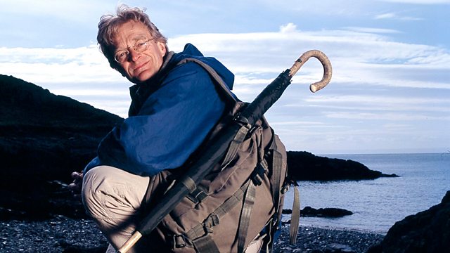
John Ogilby's Britannia Map Man
Similar Content
Browse content similar to John Ogilby's Britannia. Check below for episodes and series from the same categories and more!
Transcript
| Line | From | To | |
|---|---|---|---|
That's the M6. | 0:00:02 | 0:00:04 | |
Every day, 60,000 cars tear up and down | 0:00:04 | 0:00:08 | |
this tarmac strip, and they all know exactly where they're going. | 0:00:08 | 0:00:13 | |
That's because their road is on the map. | 0:00:13 | 0:00:17 | |
But imagine a time when there weren't many roads | 0:00:19 | 0:00:22 | |
and absolutely no road maps. | 0:00:22 | 0:00:25 | |
That's what it was like in the mid-1600s. | 0:00:25 | 0:00:28 | |
Then, in 1675, | 0:00:28 | 0:00:30 | |
along came John Ogilby's Britannia - | 0:00:30 | 0:00:33 | |
100 maps describing over 7,000 miles of roads. | 0:00:33 | 0:00:38 | |
For the first time, you could see the routes between places. | 0:00:38 | 0:00:42 | |
These maps could take you anywhere! | 0:00:42 | 0:00:45 | |
The question is - can they still do it today? | 0:00:51 | 0:00:54 | |
I'm going to put Ogilby's atlas to the ultimate road test. | 0:00:54 | 0:00:59 | |
Can I cross the treacherous Pennines from York to Lancaster | 0:00:59 | 0:01:03 | |
using only Ogilby's 17th-century road map? | 0:01:03 | 0:01:07 | |
John Ogilby's Britannia | 0:01:38 | 0:01:40 | |
was the first major breakthrough in map-making since Tudor times. | 0:01:40 | 0:01:44 | |
These maps were revolutionary. | 0:01:44 | 0:01:47 | |
They emphasised routes, not places. | 0:01:48 | 0:01:51 | |
They looked different. They're all presented in strip form | 0:01:51 | 0:01:54 | |
and they show the exact route of the road and only essential landmarks. | 0:01:54 | 0:01:59 | |
Any extraneous detail is cut out, | 0:02:00 | 0:02:03 | |
anything that won't help you find your way. | 0:02:03 | 0:02:06 | |
York is the starting point for my journey. In the 17th century, | 0:02:10 | 0:02:14 | |
it was a much-favoured city amongst the leisured classes. | 0:02:14 | 0:02:19 | |
But journeys to and from York were dogged by poor roads and bad maps. | 0:02:20 | 0:02:24 | |
Ogilby's brand-new road atlas revolutionised travel. | 0:02:26 | 0:02:30 | |
York has four historic gates, | 0:02:33 | 0:02:35 | |
and this is the one that Ogilby directed travellers to | 0:02:35 | 0:02:39 | |
when they were bound for Lancaster. | 0:02:39 | 0:02:42 | |
From here on, it was the perils of the open road. | 0:02:42 | 0:02:45 | |
So far, so good. | 0:02:55 | 0:02:57 | |
Ogilby's map exactly matches the route of the modern A59. | 0:02:57 | 0:03:02 | |
The place names are the same. | 0:03:02 | 0:03:04 | |
Poppleton, Knapton... I'm on the right track. | 0:03:04 | 0:03:08 | |
Ogilby was a child of the Restoration. | 0:03:11 | 0:03:14 | |
He was a peddler and a dancing teacher before becoming a map-maker | 0:03:14 | 0:03:18 | |
at the astonishing age of 70. | 0:03:18 | 0:03:20 | |
He had a shrewd business mind | 0:03:20 | 0:03:23 | |
and excellent contacts in court circles | 0:03:23 | 0:03:26 | |
and he knew there was money to be made | 0:03:26 | 0:03:29 | |
from a road atlas of Britain. | 0:03:29 | 0:03:32 | |
So, how did he set about it? | 0:03:32 | 0:03:34 | |
Ogilby was no cartographer, so he hired in the expertise | 0:03:34 | 0:03:38 | |
he didn't have himself. | 0:03:38 | 0:03:40 | |
He put together teams of surveyors | 0:03:40 | 0:03:42 | |
and, in 1672, he sent them off to start measuring roads. | 0:03:42 | 0:03:46 | |
His only instruction - the surveys had to be cheap and accurate. | 0:03:46 | 0:03:51 | |
I'm going to do some surveying of my own, using Ogilby's methods. | 0:03:52 | 0:03:56 | |
Because I'm not an expert on historical surveying, | 0:03:56 | 0:04:00 | |
I've called on cartographer Chris Beacock. | 0:04:00 | 0:04:02 | |
-Chris, what is this beautifully constructed machine called? -Well, | 0:04:02 | 0:04:08 | |
this is known as a dimensurator or way-wiser. | 0:04:08 | 0:04:11 | |
If you help me lift it up... As the wheel turns... | 0:04:11 | 0:04:15 | |
-The needle moves. -The needle moves. | 0:04:15 | 0:04:18 | |
On the dial, you have measurements | 0:04:18 | 0:04:21 | |
in chains and poles and yards and miles and furlongs. | 0:04:21 | 0:04:25 | |
And...a furlong is how long? | 0:04:25 | 0:04:27 | |
There's eight furlongs to a mile. | 0:04:27 | 0:04:30 | |
200 yards in a furlong. | 0:04:30 | 0:04:33 | |
5½ yards in a pole. | 0:04:33 | 0:04:35 | |
-Right! -So... -Not as easy as metric. | 0:04:35 | 0:04:39 | |
Metric is wonderful compared to this method of measuring, yes. | 0:04:39 | 0:04:43 | |
So if I want to survey this bit of road, | 0:04:43 | 0:04:48 | |
from the white gate here down to the wooden gate on that corner, | 0:04:48 | 0:04:53 | |
-the first thing I have to do is get the direction... -Yeah. -And it's... | 0:04:53 | 0:04:58 | |
87 degrees. | 0:04:58 | 0:05:01 | |
Which of us is going to be the dimensurator pusher...? | 0:05:01 | 0:05:04 | |
I see you're itching to get your hands on it. Before you set off, | 0:05:04 | 0:05:08 | |
we'll set it back to zero so we know where you're starting. | 0:05:08 | 0:05:12 | |
OK. | 0:05:12 | 0:05:14 | |
So it's ready to roll. | 0:05:14 | 0:05:17 | |
Right, this is going to be great fun. | 0:05:17 | 0:05:20 | |
I've always wanted to take a dimensurator for a walk. | 0:05:20 | 0:05:24 | |
Well... | 0:05:24 | 0:05:26 | |
the first thing that strikes me | 0:05:26 | 0:05:29 | |
is that this could get a bit tedious. | 0:05:29 | 0:05:31 | |
You've got to imagine pushing this calibrated wheelbarrow | 0:05:34 | 0:05:38 | |
over thousands of miles. | 0:05:38 | 0:05:41 | |
One of Ogilby's surveyors complained that he was surveying in winter, | 0:05:41 | 0:05:46 | |
pushing this thing through frozen mud and snow and sleet. | 0:05:46 | 0:05:50 | |
Chris has already measured the distance, | 0:05:51 | 0:05:54 | |
so we'll see how good this dimensurator really is. | 0:05:54 | 0:05:59 | |
How far is it, Nick? | 0:06:00 | 0:06:03 | |
132 yards. | 0:06:05 | 0:06:08 | |
That's quite extraordinary. | 0:06:10 | 0:06:12 | |
This machine is so precise. | 0:06:12 | 0:06:14 | |
It's like Ogilby's atlas - simple and accurate. | 0:06:14 | 0:06:18 | |
On a good day, Ogilby's team could manage up to 12 miles | 0:06:21 | 0:06:24 | |
using this process. | 0:06:24 | 0:06:26 | |
I've measured the better part of a mile now, and it's taken me an hour, | 0:06:26 | 0:06:31 | |
and the light's fading. | 0:06:31 | 0:06:33 | |
Must have been a slow business in the 1670s. | 0:06:33 | 0:06:36 | |
One of the most important breakthroughs Ogilby made | 0:06:53 | 0:06:56 | |
was in showing every single map at the same scale | 0:06:56 | 0:07:00 | |
of one inch to a mile. It had never been done before. | 0:07:00 | 0:07:03 | |
It looks like a scroll and it unravels in front of you. | 0:07:03 | 0:07:07 | |
You read it from the bottom upwards | 0:07:07 | 0:07:10 | |
and each strip represents the next section of road you'll travel along. | 0:07:10 | 0:07:14 | |
Each of the strips on the map | 0:07:14 | 0:07:16 | |
has a compass rose to show you which way magnetic north is | 0:07:16 | 0:07:20 | |
and there are two types of road marked - closed roads, | 0:07:20 | 0:07:24 | |
which have a solid line, and open roads, which have a dotted line. | 0:07:24 | 0:07:29 | |
On an open road, if you get bogged down in deep mud or a wagon has broken down in front of you, | 0:07:29 | 0:07:34 | |
you can take to the open country to get around that obstacle. | 0:07:34 | 0:07:38 | |
You get a very frequent marking of moors on this map. | 0:07:38 | 0:07:42 | |
Moors are like mine fields - very dangerous places back then - so you need to know where they are. | 0:07:42 | 0:07:47 | |
When you get to a hill, you know whether you're going up or down, | 0:07:47 | 0:07:52 | |
because if it's a rising gradient, the mountain's the right way up, | 0:07:52 | 0:07:55 | |
and if you're going downhill, there's an upside-down mountain. | 0:07:55 | 0:07:59 | |
Also, every single map has the most gorgeous cartouche | 0:08:00 | 0:08:05 | |
at the top of it. It's an elaborate affair, beautifully coloured. | 0:08:05 | 0:08:09 | |
In it is the name of the map-maker - | 0:08:09 | 0:08:11 | |
John Ogilby, his Majesty's Cosmographer. | 0:08:11 | 0:08:15 | |
It's an impressive list, | 0:08:16 | 0:08:19 | |
but I want to see whether these features are there on the ground. | 0:08:19 | 0:08:23 | |
One thing's for sure - there's some pretty tough country up ahead. | 0:08:23 | 0:08:28 | |
Ogilby's team took three years to complete their survey. | 0:08:35 | 0:08:39 | |
I've got four days to do my route. | 0:08:39 | 0:08:41 | |
The dimensurator's definitely out, | 0:08:41 | 0:08:44 | |
but for measuring a road, a bicycle will do just as well. | 0:08:44 | 0:08:47 | |
Ogilby's route often differs from the A59. | 0:09:06 | 0:09:09 | |
But, glad as I am to get off that hideous highway, | 0:09:11 | 0:09:14 | |
it's not always easy to find where the old road went. | 0:09:14 | 0:09:18 | |
This is really confusing. | 0:09:21 | 0:09:24 | |
I can see where Ogilby's supposed to go - over Keskin Moor - | 0:09:24 | 0:09:28 | |
but where is it? | 0:09:28 | 0:09:31 | |
It must be running parallel with the modern road and I'd guess higher up. | 0:09:31 | 0:09:36 | |
This is incredibly exciting. | 0:09:43 | 0:09:45 | |
I'm certain that this is the road that Ogilby marked on his map, | 0:09:45 | 0:09:49 | |
crossing Keskin Moor. | 0:09:49 | 0:09:51 | |
It bears all the hallmarks of a 17th-century road. | 0:09:51 | 0:09:55 | |
It's as if time has stood still since 1675. | 0:09:55 | 0:09:58 | |
The road follows the ridge line up to the horizon. | 0:09:58 | 0:10:02 | |
On each side of the road - very characteristic of an old road - | 0:10:02 | 0:10:05 | |
you can see the ditches that were cut to drain the road in wet weather. | 0:10:05 | 0:10:10 | |
I'm going to try and negotiate this 17th-century swamp | 0:10:10 | 0:10:13 | |
and then pedal across the moor... | 0:10:13 | 0:10:16 | |
..which Ogilby says will last for two-and-a-half miles. | 0:10:18 | 0:10:22 | |
Two-and-a-half miles of 17th-century morass. | 0:10:22 | 0:10:26 | |
Incredible to think that this was the main road between York and Lancaster. | 0:10:44 | 0:10:49 | |
In Ogilby's day, | 0:10:49 | 0:10:51 | |
this road would have been in far worse condition than it is now. | 0:10:51 | 0:10:55 | |
If you were out here in 1675, | 0:10:55 | 0:10:57 | |
you'd be exposed in the winter to rain, wind, snow and sleet. | 0:10:57 | 0:11:02 | |
If you got stuck here at night, you'd be dead from hypothermia by morning. | 0:11:02 | 0:11:06 | |
Well, I've reached the end of the old route over the moor, | 0:11:27 | 0:11:30 | |
but now Ogilby's road joins the A59 again. | 0:11:30 | 0:11:34 | |
This is Ogilby's route heading off into the rain and the traffic. It looks a complete nightmare. | 0:11:34 | 0:11:40 | |
All of which makes me wonder, why bother? | 0:11:40 | 0:11:44 | |
So, who would have been on this road 300 years ago? | 0:11:45 | 0:11:50 | |
Ogilby's clients, if you like. | 0:11:50 | 0:11:52 | |
The roads mapped by Ogilby were the postal routes used by riders carrying the king's mail. | 0:11:52 | 0:11:58 | |
And they were used by merchants and monks, | 0:11:58 | 0:12:01 | |
all probably travelling on foot or by horse. | 0:12:01 | 0:12:04 | |
And then there would have been a new breed of traveller - the tourist. | 0:12:05 | 0:12:10 | |
Each of Ogilby's routes was accompanied by a commentary | 0:12:12 | 0:12:16 | |
giving useful information for travellers on market days, local customs and good inns to stay in. | 0:12:16 | 0:12:22 | |
The town I'm in now, Skipton, | 0:12:22 | 0:12:24 | |
apparently was well built, it had a good market and good accommodation. | 0:12:24 | 0:12:29 | |
But prior to Ogilby, how did these people find their way around? | 0:12:30 | 0:12:35 | |
Where did they stay? I'm here to meet Donald Hodson, | 0:12:35 | 0:12:39 | |
a native of the Yorkshire-Lancashire borders | 0:12:39 | 0:12:42 | |
and a man who's given a large part of his life to studying Ogilby | 0:12:42 | 0:12:46 | |
and road travel in the 17th century. | 0:12:46 | 0:12:49 | |
Providing you knew where your destination was, | 0:12:49 | 0:12:53 | |
all you would have had to do was go to the local inn | 0:12:53 | 0:12:57 | |
and say to someone, | 0:12:57 | 0:12:59 | |
"This is where I want to go. What's the first day's journey?" | 0:12:59 | 0:13:03 | |
And they would give you a list of places and you might well join them | 0:13:03 | 0:13:07 | |
-on the journey. -How many people travelled by road then? | 0:13:07 | 0:13:11 | |
Far more than we would imagine. | 0:13:11 | 0:13:14 | |
Um, in any decent-sized town... | 0:13:14 | 0:13:19 | |
there would be 12-15...inns, | 0:13:19 | 0:13:24 | |
each of which | 0:13:24 | 0:13:26 | |
could take 300 people and their horses. | 0:13:26 | 0:13:30 | |
Now...clearly, there must have been thousands of people on the road. | 0:13:30 | 0:13:35 | |
It wouldn't have been difficult to get information. | 0:13:35 | 0:13:38 | |
Is it fair to say that Ogilby... | 0:13:38 | 0:13:41 | |
turned a written list of places into a map, | 0:13:41 | 0:13:45 | |
with the same places but just linked by this slender thread of road? | 0:13:45 | 0:13:50 | |
Yes, absolutely. | 0:13:50 | 0:13:51 | |
He originally planned | 0:13:51 | 0:13:54 | |
to survey 40,000 miles, | 0:13:54 | 0:13:56 | |
and he claims in the introduction to Britannia to have... | 0:13:56 | 0:14:01 | |
surveyed near two thirds, | 0:14:01 | 0:14:05 | |
which I take to be something like 26,000 miles. | 0:14:05 | 0:14:08 | |
But he ran out of money, | 0:14:08 | 0:14:11 | |
so he decides that he'll cut it from 200 roads to 100 | 0:14:11 | 0:14:15 | |
and he obviously... | 0:14:15 | 0:14:18 | |
decided this would be a good way to recoup at least some of the money. | 0:14:18 | 0:14:23 | |
-Little knowing it would change the face of Britain. -Suddenly, | 0:14:23 | 0:14:27 | |
instead of just having one route, you had 100. | 0:14:27 | 0:14:32 | |
Outside Skipton | 0:14:42 | 0:14:44 | |
is Eshton Crag Hill, | 0:14:44 | 0:14:47 | |
this monster. | 0:14:47 | 0:14:49 | |
It's the only hill named on Ogilby's map, | 0:14:50 | 0:14:54 | |
and yet the road doesn't go over it. So why mention it? | 0:14:54 | 0:14:58 | |
What makes Eshton Crag Hill so important to Ogilby? | 0:14:58 | 0:15:02 | |
I've just seen the most incredible sight. | 0:15:02 | 0:15:06 | |
The valley below me is absolutely full of water. It's flooded. | 0:15:06 | 0:15:10 | |
It's as if the waters of the Atlantic have flooded half of Yorkshire. | 0:15:10 | 0:15:14 | |
You couldn't get through there, even swimming. | 0:15:14 | 0:15:17 | |
I think this is a dry-level route | 0:15:17 | 0:15:20 | |
and Ogilby put this hill on the map | 0:15:20 | 0:15:22 | |
partly because he realised that when the valley flooded down there, | 0:15:22 | 0:15:26 | |
you had to have an alternative route. | 0:15:26 | 0:15:29 | |
The course of 17th-century roads was often dictated by water. | 0:15:29 | 0:15:33 | |
Floods could block valleys, rains could turn tracks into quagmires, | 0:15:33 | 0:15:38 | |
so travellers would always be seeking the higher ground. | 0:15:38 | 0:15:41 | |
Not that they'd find the going very easy up here! | 0:15:43 | 0:15:46 | |
Eshton Crag Hill was on the frontier. On one side, down there, | 0:15:48 | 0:15:52 | |
settled communities in the gentle lowland valleys of Lancashire. | 0:15:52 | 0:15:56 | |
On the other side, | 0:15:56 | 0:15:58 | |
up there, the desolate, high limestone plateaus of Yorkshire. | 0:15:58 | 0:16:03 | |
A wilderness! | 0:16:03 | 0:16:05 | |
So, another day, another rain-swept hilltop. | 0:16:13 | 0:16:17 | |
Still another 40 miles to go | 0:16:17 | 0:16:20 | |
and I don't expect any mercy from the elements. | 0:16:20 | 0:16:24 | |
Fantastic change this morning! | 0:16:37 | 0:16:40 | |
There's a gale blowing and it's driven out all that rain. | 0:16:40 | 0:16:44 | |
Today I should make much better progress - | 0:16:44 | 0:16:48 | |
as long as I keep to the map. | 0:16:48 | 0:16:50 | |
A strip map might be easy to read | 0:16:52 | 0:16:54 | |
and reassuring to travellers who have never used a map before, | 0:16:54 | 0:16:58 | |
It just shows the one road you're trying to follow. | 0:16:58 | 0:17:01 | |
If you leave that road, you're absolutely lost. You've stepped off the edge of the known world. | 0:17:01 | 0:17:07 | |
The extraordinary thing is that roads didn't appear on maps | 0:17:09 | 0:17:13 | |
until the 1590s, and even the word "road" was rare. | 0:17:13 | 0:17:17 | |
It occurs once in the King James Bible and a few times in Shakespeare. | 0:17:17 | 0:17:22 | |
People talked about "lanes" and "ways". | 0:17:22 | 0:17:26 | |
"Road" comes from "ride", | 0:17:26 | 0:17:29 | |
a route on which people rode horses. | 0:17:29 | 0:17:32 | |
Ogilby helped popularise the word | 0:17:32 | 0:17:34 | |
and making roads the central feature of his atlas | 0:17:34 | 0:17:37 | |
was his revolutionary selling point. | 0:17:37 | 0:17:40 | |
Not sure when I'll reach Lancaster. | 0:17:45 | 0:17:47 | |
It's spine-tingling to experience this road | 0:17:47 | 0:17:51 | |
as 17th-century travellers did, ruts and puddles and all. | 0:17:51 | 0:17:55 | |
According to the mileometer, | 0:18:18 | 0:18:21 | |
I've now done 76 miles, | 0:18:21 | 0:18:23 | |
so we're onto the last leg. | 0:18:23 | 0:18:25 | |
I'm heading to Tateham, | 0:18:25 | 0:18:27 | |
where there should be a bridge over the river, which might just be here, | 0:18:27 | 0:18:32 | |
if this inn is from Ogilby's time. | 0:18:32 | 0:18:34 | |
Ah! 1744. | 0:18:40 | 0:18:43 | |
That's 70 years after Ogilby's Britannia was published. | 0:18:43 | 0:18:46 | |
Now that's interesting. 1642. | 0:18:51 | 0:18:54 | |
This building was standing before Britannia was published. | 0:18:56 | 0:18:59 | |
It was here when the survey was made. | 0:18:59 | 0:19:02 | |
This is almost certainly the original Bridge Inn. | 0:19:02 | 0:19:05 | |
Well, that's the inn, | 0:19:07 | 0:19:09 | |
but where's the bridge and, more to the point, where's the river? | 0:19:09 | 0:19:13 | |
Something strange has happened round here. It's very difficult to lose a river in a small valley like this. | 0:19:13 | 0:19:19 | |
And they wouldn't have built the inn anywhere but right beside the bridge. | 0:19:19 | 0:19:24 | |
I can hear water over here. | 0:19:24 | 0:19:26 | |
Well, it's a dribble. It doesn't justify a bridge. | 0:19:31 | 0:19:34 | |
That stream must link to a river somewhere, | 0:19:34 | 0:19:38 | |
but there's nothing on the ground that tallies with Ogilby. | 0:19:38 | 0:19:42 | |
All I can do is follow this road | 0:19:42 | 0:19:44 | |
and hope that it's not too far off the old route. | 0:19:44 | 0:19:48 | |
The plot thickens. | 0:19:51 | 0:19:52 | |
Actually, this is really interesting. | 0:19:52 | 0:19:55 | |
Down there in the field, you can see the course of an old river, | 0:19:57 | 0:20:01 | |
and beside it, the old river bank. And over here... | 0:20:01 | 0:20:04 | |
a long way from the Bridge Inn, | 0:20:04 | 0:20:07 | |
is a bridge. | 0:20:07 | 0:20:09 | |
And underneath the bridge... | 0:20:11 | 0:20:13 | |
..the long-lost river. | 0:20:15 | 0:20:18 | |
But at some point, that river has moved from over there | 0:20:18 | 0:20:22 | |
to down here. Very puzzling. | 0:20:22 | 0:20:25 | |
So, who exactly did move the river | 0:20:25 | 0:20:28 | |
and, presumably, the old bridge? | 0:20:28 | 0:20:31 | |
And what's happened to Ogilby's road? | 0:20:31 | 0:20:34 | |
Someone who knows a great deal about the Ogilby road is Michael Goth. | 0:20:36 | 0:20:41 | |
He was brought up near here | 0:20:41 | 0:20:43 | |
and his father was a gamekeeper on a local estate. | 0:20:43 | 0:20:47 | |
I passed this inn earlier when I was looking for the bridge. | 0:20:47 | 0:20:51 | |
Until I can find the bridge, | 0:20:51 | 0:20:54 | |
I can't find the 17th-century road. | 0:20:54 | 0:20:57 | |
It's over the bridge on that picture. | 0:20:57 | 0:21:00 | |
-This picture? -Yes. -Who's this by? | 0:21:00 | 0:21:03 | |
It's by Turner. | 0:21:03 | 0:21:05 | |
This is a Turner watercolour - or a reproduction, clearly... | 0:21:05 | 0:21:08 | |
Is that Hornby Castle? | 0:21:08 | 0:21:11 | |
That's Tateham Church. And there... | 0:21:11 | 0:21:14 | |
is the stone bridge. | 0:21:14 | 0:21:16 | |
Now, this bridge has moved, hasn't it? It's not there at all now. | 0:21:16 | 0:21:21 | |
Where's the road gone? | 0:21:21 | 0:21:23 | |
It moved in the advent of the railway, in the early 1840s. | 0:21:23 | 0:21:26 | |
They brought the railway through here and the river was in the way, | 0:21:26 | 0:21:30 | |
so they shifted the river over to one side | 0:21:30 | 0:21:34 | |
and they built a new bridge - | 0:21:34 | 0:21:36 | |
it came down here and covered both the bridge and the railway. | 0:21:36 | 0:21:40 | |
Now, I found the new bridge, | 0:21:40 | 0:21:42 | |
-so where did the road go? -Ah. | 0:21:42 | 0:21:45 | |
Here is the Tateham Bridge Inn. | 0:21:45 | 0:21:48 | |
Now then, in the 1840s... | 0:21:48 | 0:21:50 | |
a railway came down here, down the vale... | 0:21:50 | 0:21:55 | |
and of course the old stone bridge was in the way, so it had to go. | 0:21:55 | 0:21:59 | |
And so did the river. | 0:21:59 | 0:22:01 | |
So they diverted the river, roughly across here... | 0:22:01 | 0:22:05 | |
-So Ogilby's road is underwater? -Yes. | 0:22:05 | 0:22:08 | |
No wonder I couldn't find it! | 0:22:08 | 0:22:11 | |
-You've solved a very knotty problem for me. -Ah, well. | 0:22:12 | 0:22:16 | |
All roads lead to Rome, but this one doesn't. | 0:22:16 | 0:22:19 | |
So, with the news that Ogilby's road got submerged in Victorian times, | 0:22:20 | 0:22:25 | |
the question is - can I rejoin it somewhere in the morning? | 0:22:25 | 0:22:29 | |
I'm running out of time. | 0:22:36 | 0:22:39 | |
Ogilby's map shows Tateham Church very clearly, | 0:22:39 | 0:22:42 | |
so I'm hoping I can find Ogilby's road again up there. | 0:22:42 | 0:22:45 | |
Now, according to Ogilby, the next village on his route from Tateham | 0:22:52 | 0:22:57 | |
is Hornby. On the way, his road passes through this feature here, | 0:22:57 | 0:23:01 | |
Lord Marley's Park. | 0:23:01 | 0:23:03 | |
Now, Ogilby's marked his road entering Lord Marley's Park | 0:23:03 | 0:23:08 | |
at a point due south of Tateham Church, where I'm now perched. | 0:23:08 | 0:23:12 | |
I've taken a bearing from the tower | 0:23:12 | 0:23:15 | |
and it points over there, | 0:23:15 | 0:23:17 | |
into the flooded valley where the river's running. | 0:23:17 | 0:23:21 | |
Now, I think that the road came along below the church, | 0:23:21 | 0:23:25 | |
then cut up into those trees which are probably the old site of Lord Marley's Park. | 0:23:25 | 0:23:30 | |
The road wouldn't run through that valley - too boggy. | 0:23:30 | 0:23:33 | |
So the road's over there in those trees somewhere. The next thing to do | 0:23:33 | 0:23:37 | |
is get among those trees and look for traces of Ogilby's road. | 0:23:37 | 0:23:41 | |
I'm on a track at the edge of the wood | 0:23:52 | 0:23:55 | |
and I've got two ways of testing whether this is the 17th-century road through Lord Marley's Park. | 0:23:55 | 0:24:02 | |
The first thing I'll do is set my mileometer to zero, | 0:24:02 | 0:24:05 | |
because I know from Ogilby's map | 0:24:05 | 0:24:08 | |
that the road through Lord Marley's Park ran for one mile two furlongs - | 0:24:08 | 0:24:12 | |
about one-and-a-quarter miles. | 0:24:12 | 0:24:15 | |
The other thing I can do is look very carefully | 0:24:15 | 0:24:19 | |
as I pedal through the trees | 0:24:19 | 0:24:21 | |
for signs of a carriageway. | 0:24:21 | 0:24:23 | |
You can see the track has been terraced out of a slope. | 0:24:23 | 0:24:28 | |
Now, it's true that might have been done by a bulldozer recently, | 0:24:28 | 0:24:32 | |
so I need to find proof that it's Ogilby's road. | 0:24:32 | 0:24:36 | |
What I'm looking for | 0:24:37 | 0:24:39 | |
are large stones at the road side to stop it sliding away in the rain and drainage channels - | 0:24:39 | 0:24:45 | |
any traces of substantial road construction. | 0:24:45 | 0:24:48 | |
I didn't know exactly what I'd find when I came into this wood, | 0:24:53 | 0:24:57 | |
but I've found the best kind of evidence I could have hoped for. | 0:24:57 | 0:25:01 | |
Down here is a moss-covered wall | 0:25:01 | 0:25:04 | |
that looks suspiciously like a 17th-century water culvert. | 0:25:04 | 0:25:08 | |
There's no doubt about it. | 0:25:21 | 0:25:23 | |
This wall here is not just a retaining wall for the old road, | 0:25:23 | 0:25:28 | |
but it's also a culvert, directing water from higher up on the moor | 0:25:28 | 0:25:32 | |
underground, so as the water pours down, it doesn't wash the road away. | 0:25:32 | 0:25:37 | |
And, actually, it's curving round there, | 0:25:38 | 0:25:42 | |
so up there may be a section of the original road as well. | 0:25:42 | 0:25:46 | |
It's not just a water culvert. | 0:25:50 | 0:25:53 | |
Underneath all of this moss, there's completely intact stone walling | 0:25:53 | 0:25:57 | |
of a 17th-century embankment. | 0:25:57 | 0:26:00 | |
The road crossed the gill and it climbed steadily up here | 0:26:00 | 0:26:03 | |
towards what looks like the apex of a very tight turn, climbing steadily... | 0:26:03 | 0:26:08 | |
There's a huge ravine on that side. | 0:26:08 | 0:26:10 | |
And it comes round the corner. | 0:26:10 | 0:26:13 | |
Here's the edge of the corner. And then it climbs up there. | 0:26:13 | 0:26:16 | |
You have to imagine, | 0:26:16 | 0:26:19 | |
in 1675, columns of pack horses tethered end on end, | 0:26:19 | 0:26:23 | |
30 or 40 at a time, crawling through this forest | 0:26:23 | 0:26:27 | |
around this very tight bend. | 0:26:27 | 0:26:29 | |
You couldn't have managed to get a wheeled vehicle around this bend. | 0:26:29 | 0:26:33 | |
One wheel over the edge, | 0:26:33 | 0:26:35 | |
straight down into the ravine. Absolutely lethal. | 0:26:35 | 0:26:39 | |
No wonder this road was abandoned. | 0:26:39 | 0:26:41 | |
I'm nearly at the end of the track, | 0:26:41 | 0:26:43 | |
and I'll then check the mileometer | 0:26:43 | 0:26:46 | |
and confirm what I think I know. | 0:26:46 | 0:26:49 | |
Well, there's Hornby Castle. | 0:26:50 | 0:26:52 | |
I've come out of the wood. | 0:26:52 | 0:26:55 | |
The mileometer reads... | 0:26:55 | 0:26:57 | |
just over one mile. | 0:26:57 | 0:26:59 | |
Ogilby reckoned it was one mile two furlongs - incredibly similar. | 0:26:59 | 0:27:03 | |
That man was clever, wasn't he? | 0:27:03 | 0:27:05 | |
This must be, then, the high road to Lancaster. | 0:27:05 | 0:27:09 | |
The amazing thing, I suppose, | 0:27:20 | 0:27:22 | |
is that so much of the road survives, | 0:27:22 | 0:27:24 | |
even after 300 years of changing landscape. | 0:27:24 | 0:27:28 | |
Well, Ogilby has led me safely over the Pennines. | 0:27:29 | 0:27:33 | |
His atlas really works. | 0:27:33 | 0:27:35 | |
This has been a much more demanding journey than I ever anticipated, | 0:27:35 | 0:27:41 | |
but, believe it or not, even today you can enter Lancaster using Ogilby's map. | 0:27:41 | 0:27:46 | |
By the time Britannia was ready for printing in the autumn of 1675, | 0:27:47 | 0:27:52 | |
Ogilby was dying. | 0:27:52 | 0:27:54 | |
Right at the very end of his long, eventful life, | 0:27:54 | 0:27:57 | |
this ingenious pioneer lurched onto the Restoration stage | 0:27:57 | 0:28:01 | |
for the final time and pulled off his most magnificent performance. | 0:28:01 | 0:28:05 | |
Britannia was accurate, elegant and gorgeously presented. | 0:28:07 | 0:28:11 | |
It celebrated roads for the first time | 0:28:11 | 0:28:14 | |
and opened the door to a new generation of travellers. | 0:28:14 | 0:28:17 | |
Subtitles by Suzanne Macdonald BBC Broadcast 2004 | 0:28:23 | 0:28:27 | |
E-mail us at [email protected] | 0:28:27 | 0:28:30 |