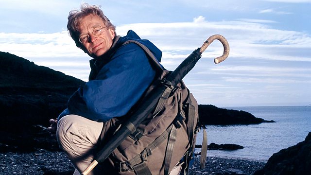
Christopher Saxton's Atlas of England and Wales Map Man
Similar Content
Browse content similar to Christopher Saxton's Atlas of England and Wales. Check below for episodes and series from the same categories and more!
Transcript
| Line | From | To | |
|---|---|---|---|
This is Norfolk - MY county. | 0:00:02 | 0:00:04 | |
I live in London, but my roots are here in Norfolk soil. | 0:00:04 | 0:00:08 | |
Most of us, in some way or other, identify with a county. | 0:00:08 | 0:00:11 | |
But it wasn't always so. | 0:00:11 | 0:00:13 | |
Before Elizabeth I, | 0:00:16 | 0:00:18 | |
people didn't know much about the county they lived in. | 0:00:18 | 0:00:22 | |
There's a good reason for that. | 0:00:22 | 0:00:24 | |
Hardly anyone had seen a map which showed them what a county was, | 0:00:24 | 0:00:27 | |
what it looked like or where its borders were. | 0:00:27 | 0:00:31 | |
Then, in 1579, | 0:00:38 | 0:00:41 | |
Christopher Saxton published his county by county atlas. | 0:00:41 | 0:00:45 | |
It changed this country, it changed English map-making | 0:00:45 | 0:00:48 | |
and it changed our sense of who we are and where we come from. | 0:00:48 | 0:00:52 | |
But why was this atlas made? | 0:00:54 | 0:00:56 | |
In those dangerous and rebellious times, | 0:00:56 | 0:00:59 | |
could these great maps have been a powerful tool | 0:00:59 | 0:01:03 | |
for Queen Elizabeth to control her unruly country? | 0:01:03 | 0:01:07 | |
What I'd like to find out | 0:01:07 | 0:01:08 | |
is what part Saxton and his maps played | 0:01:08 | 0:01:12 | |
in policing Elizabethan England. | 0:01:12 | 0:01:14 | |
Saxton's atlas looks like perfect propaganda | 0:01:42 | 0:01:46 | |
for Elizabeth I's golden age. | 0:01:46 | 0:01:49 | |
Never before had there been maps of all 52 counties of England and Wales. | 0:01:49 | 0:01:54 | |
For the first time, the country appears organised and peaceful. | 0:01:54 | 0:01:59 | |
The reality, however, was different. | 0:02:00 | 0:02:02 | |
When Saxton began his survey in the early 1570s, | 0:02:02 | 0:02:06 | |
Elizabeth, a Protestant queen, | 0:02:06 | 0:02:09 | |
was living in fear of Catholic plots to take her throne. | 0:02:09 | 0:02:13 | |
Saxton hoped his magnificent maps | 0:02:13 | 0:02:16 | |
would help his queen to neutralise the Catholic threat. | 0:02:16 | 0:02:20 | |
He started his ground-breaking survey with Norfolk. | 0:02:20 | 0:02:25 | |
Saxton must have seen Norfolk as an incredible commercial opportunity. | 0:02:25 | 0:02:30 | |
It was wealthy, but it was also a great worry to the governing classes. | 0:02:30 | 0:02:35 | |
The government needed to locate the market towns, | 0:02:35 | 0:02:39 | |
where troublemakers, rumour-mongers congregated. | 0:02:39 | 0:02:42 | |
The government also needed to isolate the homes | 0:02:42 | 0:02:45 | |
of another type of troublemaker - the dissident Catholic. | 0:02:45 | 0:02:48 | |
But above all, the government needed to protect Norwich. | 0:02:48 | 0:02:53 | |
Norwich wasn't just the county town of Norfolk, | 0:02:53 | 0:02:56 | |
it was the second city in the kingdom. | 0:02:56 | 0:02:58 | |
A map would help bring order | 0:02:58 | 0:03:00 | |
to a very difficult and absolutely crucial county. | 0:03:00 | 0:03:04 | |
On MY journey across Norfolk, | 0:03:06 | 0:03:08 | |
I'm travelling | 0:03:08 | 0:03:11 | |
from the border with Suffolk | 0:03:11 | 0:03:13 | |
to the north coast. | 0:03:13 | 0:03:15 | |
I want to know why this piece of Elizabethan England | 0:03:15 | 0:03:18 | |
was so important to the country's wealth and defences, | 0:03:18 | 0:03:23 | |
and why it was SO rebellious. | 0:03:23 | 0:03:26 | |
We don't know much about Christopher Saxton. | 0:03:28 | 0:03:31 | |
He was born in Yorkshire | 0:03:31 | 0:03:34 | |
around 1542 or 1544. He wasn't sure himself. | 0:03:34 | 0:03:38 | |
And, although he wasn't rich, he probably funded his map of Norfolk. | 0:03:38 | 0:03:43 | |
First off, he needed to establish where the county border was. | 0:03:43 | 0:03:48 | |
Simple enough, you'd think. | 0:03:48 | 0:03:50 | |
But on the copy of Saxton's map that I have, the border is wrong. | 0:03:50 | 0:03:55 | |
Places that are actually in Norfolk | 0:03:55 | 0:03:57 | |
appear to be in Suffolk. | 0:03:57 | 0:03:59 | |
Norfolk's boundaries are clearly defined by water, | 0:04:03 | 0:04:07 | |
so there shouldn't have been any confusion. | 0:04:07 | 0:04:10 | |
There's the sea to the north and east, | 0:04:10 | 0:04:13 | |
and a network of rivers marks out the western and southern borders. | 0:04:13 | 0:04:17 | |
It's almost an island. | 0:04:17 | 0:04:20 | |
So why does this Saxton map ignore the natural geography? | 0:04:20 | 0:04:24 | |
Well, something has gone seriously wrong around here. | 0:04:25 | 0:04:29 | |
The colouring on this copy of Saxton's map | 0:04:29 | 0:04:32 | |
shows the whole of this area to be Suffolk. | 0:04:32 | 0:04:36 | |
And one of the maddest buildings to put in Suffolk is this one here. | 0:04:36 | 0:04:40 | |
This is Kenninghall Palace, or the last remaining wing of it, | 0:04:40 | 0:04:43 | |
and it belonged to the Duke of Norfolk. | 0:04:43 | 0:04:47 | |
One of the Duke of Norfolk's houses in Suffolk?! Impossible, surely. | 0:04:47 | 0:04:51 | |
But the 4th Duke of Norfolk was a Catholic who'd been beheaded | 0:04:51 | 0:04:55 | |
just before Saxton began his survey. | 0:04:55 | 0:04:58 | |
He'd been accused of being the brains behind the Rodolfi plot, | 0:04:58 | 0:05:02 | |
an international Catholic conspiracy to overthrow the Protestant throne. | 0:05:02 | 0:05:07 | |
So, was this error over the border not a mistake at all but deliberate? | 0:05:07 | 0:05:12 | |
Once Saxton had finished his work, | 0:05:14 | 0:05:16 | |
artists often coloured the maps by hand to make them more beautiful. | 0:05:16 | 0:05:20 | |
But whether or not the colouring improved the map | 0:05:20 | 0:05:24 | |
or made it more difficult to read depended on the skill of the artist. | 0:05:24 | 0:05:28 | |
In this case, the artist has painted the border too far north. | 0:05:28 | 0:05:32 | |
Perhaps he didn't know where the border lay | 0:05:32 | 0:05:36 | |
or perhaps he was anti-Catholic and painted it as a snub to the duke. | 0:05:36 | 0:05:41 | |
Either way, he's turned Saxton's survey into a border dispute. | 0:05:41 | 0:05:46 | |
Whatever deception went on here, | 0:05:48 | 0:05:50 | |
I've now crossed over county lines | 0:05:50 | 0:05:53 | |
both on Saxton's map and for real, | 0:05:53 | 0:05:56 | |
and I'm heading into the political heartland of 16th-century England. | 0:05:56 | 0:06:01 | |
I've come to one of the grandest Catholic houses in Norfolk | 0:06:03 | 0:06:08 | |
to find out what it meant to one of the disloyal Catholic families | 0:06:08 | 0:06:13 | |
to be put on Saxton's map. | 0:06:13 | 0:06:15 | |
This is Oxborough Hall. | 0:06:17 | 0:06:20 | |
Oxborough was one of the most notorious Catholic strongholds in Norfolk. It's on Saxton's map | 0:06:21 | 0:06:27 | |
and, ever since the 15th century, has been home to the Bedingfeld family. | 0:06:27 | 0:06:32 | |
In Saxton's time, the owner of Oxborough was Sir Henry Bedingfeld. | 0:06:32 | 0:06:37 | |
During the reign of Catholic Queen Mary, | 0:06:37 | 0:06:39 | |
he had been Elizabeth's jailor. | 0:06:39 | 0:06:42 | |
As an unrepentant Catholic, | 0:06:42 | 0:06:44 | |
he may not have relished the idea of Saxton's map. | 0:06:44 | 0:06:48 | |
But today, his descendant, also called Henry, | 0:06:48 | 0:06:52 | |
looks on maps much more favourably. | 0:06:52 | 0:06:55 | |
What about this magnificent map?! It's enormous. | 0:06:56 | 0:07:00 | |
It's wonderful, isn't it? It's the Sheldon tapestry map of 1647, | 0:07:00 | 0:07:04 | |
-showing the county of Oxfordshire. -It looks like a Saxton map | 0:07:04 | 0:07:08 | |
writ large on your wall. It's got the same small trees, | 0:07:08 | 0:07:13 | |
the same hills, the same towns and villages, the same county boundaries. | 0:07:13 | 0:07:17 | |
-It's more than Oxford, because there are several counties around it. -Yes. | 0:07:17 | 0:07:21 | |
What would your ancestor have made, Henry, | 0:07:21 | 0:07:25 | |
of a Protestant surveyor from Yorkshire | 0:07:25 | 0:07:28 | |
knocking on the door of the gatehouse asking to survey his lands? | 0:07:28 | 0:07:33 | |
Indeed. I think he would have been rather suspicious. | 0:07:33 | 0:07:36 | |
-Do you? -Well, he was a Catholic | 0:07:36 | 0:07:39 | |
and we had Catholic priests which we used to hide | 0:07:39 | 0:07:43 | |
in the priest hiding hole, | 0:07:43 | 0:07:45 | |
and he wouldn't want that to be discovered. | 0:07:45 | 0:07:48 | |
So being a Catholic and having your home mapped for the first time | 0:07:48 | 0:07:53 | |
-was a bit of a two-edged sword? -Well, it would've pinpointed a hotbed of Catholicism, | 0:07:53 | 0:07:57 | |
which he'd be trying to avoid! | 0:07:57 | 0:08:00 | |
Saxton would have needed a bird's-eye view from which to plan out his map, | 0:08:02 | 0:08:06 | |
so he must have made use of Oxborough's tower. | 0:08:06 | 0:08:09 | |
It's the highest thing around. | 0:08:09 | 0:08:12 | |
The question is - | 0:08:15 | 0:08:17 | |
how did this brilliant 30-year-old carry out his survey? | 0:08:17 | 0:08:21 | |
GROANING | 0:08:21 | 0:08:24 | |
Saxton probably used one of these. | 0:08:24 | 0:08:27 | |
It's an angle-measuring device or a cross-staff. | 0:08:27 | 0:08:30 | |
It's simple, it's lightweight and it's reasonably accurate. | 0:08:30 | 0:08:34 | |
Three qualities Saxton absolutely had to have | 0:08:34 | 0:08:37 | |
if he was going to map 52 counties in double-quick time. | 0:08:37 | 0:08:41 | |
All you have to do is to climb a high point - | 0:08:41 | 0:08:44 | |
I'm on top of a church tower - and look across the landscape | 0:08:44 | 0:08:48 | |
for any towns or villages you might want to mark on your map. | 0:08:48 | 0:08:52 | |
There's one over there, with the windmill sticking up above it. | 0:08:52 | 0:08:55 | |
And one over there with a church tower. | 0:08:55 | 0:08:59 | |
To measure the angle between them all I have to do | 0:08:59 | 0:09:02 | |
is slide the cross-piece to and fro | 0:09:02 | 0:09:05 | |
until the left-hand side of the cross-piece here | 0:09:05 | 0:09:10 | |
is level with the windmill in that village... | 0:09:10 | 0:09:14 | |
and the right-hand side of my cross-piece here | 0:09:14 | 0:09:18 | |
is level with the church tower of my village over there, | 0:09:18 | 0:09:22 | |
tighten up the nut, look down the cross-staff | 0:09:22 | 0:09:26 | |
and read off the angle between that windmill and that church tower. | 0:09:26 | 0:09:30 | |
The cross-staff describes a very simple triangle | 0:09:30 | 0:09:34 | |
in which I am placed here, | 0:09:34 | 0:09:37 | |
the windmill is here | 0:09:37 | 0:09:39 | |
and the church tower is here. | 0:09:39 | 0:09:41 | |
And the angle between the windmill and the church tower is this one. | 0:09:41 | 0:09:46 | |
Now all I have to do is transfer that triangle onto my sheet of paper. | 0:09:46 | 0:09:50 | |
I do that like this. | 0:09:50 | 0:09:53 | |
I draw my church tower here, where I'm perched, | 0:09:53 | 0:09:57 | |
I draw a line from my church tower to the village with the windmill... | 0:09:57 | 0:10:01 | |
..I measure 42 degrees from my church... | 0:10:03 | 0:10:07 | |
That's the angle my cross-staff has just given me. | 0:10:07 | 0:10:11 | |
I then walk or ride my horse, as Saxton would have done, | 0:10:13 | 0:10:17 | |
from my church tower to the village with the windmill, | 0:10:17 | 0:10:20 | |
I measure the angle between my first church tower and the village with the other church tower | 0:10:20 | 0:10:26 | |
and where it intersects with the first line... | 0:10:26 | 0:10:29 | |
I have my second village with its church tower. I think... | 0:10:29 | 0:10:33 | |
that's how Saxton mapped Norfolk. | 0:10:33 | 0:10:36 | |
For his mammoth project, | 0:10:39 | 0:10:42 | |
Saxton would have obtained rough distances between places | 0:10:42 | 0:10:46 | |
by consulting locals. | 0:10:46 | 0:10:48 | |
He travelled from high point to high point, | 0:10:48 | 0:10:51 | |
taking bearings with his cross-staff and making drafts of his maps, | 0:10:51 | 0:10:55 | |
ready for the engraver to copy in exquisite detail. | 0:10:55 | 0:10:59 | |
The atlas just glows with a sense of authority and ostentation. | 0:11:05 | 0:11:10 | |
The panels in the corner are called cartouches. | 0:11:10 | 0:11:14 | |
This cartouche carries the title of the map and the name of the engraver, | 0:11:14 | 0:11:18 | |
Cornelius de Hooge. | 0:11:18 | 0:11:20 | |
He was a brilliant engraver. | 0:11:20 | 0:11:23 | |
This is no ordinary copperplate engraving. It's outstanding. | 0:11:23 | 0:11:27 | |
The engraver has used | 0:11:27 | 0:11:29 | |
italic handwriting. | 0:11:29 | 0:11:31 | |
This was a state-of-the-art form for map labelling. | 0:11:31 | 0:11:35 | |
You can get a large number of place names on a relatively small area, | 0:11:35 | 0:11:39 | |
so you can get more detail on your map. | 0:11:39 | 0:11:42 | |
There are no roads on this map. | 0:11:42 | 0:11:44 | |
But there are rivers. | 0:11:44 | 0:11:46 | |
Norfolk was a very important maritime county | 0:11:46 | 0:11:49 | |
and the rivers are the networks for transport. | 0:11:49 | 0:11:52 | |
We're got them running right round the county. | 0:11:52 | 0:11:56 | |
From the centre here, at Norwich, | 0:11:56 | 0:11:58 | |
they funnel down here to the sea, | 0:11:58 | 0:12:00 | |
so you could bring ships inland from Great Yarmouth to Norwich. | 0:12:00 | 0:12:05 | |
Norwich is at the focal point of this county map. | 0:12:05 | 0:12:09 | |
This is a very systematic selection of geographical information. | 0:12:11 | 0:12:15 | |
The settlements, for example. | 0:12:15 | 0:12:17 | |
If you look at towns and villages, | 0:12:17 | 0:12:20 | |
we've got a particular symbol of a church tower and perhaps a building | 0:12:20 | 0:12:24 | |
to denote a town or a village. | 0:12:24 | 0:12:27 | |
Then we have a bigger symbol, | 0:12:27 | 0:12:29 | |
a taller tower with more roofs beside it, | 0:12:29 | 0:12:33 | |
which is the main town in each hundred. | 0:12:33 | 0:12:36 | |
The hundred was an administrative unit | 0:12:36 | 0:12:38 | |
part way in size between a parish and a county. | 0:12:38 | 0:12:41 | |
For the government, knowing where the hundreds were was very important. | 0:12:41 | 0:12:46 | |
Some hundreds were known to be particularly rebellious, for example. | 0:12:46 | 0:12:50 | |
Rather than clutter up the surface of Norfolk | 0:12:50 | 0:12:53 | |
with the names of the hundreds, | 0:12:53 | 0:12:56 | |
he's given each a little letter code and he's written them up here, | 0:12:56 | 0:13:00 | |
in this cartouche, so that you don't clutter up the map. | 0:13:00 | 0:13:04 | |
This is one of the things that makes this a work of pure genius. | 0:13:04 | 0:13:09 | |
It's got a beautiful balance to it. | 0:13:09 | 0:13:12 | |
You've got the cartouche in each corner, | 0:13:12 | 0:13:15 | |
with the scale bar down here. | 0:13:15 | 0:13:17 | |
This is a scale of one to 235,000. | 0:13:17 | 0:13:20 | |
Interestingly, the same scale, pretty much, as a modern road atlas. | 0:13:20 | 0:13:24 | |
The whole effect is very balanced, very beautiful | 0:13:24 | 0:13:27 | |
and it's very systematic. It's a functioning decorative map. | 0:13:27 | 0:13:31 | |
On to the next leg of my journey. I'm heading for Holton-sur-Mont, | 0:13:40 | 0:13:45 | |
the only village Saxton depicts on a hill. | 0:13:45 | 0:13:48 | |
There's a real mystery here. Norfolk is flat, | 0:13:48 | 0:13:52 | |
so why did Saxton make his hill so big? | 0:13:52 | 0:13:55 | |
And, according to my Ordnance Survey map, Holton-sur-Mont has disappeared. | 0:13:55 | 0:14:00 | |
A whole village gone?! | 0:14:00 | 0:14:03 | |
What a wonderful old track! | 0:14:07 | 0:14:10 | |
I can just imagine Saxton plodding his weary, determined way | 0:14:10 | 0:14:14 | |
along a road that looked just like this in the Tudor age. | 0:14:14 | 0:14:18 | |
And it's on a discernible hill. We are about 65 metres above sea level. | 0:14:18 | 0:14:23 | |
So Norfolk's not entirely flat after all. | 0:14:23 | 0:14:26 | |
Well, here's the church. | 0:14:26 | 0:14:28 | |
But where's the village? | 0:14:28 | 0:14:30 | |
It was here in 1574, because Saxton marked it on his map. | 0:14:31 | 0:14:36 | |
No sign of the village. | 0:14:39 | 0:14:41 | |
It's as if it's been wiped off the face of the earth. | 0:14:41 | 0:14:44 | |
I'm going to have to go up that tower. | 0:14:44 | 0:14:47 | |
If you want to find out the history of an old, vanished parish, | 0:14:47 | 0:14:52 | |
one of the best people to ask is the church warden. | 0:14:52 | 0:14:56 | |
Bob Davey fell in love with this church 12 years ago. | 0:14:57 | 0:15:00 | |
It had fallen into ruin, so he single-handedly he took on its restoration. | 0:15:00 | 0:15:05 | |
Note the steps. All in brick. | 0:15:05 | 0:15:08 | |
Very unusual. | 0:15:08 | 0:15:10 | |
Normally the treads are in stone. | 0:15:10 | 0:15:13 | |
'I'll ask Bob if he knows about this long-lost village.' | 0:15:13 | 0:15:17 | |
I was looking down in that field before we came up the tower, | 0:15:17 | 0:15:22 | |
and there are all sorts of dips and ridges. Is that the old village site? | 0:15:22 | 0:15:26 | |
It's part of the old village site. | 0:15:26 | 0:15:28 | |
There were five cottages to the left. | 0:15:28 | 0:15:31 | |
There were eight in the next field, 12 on the common | 0:15:31 | 0:15:34 | |
and 14 to the east of the church, quite a large village. | 0:15:34 | 0:15:38 | |
How many houses altogether? | 0:15:38 | 0:15:40 | |
I haven't added them all up! | 0:15:40 | 0:15:42 | |
-Roughly. -14...20...25... 33 houses. | 0:15:42 | 0:15:46 | |
So, standing up here on top of the church tower in Saxton's day, | 0:15:46 | 0:15:50 | |
we'd have seen the roofs of the village running right across this semicircular view. | 0:15:50 | 0:15:55 | |
Yes, and circling all round the church. | 0:15:55 | 0:15:58 | |
And what was it that made the village disappear? | 0:15:58 | 0:16:01 | |
It's as if it's just been rubbed off the map. | 0:16:01 | 0:16:04 | |
Why did the villagers leave? | 0:16:04 | 0:16:07 | |
It disappeared when sheep became more profitable than arable. | 0:16:07 | 0:16:11 | |
For arable, in those days, you needed a lot of people. For sheep, you need very few. | 0:16:11 | 0:16:16 | |
So you pull the houses down and turn the gardens into sheep runs. | 0:16:16 | 0:16:20 | |
Do you know when that would have happened? | 0:16:20 | 0:16:23 | |
Mainly in the late 1600s, early 1700s. | 0:16:23 | 0:16:26 | |
The houses were just knocked down? | 0:16:26 | 0:16:28 | |
Yes. They'd probably only have been wattle and daub anyway, which would've been easy to smash. | 0:16:28 | 0:16:33 | |
-The weather would have done the rest. -If it was anything like today. -Yes. It's freezing, isn't it? | 0:16:33 | 0:16:39 | |
Saxton's magnificent map is a snapshot of the 16th century - | 0:16:52 | 0:16:57 | |
how the land looked then. | 0:16:57 | 0:16:59 | |
It celebrates the county, sees Norfolk at peace. | 0:16:59 | 0:17:03 | |
But the truth behind the map was very different. | 0:17:03 | 0:17:06 | |
Besides the fear | 0:17:06 | 0:17:09 | |
that the native Catholics might rise up against Elizabeth, | 0:17:09 | 0:17:12 | |
there was also the terrifying possibility | 0:17:12 | 0:17:16 | |
that they'd conspire with Britain's Catholic enemies abroad, | 0:17:16 | 0:17:20 | |
and in the 1570s, Britain faced a new and powerful threat from Spain. | 0:17:20 | 0:17:24 | |
Norfolk offers a number of potential places to land an army. | 0:17:26 | 0:17:30 | |
One is at Weybourne Hope. It's England's back door. | 0:17:30 | 0:17:34 | |
So, did Saxton's map play any part | 0:17:35 | 0:17:37 | |
in the military planning for the defence of the realm? | 0:17:37 | 0:17:41 | |
There's been a military observation post at Weybourne Hope | 0:17:44 | 0:17:48 | |
for over 400 years. | 0:17:48 | 0:17:50 | |
Today, the site is occupied by a Royal Air Force radar station. | 0:17:50 | 0:17:55 | |
These masts monitor air and sea activity across northern Europe. | 0:17:56 | 0:18:01 | |
They watch for military invasion | 0:18:01 | 0:18:04 | |
in much the same way that the Elizabethans watched and waited | 0:18:04 | 0:18:08 | |
for an invading Spanish armada in the 1580s. | 0:18:08 | 0:18:11 | |
But, in those days, they did their watching from THAT hill over there. | 0:18:11 | 0:18:16 | |
This is Muckleburgh Hill, | 0:18:19 | 0:18:22 | |
the highest point in these parts. | 0:18:22 | 0:18:24 | |
In Saxton's day, | 0:18:24 | 0:18:26 | |
this was one of a string of beacon sites along the Norfolk coast, | 0:18:26 | 0:18:30 | |
an Elizabethan early-warning system and a very effective one, too. | 0:18:30 | 0:18:34 | |
There were watches here around the clock | 0:18:34 | 0:18:37 | |
and a sighting could spark a chain of fires from Norfolk to London. | 0:18:37 | 0:18:41 | |
With danger from Spain increasing, | 0:18:45 | 0:18:48 | |
the need for an accurate map of the coast was obvious. | 0:18:48 | 0:18:51 | |
In theory, Saxton would provide exactly the information needed to plan an effective defence. | 0:18:51 | 0:18:56 | |
But at this point, the map reveals another huge mystery. | 0:18:56 | 0:19:00 | |
Today's coastal area doesn't look at all like Saxton's original. | 0:19:02 | 0:19:07 | |
I'm going to try and find out why. | 0:19:07 | 0:19:09 | |
Using Saxton's methods, taking bearings from high points like this, | 0:19:27 | 0:19:32 | |
I'm going to conduct my own survey | 0:19:32 | 0:19:34 | |
from Sea Palling to Winterton Ness, a distance of about 14 miles. | 0:19:34 | 0:19:39 | |
Along the way, I'd like to solve | 0:19:39 | 0:19:41 | |
a really puzzling problem posed by Saxton's map. Why did he leave off | 0:19:41 | 0:19:46 | |
Norfolk's most prominent, and today most famous, geographical landmark, | 0:19:46 | 0:19:51 | |
the Norfolk Broads? | 0:19:51 | 0:19:53 | |
So, Saxton's coastal area, has several real oddities. | 0:19:54 | 0:19:58 | |
The headland at Winterton, for instance, isn't even there today. | 0:19:58 | 0:20:02 | |
I'm hoping my survey will sort out why the coastline changed. | 0:20:02 | 0:20:07 | |
First stop, Sea Palling. This part of Norfolk is barely above sea level. | 0:20:08 | 0:20:13 | |
In 1953, a terrible storm | 0:20:13 | 0:20:15 | |
caused a huge surge of sea to crash through the sand dunes | 0:20:15 | 0:20:20 | |
and flood the village of Sea Palling, tragically killing seven people. | 0:20:20 | 0:20:25 | |
So they built this huge reef off-shore | 0:20:25 | 0:20:29 | |
to hold back the wild tides. | 0:20:29 | 0:20:32 | |
The first thing I'm going to do | 0:20:37 | 0:20:39 | |
is measure the angle between the end of the reef and Happisburgh church | 0:20:39 | 0:20:44 | |
then measure the angle between the end of the reef and Waxham church. | 0:20:44 | 0:20:48 | |
Measuring the reefs gives me a thought - | 0:20:48 | 0:20:51 | |
in the 1500s, this headland was called Winterton Ness. | 0:20:51 | 0:20:55 | |
Ness means "nose" or "promontory" | 0:20:55 | 0:20:58 | |
and the sailing charts of the day would have shown it as land | 0:20:58 | 0:21:02 | |
projecting out into the sea to warn off ships. | 0:21:02 | 0:21:05 | |
We know there were severe storms in this part shortly after Saxton, | 0:21:05 | 0:21:09 | |
and the sea levels have risen. | 0:21:09 | 0:21:11 | |
So perhaps his promontory simply dissolved into the ocean. | 0:21:11 | 0:21:15 | |
That would explain why today's coastline doesn't match Saxton's map. | 0:21:15 | 0:21:20 | |
I'm at the top of Winterton church tower | 0:21:26 | 0:21:29 | |
and I've taken bearings to all the other church towers that I can see | 0:21:29 | 0:21:33 | |
and I've transferred those bearings onto my sketch map. | 0:21:33 | 0:21:37 | |
I've drawn in the lines and, at last, | 0:21:37 | 0:21:40 | |
I can mark the smooth, curving coast of Norfolk | 0:21:40 | 0:21:44 | |
as it makes its way past Waxham, | 0:21:44 | 0:21:47 | |
down towards Winterton Ness here. | 0:21:47 | 0:21:50 | |
So, there's my Norfolk coastline. | 0:21:50 | 0:21:53 | |
But I do have a huge void | 0:21:53 | 0:21:55 | |
right in the middle of my map. | 0:21:55 | 0:21:58 | |
That's where I'm going to next. | 0:21:58 | 0:22:00 | |
Today we know that void is the Norfolk Broads. | 0:22:07 | 0:22:11 | |
That's the second intriguing mystery of Saxton's coastal area. | 0:22:11 | 0:22:15 | |
Why did he miss out Norfolk's best-known landmark? | 0:22:15 | 0:22:19 | |
They're not particularly dangerous, the Broads, but you can get lost, | 0:22:23 | 0:22:28 | |
so I've arranged to meet up with a Broads expert, John Blackburn, | 0:22:28 | 0:22:33 | |
who's lived on Hickling Broad for seven years. | 0:22:33 | 0:22:37 | |
John, until recently, it was thought | 0:22:37 | 0:22:39 | |
-that the Broads were a natural geographical feature. -Yes. | 0:22:39 | 0:22:43 | |
-It's not true, is it? -No. It's been found | 0:22:43 | 0:22:46 | |
that the vast majority is just medieval peat digging | 0:22:46 | 0:22:50 | |
that has flooded over time. | 0:22:50 | 0:22:52 | |
-What chance would you have given a Yorkshire surveyor of finding his way around the Norfolk Broads? -Not much, | 0:22:52 | 0:22:58 | |
-without a friendly local guide! -One thing that strikes me | 0:22:58 | 0:23:02 | |
is how difficult it is to draw the outline of a broad, | 0:23:02 | 0:23:06 | |
because it's waterlogged at the edge. | 0:23:06 | 0:23:09 | |
-So how could Saxton have mapped the Broads? -It's very difficult, | 0:23:09 | 0:23:13 | |
because the woodland that you see around here is a recent phenomenon. | 0:23:13 | 0:23:19 | |
Apart from the small mills, | 0:23:19 | 0:23:21 | |
it's difficult to get an elevated view. I don't know how he did it. | 0:23:21 | 0:23:25 | |
-That could explain why Hickling Broad isn't on his map. -It could well be! | 0:23:25 | 0:23:30 | |
Well, we're approaching a landing stage now and I'm rather excited | 0:23:34 | 0:23:39 | |
because, at last, I'll be able to rise above this water land | 0:23:39 | 0:23:43 | |
and get a view over Hickling Broad, | 0:23:43 | 0:23:46 | |
get some idea of its geography from above. | 0:23:46 | 0:23:49 | |
Somewhere in those trees, there's an observation tower, | 0:23:49 | 0:23:53 | |
a very exotic kind of tree house. | 0:23:53 | 0:23:56 | |
Perhaps it's no coincidence | 0:23:57 | 0:23:59 | |
that the queen's only visit to Norfolk took place in 1578, | 0:23:59 | 0:24:04 | |
shortly after Saxton's survey. | 0:24:04 | 0:24:06 | |
Elizabeth was entering the Catholic heartland, the lion's den, | 0:24:09 | 0:24:13 | |
and Saxton's map would have ensured | 0:24:13 | 0:24:16 | |
that she didn't get lost or stray into dangerous places. | 0:24:16 | 0:24:20 | |
The queen was clearly delighted with Saxton's work. | 0:24:22 | 0:24:26 | |
She granted him lands in London and York | 0:24:26 | 0:24:29 | |
and the right to exclusive publication of his maps for 10 years. | 0:24:29 | 0:24:33 | |
It made him a fortune. | 0:24:33 | 0:24:35 | |
Even if Christopher Saxton had been | 0:24:35 | 0:24:38 | |
the best tree-climber in the 16th century, | 0:24:38 | 0:24:41 | |
he wouldn't have been able to get this high up, | 0:24:41 | 0:24:44 | |
because I'm on an observation platform 60 foot up. | 0:24:44 | 0:24:48 | |
It's an incredible panorama of broad land. | 0:24:48 | 0:24:52 | |
I'm going to take three bearings | 0:24:52 | 0:24:54 | |
to help me complete my survey. First, Hickling over here... | 0:24:54 | 0:24:58 | |
OK. | 0:24:59 | 0:25:00 | |
And I'm going to swing round and take the bearing to Sea Palling. | 0:25:00 | 0:25:05 | |
They're 33 degrees apart. | 0:25:05 | 0:25:08 | |
And the final bearing, towards West Somerton. | 0:25:08 | 0:25:11 | |
Now, West Somerton is... | 0:25:12 | 0:25:14 | |
100 degrees from Sea Palling. | 0:25:14 | 0:25:16 | |
Well, that's all the information I need for MY survey. | 0:25:16 | 0:25:21 | |
But I think that Saxton had an incredible problem | 0:25:21 | 0:25:24 | |
when he came to this bit of Norfolk. | 0:25:24 | 0:25:26 | |
It's a shifting, unstable network of reed beds and water. | 0:25:26 | 0:25:30 | |
It's very mysterious and it's a map-maker's nightmare! | 0:25:30 | 0:25:34 | |
He didn't put Hickling Broad on his map | 0:25:34 | 0:25:38 | |
and I don't think he even came here. | 0:25:38 | 0:25:40 | |
Saxton was defeated by the very thing he was trying to map - | 0:25:42 | 0:25:47 | |
the geography. He simply ran out of high points to survey the land. | 0:25:47 | 0:25:53 | |
Having done MY fieldwork, | 0:25:55 | 0:25:57 | |
I just want to add in a few details of the landscape | 0:25:57 | 0:26:01 | |
and then send it all off to my engraver in Norwich. | 0:26:01 | 0:26:05 | |
He's been busy preparing a Saxton-style map | 0:26:05 | 0:26:09 | |
of my bit of coastline. | 0:26:09 | 0:26:11 | |
So, here we are. This is where Martin Mitchell's been engraving my map. | 0:26:28 | 0:26:32 | |
Let's see what he's done with it. | 0:26:32 | 0:26:35 | |
What a sense of expectation! | 0:26:47 | 0:26:50 | |
This is the exciting bit. You still don't know exactly what's happened. | 0:26:50 | 0:26:54 | |
Here we go! | 0:26:58 | 0:27:00 | |
Incredible! | 0:27:06 | 0:27:08 | |
You've turned my crude surveying sketch | 0:27:08 | 0:27:12 | |
into a work of art and science. | 0:27:12 | 0:27:14 | |
You can see the rivers, the coastline... | 0:27:16 | 0:27:18 | |
the scale bar... | 0:27:18 | 0:27:20 | |
..the Norfolk Broads right in the middle. | 0:27:21 | 0:27:24 | |
It's absolutely beautiful. | 0:27:24 | 0:27:27 | |
Thank you very much, Martin. It's absolutely wonderful. | 0:27:28 | 0:27:32 | |
For me, | 0:27:35 | 0:27:37 | |
this journey through 16th-century Norfolk has been a peaceful one. | 0:27:37 | 0:27:41 | |
And that was the intention of Saxton's map hundreds of years ago - | 0:27:41 | 0:27:45 | |
it helped keep the peace. | 0:27:45 | 0:27:48 | |
The Spanish invasion never happened | 0:27:48 | 0:27:51 | |
and Elizabeth held onto her throne, despite the Catholics. | 0:27:51 | 0:27:55 | |
As for Christopher Saxton himself, | 0:27:56 | 0:27:59 | |
he lived to a ripe old age, | 0:27:59 | 0:28:01 | |
mapping his home county of Yorkshire well into his sixties. | 0:28:01 | 0:28:05 | |
No gravestone, no monument, | 0:28:05 | 0:28:07 | |
nothing to recall the man who first mapped the counties. | 0:28:07 | 0:28:11 | |
Saxton mapped 52 counties in five years. | 0:28:11 | 0:28:14 | |
His maps became symbols of county pride | 0:28:14 | 0:28:17 | |
and his atlas, the first systematic survey of the kingdom, | 0:28:17 | 0:28:21 | |
gave the governing classes a bird's-eye view of every town and village, coast and river. | 0:28:21 | 0:28:27 | |
Christopher Saxton was and is the father of English map-making. | 0:28:27 | 0:28:31 | |
Subtitles by Audrey Flynn BBC Broadcast 2004 | 0:28:40 | 0:28:44 | |
E-mail us at subtitling @bbc.co.uk | 0:28:44 | 0:28:47 |