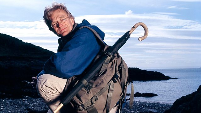
Bartholomew's Cycling Map of England and Wales Map Man
Similar Content
Browse content similar to Bartholomew's Cycling Map of England and Wales. Check below for episodes and series from the same categories and more!
Transcript
| Line | From | To | |
|---|---|---|---|
Imagine yourself on a windswept hill, nothing around you apart from towering peaks and river torrents. | 0:00:15 | 0:00:21 | |
In the early 1900s, that was the scenery that people craved. | 0:00:21 | 0:00:25 | |
So many lived in cities that they longed | 0:00:25 | 0:00:27 | |
for the wild and the beautiful, but to find it they needed a map. | 0:00:27 | 0:00:31 | |
The Bartholomew's Reduced Survey for Tourists and Cyclists was an answer to a prayer - | 0:00:33 | 0:00:39 | |
37 maps, all in colour, | 0:00:39 | 0:00:41 | |
that could lead you to a pastoral idyll anywhere in England and Wales. | 0:00:41 | 0:00:46 | |
They sold in thousands. | 0:00:46 | 0:00:47 | |
Many of those intrepid travellers set off on one of these, the classic roadster bicycle. | 0:00:50 | 0:00:56 | |
Bikes were new then and were intended to deal with everything. | 0:00:56 | 0:00:59 | |
On my journey I'll be facing dirt roads, | 0:00:59 | 0:01:03 | |
deep rivers and mountain passes. | 0:01:03 | 0:01:05 | |
What I'd like to find out is, | 0:01:05 | 0:01:07 | |
can I use THIS map | 0:01:07 | 0:01:09 | |
to get THIS bicycle | 0:01:09 | 0:01:10 | |
deep into the heart of England's most romantic landscape - | 0:01:10 | 0:01:14 | |
Wordsworth's country, the Lake District? | 0:01:14 | 0:01:17 | |
Bartholomew's half-inch maps - | 0:01:45 | 0:01:46 | |
the Bart's maps, as they came to be known - | 0:01:46 | 0:01:49 | |
just looked like the countryside they depicted. | 0:01:49 | 0:01:52 | |
Decked out in browns and greens, | 0:01:52 | 0:01:54 | |
they gave an immediate sense of being away from it all. | 0:01:54 | 0:01:58 | |
But they were extremely practical too. | 0:01:59 | 0:02:03 | |
Bart's aimed for greater accuracy and more information than any of their rivals. | 0:02:03 | 0:02:09 | |
A cyclist with just one map could follow it for over 100 miles. | 0:02:09 | 0:02:13 | |
And where better to test out a cyclist's map | 0:02:16 | 0:02:19 | |
than the Lake District, Edwardian England's favourite playground? | 0:02:19 | 0:02:24 | |
Tourists started coming to the Lake District in the 19th century. | 0:02:30 | 0:02:34 | |
They were attracted by what they'd read and seen in the poetry and painting of the Romantics. | 0:02:34 | 0:02:39 | |
They would arrive by train at Windermere | 0:02:39 | 0:02:41 | |
and continue by horse and carriage, or bicycle, | 0:02:41 | 0:02:44 | |
crossing Lake Windermere on the steamer. | 0:02:44 | 0:02:46 | |
The Bartholomew's map of the Lake District | 0:02:51 | 0:02:54 | |
shows how all the lakes radiate out from a central mountainous hub. | 0:02:54 | 0:02:58 | |
The modern motor roads wriggle all the way round the outside, making very long detours. | 0:02:58 | 0:03:04 | |
What I'd like to do is to get into this incredibly rugged heartland. | 0:03:04 | 0:03:08 | |
The question is, can the routes on this map get me from where I am, | 0:03:08 | 0:03:12 | |
Lake Windermere, | 0:03:12 | 0:03:14 | |
all the way to the Queen of the Lakes, Derwentwater? | 0:03:14 | 0:03:18 | |
And, just as important, is my classic 1930 roadster bicycle. | 0:03:18 | 0:03:23 | |
It's 50% heavier than a modern mountain bike. | 0:03:23 | 0:03:27 | |
Can it survive five mountain passes | 0:03:27 | 0:03:31 | |
and 65 miles of tough winter cycling? | 0:03:31 | 0:03:34 | |
This could be crazy. | 0:03:34 | 0:03:37 | |
Someone who knows all about cycling in this area is Guy Fitzgerald. | 0:03:41 | 0:03:46 | |
He's going to give me a few tips and, I suspect, a few warnings. | 0:03:46 | 0:03:50 | |
-This was a state-of-the-art machine when it was built. -Really? Wow. | 0:03:50 | 0:03:54 | |
-British-made. -A British-made bike. | 0:03:54 | 0:03:56 | |
-How old is this, can I ask? -It's only about 70. | 0:03:56 | 0:03:59 | |
70 years old, wow. | 0:03:59 | 0:04:00 | |
I might just check the brakes over. | 0:04:00 | 0:04:03 | |
The... The rear brake... | 0:04:03 | 0:04:07 | |
is not actually working very well, I'm afraid. | 0:04:07 | 0:04:11 | |
-No, it's not a modern system, rods! -It's not, no. | 0:04:11 | 0:04:14 | |
I'd advise controlling your speed very carefully and don't let yourself get out of control. | 0:04:14 | 0:04:20 | |
And the heels of my boots on corners. | 0:04:20 | 0:04:22 | |
Possibly, as a last resort, it's an option. | 0:04:22 | 0:04:25 | |
Another thing to watch out for is the tyres. | 0:04:25 | 0:04:27 | |
There's not much tread on there, so you're not gonna get much grip. | 0:04:27 | 0:04:32 | |
-Well, it was very good when it was new. -Absolutely! | 0:04:32 | 0:04:35 | |
Now, what about the saddle? It seems to have a bit of movement in it. | 0:04:35 | 0:04:39 | |
Is it meant to do that? That's not a primitive suspension system, is it? | 0:04:39 | 0:04:43 | |
It's not, no, that is actually supposed to be secure and fixed level in one position, | 0:04:43 | 0:04:48 | |
so I'd advise you to get that tightened up, which I'll be happy to do before you set off. | 0:04:48 | 0:04:53 | |
So, marks out of ten? | 0:04:53 | 0:04:54 | |
For doing a very technical route, like you're taking on, | 0:04:54 | 0:04:59 | |
I'd probably give it a two. | 0:04:59 | 0:05:01 | |
Two out of ten? Is that all you'll give it? | 0:05:01 | 0:05:03 | |
A two out of ten on a difficult technical circuit like you're doing. | 0:05:03 | 0:05:08 | |
It's difficult on a bike of this nature. | 0:05:08 | 0:05:10 | |
'Hmm, it doesn't sound too encouraging.' | 0:05:10 | 0:05:13 | |
Stretching west of me is the most inhospitable terrain in England. | 0:05:22 | 0:05:27 | |
I'm heading for Langdale, one of the Lakes' most beautiful valleys, | 0:05:27 | 0:05:31 | |
and the first problem I've got is finding the route. | 0:05:31 | 0:05:35 | |
Some of the Bart's roads are minuscule. | 0:05:35 | 0:05:37 | |
The people who first rode these iron horses must have been a breed apart. | 0:05:40 | 0:05:45 | |
They were dubbed devotees of the wheel | 0:05:45 | 0:05:48 | |
and there was no shortage of them - men and women in search of a bit of wild rural bliss. | 0:05:48 | 0:05:54 | |
This was a brief period between the horse and the car when the bicycle was king. | 0:05:55 | 0:06:01 | |
Bart's realised that the Ordnance Survey maps, on which their new leisure maps were based, | 0:06:03 | 0:06:09 | |
were no good for cyclists. They lacked detail, the surveying was 50 years old, | 0:06:09 | 0:06:14 | |
and they were no longer accurate. | 0:06:14 | 0:06:17 | |
So Bart's turned for help to the obvious people - the cyclists. | 0:06:17 | 0:06:23 | |
From 1898 right up to the 1970s, | 0:06:23 | 0:06:25 | |
the Cyclists' Touring Club, | 0:06:25 | 0:06:28 | |
or CTC, provided information about landmarks and dangers | 0:06:28 | 0:06:32 | |
to the map makers at Bart's. | 0:06:32 | 0:06:35 | |
This looks like a bump in the road! | 0:06:35 | 0:06:38 | |
'They also described the condition of the cycle routes.' | 0:06:38 | 0:06:42 | |
Amazingly, there are 11 different grades of road and track on this map. | 0:06:42 | 0:06:46 | |
At the top end, some of the roads, like this one here, | 0:06:46 | 0:06:50 | |
are rated first class. | 0:06:50 | 0:06:52 | |
But some, like this one here, are not recommended at all. | 0:06:52 | 0:06:57 | |
For cyclists, this map could make the difference between a good, safe holiday and a disaster. | 0:06:57 | 0:07:03 | |
So what's the difference between a route that's not recommended and one that is? | 0:07:04 | 0:07:10 | |
This track goes north from High Tilberthwaite to Little Langdale. | 0:07:10 | 0:07:14 | |
The Bart's map describes it as, "Indifferent, passable." | 0:07:14 | 0:07:18 | |
But it looks like a good short cut. | 0:07:18 | 0:07:20 | |
There's a slate quarry marked on it, which should mean | 0:07:22 | 0:07:26 | |
that there's a reasonable track for moving the slate out of the valley. | 0:07:26 | 0:07:30 | |
On the other hand, there's a ford through a river up here and that could be a problem. | 0:07:30 | 0:07:35 | |
So let's just see. | 0:07:35 | 0:07:36 | |
The bike doesn't seem too bad at the moment, | 0:07:39 | 0:07:42 | |
no punctures yet, though I can't say I'm too thrilled by these brakes. | 0:07:42 | 0:07:47 | |
According to the map, there should be a slate quarry on the right, | 0:07:49 | 0:07:53 | |
and there it is, that's the slate that used to roof Edwardian England. | 0:07:53 | 0:07:57 | |
Oh, that's amazing! Right down here... | 0:07:57 | 0:07:59 | |
in the bedrock of the track, | 0:07:59 | 0:08:01 | |
there's some cuts caused by wagon wheels | 0:08:01 | 0:08:03 | |
taking the slate down the valley. | 0:08:03 | 0:08:06 | |
Those are just ordinary cracks in the rock, | 0:08:06 | 0:08:09 | |
but this line here is where a metal-rimmed wheel | 0:08:09 | 0:08:12 | |
has cut into the bedrock, and it's along here, too. | 0:08:12 | 0:08:15 | |
So this road was being used by industry | 0:08:15 | 0:08:17 | |
long before it was a cycle track. | 0:08:17 | 0:08:19 | |
But if it was a road also used by civilian traffic, | 0:08:19 | 0:08:22 | |
I should find some signs further up there | 0:08:22 | 0:08:25 | |
of some kind of engineering to keep it in good repair. | 0:08:25 | 0:08:28 | |
So far, I'd say this was a cyclist's dream - | 0:08:31 | 0:08:35 | |
a firm surface, well maintained. | 0:08:35 | 0:08:37 | |
I can't imagine why you'd call it, "Indifferent, passable." | 0:08:37 | 0:08:41 | |
That sounds very second-rate. | 0:08:41 | 0:08:42 | |
Yep, just as I thought! | 0:08:50 | 0:08:52 | |
This is absolutely wonderful. | 0:08:56 | 0:08:58 | |
There's a culvert underneath the track here, | 0:08:58 | 0:09:01 | |
and this river has had its flow broken by this weir here, | 0:09:01 | 0:09:04 | |
so that when the river's in spate, | 0:09:04 | 0:09:07 | |
it doesn't rise up and wash away this bridge. | 0:09:07 | 0:09:10 | |
The river's also been channelled to direct the current underneath the road and then on top... | 0:09:10 | 0:09:15 | |
Here we've got a huge slab of slate | 0:09:15 | 0:09:18 | |
that's been carried from the quarry above here. | 0:09:18 | 0:09:20 | |
Now, the thing is, it's a very, very good piece of engineering, | 0:09:20 | 0:09:25 | |
and in the early 1900s this would have been one of the better roads in the Lake District. | 0:09:25 | 0:09:29 | |
Well, why isn't it one of the top-grade roads on Bart's, | 0:09:29 | 0:09:33 | |
the first-class category? Very puzzling. | 0:09:33 | 0:09:36 | |
'Hmm, so maybe there's worse up ahead.' | 0:09:36 | 0:09:39 | |
That's a pretty scary sight. | 0:09:51 | 0:09:53 | |
When I saw the ford marked on the map, | 0:09:53 | 0:09:56 | |
I thought I'd be able to ride the bicycle through it. | 0:09:56 | 0:09:59 | |
But this river is in spate, all this heavy rain's swollen the river, | 0:09:59 | 0:10:04 | |
and it looks pretty... a pretty fearsome sight. | 0:10:04 | 0:10:07 | |
On the map, the nearest bridge is a mile that way, | 0:10:07 | 0:10:10 | |
or a mile that way, so what would an Edwardian cyclist have done? | 0:10:10 | 0:10:14 | |
Pressed on right through the water, I think. | 0:10:14 | 0:10:17 | |
I'm so wet from this rain, it's not gonna make any difference, | 0:10:17 | 0:10:20 | |
so here goes - fortune favours the brave. | 0:10:20 | 0:10:22 | |
God, this is... oh, absolutely freezing! | 0:10:27 | 0:10:31 | |
It's quite deep, too. You can't tell from the bank... | 0:10:32 | 0:10:36 | |
..how deep it is. | 0:10:37 | 0:10:39 | |
And the current's quite strong, because the river's in flood, and it's pushing the bike. | 0:10:39 | 0:10:45 | |
Those Edwardians certainly had a wonderful spirit of adventure... | 0:10:45 | 0:10:50 | |
because this is a recommended cycling route. | 0:10:50 | 0:10:53 | |
Great guys! | 0:10:53 | 0:10:55 | |
'Recommended but definitely not first class.' | 0:10:57 | 0:11:01 | |
When cyclists in the 1900s stepped out of rivers like this, | 0:11:03 | 0:11:07 | |
they'd have been wearing heavy, waterlogged tweeds, | 0:11:07 | 0:11:10 | |
and what they needed was somewhere warm they could go and get dry. | 0:11:10 | 0:11:14 | |
So the CTC asked Bartholomew's to mark on their maps inns and hotels, | 0:11:14 | 0:11:20 | |
and that is where I'm going now. | 0:11:20 | 0:11:22 | |
Well, I've got to Langdale, but it's taken me all day, | 0:11:37 | 0:11:42 | |
and if it is beautiful, there's no way of telling at this hour. | 0:11:42 | 0:11:46 | |
The most exciting thing about this map is that it's coloured. | 0:11:51 | 0:11:54 | |
At the time, most British maps, | 0:11:54 | 0:11:56 | |
like this Ordnance Survey one, were black and white. | 0:11:56 | 0:11:59 | |
Which would you rather have? | 0:11:59 | 0:12:00 | |
This multi-coloured work of art, or this monochrome map here? | 0:12:00 | 0:12:05 | |
So perhaps it's not surprising | 0:12:05 | 0:12:06 | |
that Bart's could sell 10,000 copies of a map like this | 0:12:06 | 0:12:11 | |
and the Ordnance Survey just 1,000. | 0:12:11 | 0:12:13 | |
Now, the first thing you have to decide when you're making a map | 0:12:13 | 0:12:17 | |
is which scale to use. | 0:12:17 | 0:12:18 | |
Bart's chose a scale of half-an-inch to the mile, | 0:12:18 | 0:12:22 | |
or about one to 127,000. | 0:12:22 | 0:12:23 | |
And that reflects the kinds of distance a cyclist could cover in any one day, quite large distances. | 0:12:23 | 0:12:29 | |
Now, just one Bart's map would cover the whole of the Lake District, | 0:12:29 | 0:12:33 | |
whereas you'd need nine Ordnance Survey maps to do the same job. | 0:12:33 | 0:12:37 | |
So Bart's is much, much cheaper. | 0:12:37 | 0:12:39 | |
The amazing thing is that, despite the small scale, | 0:12:39 | 0:12:42 | |
Bart's managed to cram on more detail | 0:12:42 | 0:12:44 | |
than many of the Ordnance Survey maps. | 0:12:44 | 0:12:47 | |
It has everything you need to know as a cyclist. | 0:12:47 | 0:12:49 | |
It's got hotels, it's got inns, | 0:12:49 | 0:12:52 | |
we've got the footpaths up Scafell Pike. | 0:12:52 | 0:12:55 | |
All of that detail was only possible because the engravers | 0:12:55 | 0:12:59 | |
that Bartholomew's employed were incredibly skilled, | 0:12:59 | 0:13:02 | |
and miniaturised the place-names so a huge amount of detail's visible. | 0:13:02 | 0:13:07 | |
But what makes this a major milestone in British map-making | 0:13:07 | 0:13:11 | |
is a technique that Bart's used called layer colouring. | 0:13:11 | 0:13:14 | |
Down here you've got 16 different colours | 0:13:14 | 0:13:18 | |
from deep green through light green, light brown to dark brown. | 0:13:18 | 0:13:22 | |
And each of those colours represents a different altitude or contour. | 0:13:22 | 0:13:26 | |
What that means is you can get an overview of the Lake District | 0:13:26 | 0:13:29 | |
as if you're looking down from space and you can see the terrain. | 0:13:29 | 0:13:33 | |
It was the first time it had ever been used on a British map, | 0:13:33 | 0:13:37 | |
and it's absolutely brilliant. | 0:13:37 | 0:13:39 | |
Well, I'll be glad of some rest tonight | 0:13:40 | 0:13:43 | |
because my journey is about to turn extreme. | 0:13:43 | 0:13:46 | |
Tomorrow I have to ride over the Rhinos and Hardknott Passes | 0:13:46 | 0:13:51 | |
and then somehow cross the mountains to Buttermere, | 0:13:51 | 0:13:54 | |
so it's as well I get some expert advice. | 0:13:54 | 0:13:57 | |
Pete Collins trains people in abseiling and gorge scrambling | 0:13:59 | 0:14:04 | |
and he's involved in mountain rescue work. | 0:14:04 | 0:14:06 | |
The first thing to know is what the weather's going to do. | 0:14:06 | 0:14:09 | |
Things that can get you are the cold, the wind, erm... | 0:14:09 | 0:14:13 | |
rain or snow and... | 0:14:13 | 0:14:16 | |
also cloud. | 0:14:16 | 0:14:18 | |
If the cloud's low, you'll have real difficulties with navigation. | 0:14:18 | 0:14:22 | |
So have you got a map and compass? | 0:14:22 | 0:14:24 | |
I've got a map and a compass. My map is 100 years old. | 0:14:24 | 0:14:27 | |
It's a Bartholomew's half-inch to the mile map. | 0:14:27 | 0:14:30 | |
No contours to speak of. | 0:14:30 | 0:14:31 | |
It gives you an idea, but you're gonna struggle in bad weather to navigate with that map. | 0:14:31 | 0:14:37 | |
-What else do I need? -Waterproof clothing. | 0:14:37 | 0:14:39 | |
-Ah, well, I've got this. This is waterproof. -Is it? -Yep. -OK. | 0:14:39 | 0:14:44 | |
And I've got a spare, er... warm jacket here. | 0:14:44 | 0:14:48 | |
-Have you got waterproof trousers? -I don't believe in the trousers, I've got windproof trousers. | 0:14:48 | 0:14:53 | |
Windproof's all right if you keep moving. | 0:14:53 | 0:14:56 | |
And...a spare pair of socks there. | 0:14:56 | 0:14:58 | |
Right, for river crossings. | 0:14:58 | 0:14:59 | |
-Have you got gloves? -I've got gloves. | 0:14:59 | 0:15:02 | |
Cos socks, when you have to stop, you can stick on instead of gloves | 0:15:02 | 0:15:05 | |
or put them over your gloves, so they've got two uses. | 0:15:05 | 0:15:09 | |
-The other thing that's concerning, you're taking a bike. -I am. | 0:15:09 | 0:15:12 | |
-Have you got anything to fix problems with the bike? -Well, I do have a toolkit here. | 0:15:12 | 0:15:17 | |
If the chain breaks, would you be able to fix that? | 0:15:17 | 0:15:19 | |
Er...I'd have trouble if the chain broke, | 0:15:19 | 0:15:22 | |
but I have got a rope with me just in case I have to lower the bike over cliffs or anything like that. | 0:15:22 | 0:15:28 | |
Yeah, I wouldn't trust myself to it cos I don't think it's enough. | 0:15:28 | 0:15:32 | |
No, it's not a human-lowering rope, but it'll carry the weight of a bicycle. | 0:15:32 | 0:15:36 | |
On to the next leg of my journey and Rhinos, | 0:15:49 | 0:15:52 | |
the first of my mountain passes. | 0:15:52 | 0:15:55 | |
Ahead, you can see the road rises very steeply, | 0:15:57 | 0:16:00 | |
and this is making me a little anxious | 0:16:00 | 0:16:03 | |
because the map isn't telling me what I'm seeing on the ground. | 0:16:03 | 0:16:06 | |
According to the Bart's map, I should be on a gentle decline. | 0:16:06 | 0:16:10 | |
Which this clearly isn't! | 0:16:11 | 0:16:13 | |
Rhinos Bottom! | 0:16:18 | 0:16:20 | |
Sounds like something an Edwardian cyclist gets after a week in the saddle. | 0:16:20 | 0:16:26 | |
Over the bridge now and into the second pass, Hardknott, | 0:16:29 | 0:16:33 | |
which is about the same height as Rhinos - | 0:16:33 | 0:16:36 | |
just short of 1,300 feet - but it's considerably steeper. | 0:16:36 | 0:16:41 | |
The weather's changing every five minutes. | 0:16:41 | 0:16:44 | |
And when it rains, boy, does it rain! | 0:16:44 | 0:16:48 | |
The Lake District gets up to 140 inches of rain a year, | 0:16:53 | 0:16:57 | |
more than anywhere else in England. | 0:16:57 | 0:17:00 | |
Well, I've covered only about eight miles, | 0:17:02 | 0:17:05 | |
but the sheer weight of this bike | 0:17:05 | 0:17:07 | |
makes it feel like a week's worth of cycling! | 0:17:07 | 0:17:11 | |
I've a long way to go. I've just got to find a quicker route. | 0:17:11 | 0:17:15 | |
If I can take a short cut across the mountains | 0:17:18 | 0:17:20 | |
to Lake Buttermere, I'm going to save myself an awful lot of pedalling. | 0:17:20 | 0:17:24 | |
The Bart's map shows a very thin black dotted line | 0:17:24 | 0:17:27 | |
crossing two mountain passes - Black Sail and Scarth Gap. | 0:17:27 | 0:17:31 | |
The question is, can I cross those passes and get down before dark? | 0:17:31 | 0:17:35 | |
And the weather is terrible! | 0:17:35 | 0:17:38 | |
Mountain passes can be dangerous places, especially in winter. | 0:17:39 | 0:17:44 | |
It used to be said that people take their bikes over Black Sail | 0:17:44 | 0:17:47 | |
and never come back. | 0:17:47 | 0:17:49 | |
THUNDER RUMBLES | 0:17:49 | 0:17:51 | |
This pass rises to nearly 2,000 feet, | 0:17:51 | 0:17:55 | |
and if the map's anything to go by, | 0:17:55 | 0:17:57 | |
the road is a thin path that I could lose at any time. | 0:17:57 | 0:18:01 | |
In the past, a narrow track like this would have been the quickest, | 0:18:02 | 0:18:06 | |
safest route for pack horses crossing the mountains. | 0:18:06 | 0:18:10 | |
The shepherds and the drivers of the pack trains | 0:18:13 | 0:18:15 | |
that used to cross this mountain pass | 0:18:15 | 0:18:18 | |
knew a thing or two about using the lie of the land. | 0:18:18 | 0:18:22 | |
The path they cut created a series of zigzags in the mountain side, | 0:18:22 | 0:18:27 | |
so that they could climb steadily and gently, | 0:18:27 | 0:18:31 | |
the idea, of course, being to conserve the energy of man | 0:18:31 | 0:18:36 | |
and the energy of the beasts of burden. | 0:18:36 | 0:18:39 | |
The trouble is that nowadays not everybody's prepared to take the long route | 0:18:41 | 0:18:45 | |
and you can see here where modern mountain walkers have been taking short cuts | 0:18:45 | 0:18:50 | |
up and down the mountain side by cutting off all the zigzags. | 0:18:50 | 0:18:54 | |
And their boot prints have scarred the mountain side, | 0:18:54 | 0:18:57 | |
water's collected in those prints | 0:18:57 | 0:18:59 | |
and created a gully running down here. | 0:18:59 | 0:19:01 | |
The National Trust have had to put these huge boulders along here | 0:19:01 | 0:19:05 | |
to keep walkers on the old zigzags. | 0:19:05 | 0:19:07 | |
And if the National Trust hadn't done that, | 0:19:07 | 0:19:09 | |
this gully would have widened with flash floods | 0:19:09 | 0:19:12 | |
and the whole mountain side would have slithered into the ravine. | 0:19:12 | 0:19:15 | |
At 1,800 feet, it's fairly alarming | 0:19:29 | 0:19:32 | |
in this cloud and mist... | 0:19:32 | 0:19:34 | |
and the cold. | 0:19:34 | 0:19:36 | |
No matter how good your clothing, | 0:19:36 | 0:19:39 | |
the cold always gets through eventually. | 0:19:39 | 0:19:42 | |
I was warned I'd have trouble navigating this with a Bart's map, | 0:19:42 | 0:19:46 | |
but I must surely be at the top of Black Sail by now. | 0:19:46 | 0:19:50 | |
They must have been absolutely determined, those cyclists, simply to get over this pass. | 0:19:56 | 0:20:02 | |
The way down is even worse in parts than the way up. | 0:20:02 | 0:20:05 | |
The Bartholomew's half-inch to the mile map is a wonderful map | 0:20:32 | 0:20:37 | |
if you're cycling on roads and good tracks, | 0:20:37 | 0:20:40 | |
but it's not such a great map if you go mountaineering | 0:20:40 | 0:20:43 | |
because at that scale, it doesn't show obstacles | 0:20:43 | 0:20:47 | |
like rivers that are too big to ford, | 0:20:47 | 0:20:49 | |
or big mountain crags you've got to climb down. | 0:20:49 | 0:20:52 | |
So if you go mountaineering with Bart's, | 0:20:52 | 0:20:55 | |
you're gonna find yourself | 0:20:55 | 0:20:57 | |
coming across lots of obstacles... and this is one of them. | 0:20:57 | 0:21:01 | |
I've got a rock step here, and I'm going to lower the bike over it | 0:21:03 | 0:21:07 | |
on a length of rope I've brought with me for just this purpose. | 0:21:07 | 0:21:10 | |
It sounds a slightly eccentric thing to do, but actually it's a much safer way of getting down | 0:21:10 | 0:21:16 | |
this very greasy wet rock | 0:21:16 | 0:21:17 | |
because I don't want to try walking down it with a bicycle around my neck. | 0:21:17 | 0:21:22 | |
This way, if the bicycle slips, it doesn't take me with it. | 0:21:22 | 0:21:25 | |
If you wanted to come here on a bike, you had to have quite a lot of initiative | 0:21:29 | 0:21:34 | |
and obviously be very fit as well... | 0:21:34 | 0:21:36 | |
because it's not an ordinary kind of bike ride. | 0:21:36 | 0:21:40 | |
Now I'm headed over to Scarth Gap. | 0:21:42 | 0:21:44 | |
Not sure the light's going to hold, though. | 0:21:44 | 0:21:46 | |
The bicycle as we know it was invented in 1888. | 0:21:56 | 0:22:01 | |
It transformed Victorian leisure. | 0:22:01 | 0:22:04 | |
By 1904, there were over one million machines on the road. | 0:22:04 | 0:22:08 | |
The bicycle had so much going for it. | 0:22:08 | 0:22:11 | |
It cost less than a horse, it didn't need food or a stable overnight, | 0:22:11 | 0:22:16 | |
and, generally, you could cover more ground on a bike than a horse. | 0:22:16 | 0:22:21 | |
Well, maybe not going over mountains. | 0:22:21 | 0:22:23 | |
THUNDER RUMBLES | 0:22:27 | 0:22:29 | |
Growing darker now. | 0:22:33 | 0:22:34 | |
With this mist, it's still impossible to know | 0:22:34 | 0:22:37 | |
how far it is to the top of the second pass. | 0:22:37 | 0:22:40 | |
Every time I think I'm getting near it, there's another slope to climb. | 0:22:40 | 0:22:44 | |
If I don't reach the top soon, I'll be climbing down to Buttermere in the pitch black. | 0:22:44 | 0:22:50 | |
I just hope this is it. | 0:22:54 | 0:22:56 | |
Wow, that's fantastic! | 0:23:00 | 0:23:02 | |
Just look at that mountain! Everywhere there are huge drops, | 0:23:02 | 0:23:06 | |
towering peaks, fantastic slabs of rock! | 0:23:06 | 0:23:10 | |
It's absolutely wonderful! | 0:23:10 | 0:23:12 | |
Over there's Fleetwith Pike. | 0:23:12 | 0:23:14 | |
I wonder what the view's like from up there. | 0:23:14 | 0:23:16 | |
It's like being up in the heavens, looking down on the wrinkled, | 0:23:16 | 0:23:20 | |
detailed surface of the planet - a map-maker's view. | 0:23:20 | 0:23:23 | |
And down there is Lake Buttermere, where I'm going next. | 0:23:23 | 0:23:28 | |
So, I've made it, | 0:23:28 | 0:23:29 | |
and just in time to get down to the lake before nightfall. | 0:23:29 | 0:23:34 | |
The final day of my journey. | 0:23:40 | 0:23:43 | |
The route I've been cycling and climbing | 0:23:43 | 0:23:45 | |
is a semi-circular tour of the Lakes | 0:23:45 | 0:23:48 | |
and now I'm 80% of the way round, | 0:23:48 | 0:23:51 | |
but there's just one more thing I have to do. | 0:23:51 | 0:23:54 | |
Derwentwater's only about ten miles away now, | 0:23:54 | 0:23:57 | |
but before I get there later, I've set myself a little challenge. | 0:23:57 | 0:24:02 | |
A hundred years ago, most cyclists coming to the Lake District | 0:24:02 | 0:24:06 | |
wouldn't have left before climbing a decent peak, | 0:24:06 | 0:24:08 | |
and I saw a great one yesterday from the top of Scarth Gap. | 0:24:08 | 0:24:11 | |
It's called Fleetwith Pike, and it's this monster up ahead. | 0:24:11 | 0:24:15 | |
The mountains and lakes on Bart's | 0:24:18 | 0:24:20 | |
look a bit like the spokes of a wheel on my bicycle. | 0:24:20 | 0:24:23 | |
That's a result of the glaciation that created the landscape. | 0:24:23 | 0:24:28 | |
And one man who knows all about that is geologist Alan Smith. | 0:24:28 | 0:24:32 | |
The Lake District has been subjected to glaciations, | 0:24:32 | 0:24:35 | |
cold climate conditions, for nearly two and a half million years. | 0:24:35 | 0:24:41 | |
The ice was moving out in all directions, | 0:24:41 | 0:24:43 | |
and standing here looking down at Buttermere | 0:24:43 | 0:24:46 | |
and Crummock Water, this was one of the main routes that the ice was taking. | 0:24:46 | 0:24:50 | |
So we have to imagine Buttermere Valley | 0:24:50 | 0:24:53 | |
-filled to the brim with ice creeping down towards the sea. -Yes. | 0:24:53 | 0:24:56 | |
The ice was over the top of the highest fells. | 0:24:56 | 0:25:00 | |
What you've got in front of us now | 0:25:00 | 0:25:03 | |
are these two lakes in the floor of the valley, steep sides. | 0:25:03 | 0:25:06 | |
The reason why the left-hand side is steeper than the other side | 0:25:06 | 0:25:11 | |
is that the rocks are different. | 0:25:11 | 0:25:13 | |
On the left volcanic rocks | 0:25:13 | 0:25:15 | |
and a fine-grained granite, whereas, on the other side, | 0:25:15 | 0:25:18 | |
we've got slatey, shaley rocks | 0:25:18 | 0:25:20 | |
which break down easily | 0:25:20 | 0:25:22 | |
and streams are able to carry material away from those. | 0:25:22 | 0:25:26 | |
And you can see the effects of that | 0:25:26 | 0:25:28 | |
with the way the alluvial fans are building out into the lake | 0:25:28 | 0:25:32 | |
and the way the alluvial fan has built right across the valley | 0:25:32 | 0:25:36 | |
and separated what we call Buttermere from Crummock Water. | 0:25:36 | 0:25:40 | |
The two used to be one continuous sheet of water. | 0:25:40 | 0:25:43 | |
And the whole of this skyline in the heart of the Lake District is so rugged, what caused that? | 0:25:43 | 0:25:48 | |
Well, it's partly a reflection of these hard volcanic rocks, | 0:25:48 | 0:25:53 | |
but the ice, you've got to remember, was streaming over this landscape, | 0:25:53 | 0:25:57 | |
picking material up and carrying it away - | 0:25:57 | 0:25:59 | |
sandpapering the landscape, if you like. | 0:25:59 | 0:26:02 | |
And it's left behind these rocky knolls and rocky hillocks, | 0:26:02 | 0:26:06 | |
so the whole area is an ice-roughened landscape. | 0:26:06 | 0:26:09 | |
Last leg now and, true to form, | 0:26:14 | 0:26:16 | |
the Lake District is throwing at me every one of those 140 inches of annual rainfall. | 0:26:16 | 0:26:22 | |
I can't get over how changeable the weather is! | 0:26:22 | 0:26:25 | |
This has to be as bad as it gets - | 0:26:25 | 0:26:27 | |
icy rain straight in the face and a wind to blow your head off. | 0:26:27 | 0:26:33 | |
55 miles done. | 0:26:40 | 0:26:42 | |
I started by crossing the largest lake, Windermere, | 0:26:42 | 0:26:46 | |
I cycled past the deepest, Wast Water, | 0:26:46 | 0:26:48 | |
and now, all being well, | 0:26:48 | 0:26:50 | |
I should be about to see the one they call the Queen of the Lakes. | 0:26:50 | 0:26:54 | |
Here I am, the edge of the lake, Derwentwater! | 0:27:00 | 0:27:03 | |
Why is this the Queen of the Lakes? | 0:27:03 | 0:27:05 | |
Because, to many people, this is the most beautiful of them all, | 0:27:05 | 0:27:09 | |
and I can't wait to get out there. | 0:27:09 | 0:27:11 | |
In the middle of the lake is St Herbert's Island, | 0:27:11 | 0:27:14 | |
once occupied by a monk of that name in the seventh century. | 0:27:14 | 0:27:18 | |
And, much later, it was home to Beatrix Potter's character Squirrel Nutkin. | 0:27:18 | 0:27:23 | |
And it's on Bart's half-inch map. | 0:27:23 | 0:27:26 | |
Sadly, the Bart's map in the form I have it didn't last. | 0:27:31 | 0:27:37 | |
Bart's soon fell in love with the motor car. | 0:27:37 | 0:27:39 | |
By 1904, there were already 8,500 cars on the road. | 0:27:39 | 0:27:45 | |
The Bart's map, so easily adapted for motorists, | 0:27:45 | 0:27:48 | |
began to ignore specific cycling information, | 0:27:48 | 0:27:52 | |
and the special relationship between cyclists and Bart's came to an end. | 0:27:52 | 0:27:56 | |
But all is not lost. | 0:27:59 | 0:28:02 | |
The great news is that cycling and cyclists' maps are booming again. | 0:28:02 | 0:28:07 | |
A century after Bart's, an organisation called Sustrans | 0:28:07 | 0:28:11 | |
has just opened a 10,000-mile network of cycling routes, | 0:28:11 | 0:28:15 | |
and they're mapped on maps like this - | 0:28:15 | 0:28:18 | |
layer coloured with cyclists' information and recommended routes. | 0:28:18 | 0:28:22 | |
And the scale on these new maps is one to 100,000, | 0:28:22 | 0:28:26 | |
the close metric equivalent of half-an-inch to the mile. | 0:28:26 | 0:28:29 | |
So the old Bart's half-inch never died, it just had a 100-year rest! | 0:28:29 | 0:28:35 | |
Subtitles by Laura Jones BBC Broadcast 2005 | 0:28:47 | 0:28:50 | |
E-mail us at [email protected] | 0:28:50 | 0:28:54 |