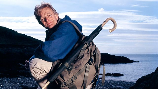
Timothy Pont's Map of Scotland Map Man
Similar Content
Browse content similar to Timothy Pont's Map of Scotland. Check below for episodes and series from the same categories and more!
Transcript
| Line | From | To | |
|---|---|---|---|
This is Sutherland in north-west Scotland. | 0:00:11 | 0:00:15 | |
It's a bleak landscape - | 0:00:15 | 0:00:17 | |
towering mountains, | 0:00:17 | 0:00:19 | |
scarcely a tree, unforgiving tracts of untamed wilderness. | 0:00:19 | 0:00:22 | |
Not a comfortable destination for a mapmaker. | 0:00:22 | 0:00:26 | |
But one young man in the late 1500s thought it was spectacular. | 0:00:26 | 0:00:31 | |
When Timothy Pont set out to survey his homeland, he was in his 20s, and Scotland was in trouble. | 0:00:38 | 0:00:44 | |
Witch burning, rebellious clans, cattle rustling, banditry, wolves - the Scots had the lot. | 0:00:44 | 0:00:52 | |
Only a particularly brave, or perhaps foolhardy, map maker would tackle a country like this. | 0:00:52 | 0:00:57 | |
I'm going to take an incredible journey in Pont's footsteps | 0:01:02 | 0:01:06 | |
across the last remaining wilderness in Britain. | 0:01:06 | 0:01:09 | |
I want to discover what Pont charted on these, the very first detailed maps of Scotland. | 0:01:09 | 0:01:15 | |
Were they accurate? And, most importantly, | 0:01:15 | 0:01:17 | |
what drove one man to attempt to map such a vast and inhospitable land? | 0:01:17 | 0:01:22 | |
Timothy Pont's maps of the north-west of Scotland may be rough sketches. | 0:01:51 | 0:01:56 | |
But they are the field work of an exceptional mapmaker. | 0:01:56 | 0:02:00 | |
Never before had the rivers and towns, the forests and mountains been set down in such detail. | 0:02:00 | 0:02:07 | |
This was clan territory. | 0:02:07 | 0:02:09 | |
It was dangerous, and what Pont provided for the first time was a way through the Highlands. | 0:02:09 | 0:02:15 | |
The Highlands were the most rebellious and lawless part of the country. | 0:02:18 | 0:02:22 | |
And that's what fascinates me. | 0:02:22 | 0:02:25 | |
Round here, even royal messengers didn't dare deliver the King's letters to clan chiefs. | 0:02:25 | 0:02:31 | |
So, how did Pont do his survey without losing himself or his head? | 0:02:31 | 0:02:37 | |
My route will take me from the shores of Loch Maree | 0:02:37 | 0:02:40 | |
to the far north-west of Sutherland, deep in the heart of Britain's last true wilderness. | 0:02:40 | 0:02:46 | |
I'll be crossing a holy loch, tracking a bandit's highway, and my goal is the mysterious | 0:02:46 | 0:02:52 | |
and frighteningly named Way of the Wolves. It's gonna be quite some journey. | 0:02:52 | 0:02:56 | |
They're not the easiest maps to follow, | 0:02:59 | 0:03:02 | |
and that's because Pont's sketches depict individual geographical scenes. | 0:03:02 | 0:03:07 | |
They don't give you the big picture. | 0:03:07 | 0:03:09 | |
Certain things stand out very clearly, though - | 0:03:09 | 0:03:13 | |
particularly the lochs. | 0:03:13 | 0:03:17 | |
This is Loch Maree. | 0:03:17 | 0:03:18 | |
We know Pont came here because he was no armchair cartographer. | 0:03:18 | 0:03:22 | |
He visited places that were scarcely known, | 0:03:22 | 0:03:25 | |
like these islands. | 0:03:25 | 0:03:27 | |
He mapped all 24 of them and he gave names to 16. | 0:03:27 | 0:03:31 | |
The trouble is that he didn't show us where on the loch the islands are, | 0:03:31 | 0:03:35 | |
and I can't see a single one of them from here. | 0:03:35 | 0:03:37 | |
I've a suspicion that he can only have mapped those islands by looking down on them from above. | 0:03:37 | 0:03:42 | |
So I need to get across that loch and up a mountain. | 0:03:42 | 0:03:46 | |
Pont was not commissioned to do his survey. | 0:03:57 | 0:04:01 | |
It's possible that it was his father's idea. | 0:04:01 | 0:04:05 | |
Robert Pont was a key figure in Scottish religious and political circles | 0:04:05 | 0:04:10 | |
and he may have hoped that, by mapping Scotland, his son could win the favour of the King. | 0:04:10 | 0:04:16 | |
The King of Scotland was James VI. | 0:04:16 | 0:04:19 | |
His mother, Mary Queen of Scots, had been a cousin to Elizabeth I. | 0:04:19 | 0:04:23 | |
Now that Mary was dead, James became heir to the English throne as well. | 0:04:23 | 0:04:28 | |
And that gave Scotland a bit of an inferiority complex. | 0:04:28 | 0:04:32 | |
Compared to well mapped England, Scotland was still a blank on the map. | 0:04:32 | 0:04:36 | |
The King knew next to nothing about his hills, his rivers, his boundaries | 0:04:36 | 0:04:41 | |
and especially where his loyal and rebellious subjects were. | 0:04:41 | 0:04:45 | |
Timothy Pont set out to change all that. | 0:04:45 | 0:04:48 | |
The place on the far side of the loch is known as Letterewe. It means "middle of the loch". | 0:04:51 | 0:04:57 | |
And it took a very brave man to come here as a visitor in the 16th century. | 0:04:57 | 0:05:02 | |
The locals were not exactly renowned for their hospitality. | 0:05:02 | 0:05:06 | |
Part of the problem was religion. | 0:05:08 | 0:05:11 | |
Some of the clans hung on to the old faith, Catholicism, | 0:05:11 | 0:05:15 | |
and they didn't care much for the Protestant King and the tide of Protestantism sweeping the nation. | 0:05:15 | 0:05:21 | |
Today, things are a bit quieter, | 0:05:23 | 0:05:25 | |
although, according to one of the local estate workers, Bill Hart, | 0:05:25 | 0:05:29 | |
memories of those violent days still linger. | 0:05:29 | 0:05:32 | |
When our mapmaker, Timothy Pont, came here 400 years ago, | 0:05:32 | 0:05:35 | |
would he have been made welcome by the people living on the loch? | 0:05:35 | 0:05:39 | |
He'd have been welcomed as long he wasn't preaching religion. | 0:05:39 | 0:05:43 | |
Religion got the people's backs up in them days. | 0:05:43 | 0:05:45 | |
There was a story in 1711 of a minister came to Letterewe | 0:05:45 | 0:05:51 | |
called John Morrison, | 0:05:51 | 0:05:53 | |
and he came to preach his form of religion to the islanders and they took offence. | 0:05:53 | 0:05:58 | |
And they took him out to a place called Fool's Rock, which is a small island as you cross the loch. | 0:05:58 | 0:06:03 | |
On there, they staked him out, stripped him naked and left him to the midges. | 0:06:03 | 0:06:08 | |
And it was only because there was a lady on the estate that sort of took a soft spot | 0:06:08 | 0:06:13 | |
for this John Morris, that she sailed out after dark and rescued him from his plight on the island. | 0:06:13 | 0:06:19 | |
And he managed to escape from it. | 0:06:19 | 0:06:20 | |
But there was others that didn't. | 0:06:20 | 0:06:23 | |
Where do you think Timothy Pont was standing when he sketched the islands of Loch Maree? | 0:06:23 | 0:06:29 | |
He seems to be above the islands looking down on them. | 0:06:29 | 0:06:32 | |
Is there a mountain around here that he might have been using as a viewpoint? | 0:06:32 | 0:06:36 | |
Yes, I think, if you look at the islands... | 0:06:36 | 0:06:39 | |
If you came across to Letterewe to start with, | 0:06:39 | 0:06:42 | |
he'd have taken this path that runs up along a ridge | 0:06:42 | 0:06:45 | |
that we call Spy Point, which looks down over Isle Maree, you can see all the islands from that point. | 0:06:45 | 0:06:51 | |
How would I get there from Letterewe? | 0:06:51 | 0:06:53 | |
From Letterewe, you would follow the path round past the river to the cairn, then you would | 0:06:53 | 0:06:58 | |
bear left at the cairn, down over a bridge which crosses a very, very fast-flowing stream. | 0:06:58 | 0:07:03 | |
And you cross that and follow the path out till you arrive at the Spy Point. | 0:07:03 | 0:07:07 | |
Spy Point is around 1,000ft above the loch and the islands. | 0:07:17 | 0:07:20 | |
So that's quite a climb. | 0:07:20 | 0:07:22 | |
I always get really excited walking ancient trackways. | 0:07:35 | 0:07:39 | |
This trackway has been excavated from the mountain side by countless hooves and feet. | 0:07:39 | 0:07:45 | |
It's probably been in use for at least 1,000 years - possibly twice that long. | 0:07:45 | 0:07:49 | |
Bill told me to look out for a fork in the path, marked by a cairn. | 0:07:50 | 0:07:55 | |
I've got to the fork and the cairn, but the cairn's one of the smallest I've ever seen - | 0:07:55 | 0:07:59 | |
it's absolutely tiny, and in thick mist you could walk straight past this without even seeing it. | 0:07:59 | 0:08:04 | |
These mountains would be very dangerous, | 0:08:04 | 0:08:07 | |
and this is one of the problems that Pont faced when he was up here mapping. | 0:08:07 | 0:08:11 | |
Much like me, Pont must have relied hugely on local knowledge and he may have made some use of guides. | 0:08:11 | 0:08:18 | |
They'd know where to get the best views, the names of hills and rivers, | 0:08:18 | 0:08:22 | |
the distances he'd have to cover and - very important - | 0:08:22 | 0:08:26 | |
the landmarks to help you stay out of danger | 0:08:26 | 0:08:30 | |
from the bogs and the bandits and the wolves. | 0:08:30 | 0:08:35 | |
77 of Pont's maps survive, | 0:08:39 | 0:08:43 | |
and he must have made many more. | 0:08:43 | 0:08:44 | |
All of them entailed long walks, fast-flowing mountain streams and ferocious weather. | 0:08:44 | 0:08:51 | |
This is it! The exact spot that Timothy Pont stood. | 0:09:08 | 0:09:12 | |
I can see the entire loch, all the islands - what a fantastic place. | 0:09:15 | 0:09:21 | |
What strikes you about these maps is that they glorify Scotland. | 0:09:38 | 0:09:42 | |
They're a remarkable picture of the history, | 0:09:42 | 0:09:45 | |
the geography and the architecture of the 16th century. | 0:09:45 | 0:09:48 | |
In fact, they're not maps at all, | 0:09:48 | 0:09:50 | |
but collections of working notes, | 0:09:50 | 0:09:53 | |
miraculously preserved for 400 years. | 0:09:53 | 0:09:55 | |
Did Pont really hope that the King would eventually see them? | 0:09:55 | 0:09:59 | |
Nobody really knows. | 0:09:59 | 0:10:01 | |
What we do know is that the King and his ministers were becoming aware | 0:10:01 | 0:10:05 | |
that Scotland's Highlands were rich in untapped resources. | 0:10:05 | 0:10:09 | |
Just look how carefully he's marked this forest and the river running through it. | 0:10:09 | 0:10:13 | |
Over here, he's shown a slate quarry. | 0:10:13 | 0:10:18 | |
But if you're an army on the march, or you're collecting taxes, | 0:10:18 | 0:10:22 | |
you might want to know what food the land can provide. | 0:10:22 | 0:10:25 | |
Down here beside the loch, | 0:10:25 | 0:10:26 | |
he's shown an area that's very good for hunting deer. | 0:10:26 | 0:10:30 | |
And beside it, a river that's full of salmon. | 0:10:30 | 0:10:33 | |
The maps are covered with thousands of place-names. | 0:10:33 | 0:10:37 | |
All the important towns are here, of course, like Forres up here, | 0:10:37 | 0:10:41 | |
but also individual buildings. | 0:10:41 | 0:10:43 | |
Mills, a church here and a castle up here. | 0:10:43 | 0:10:49 | |
But what about transport? | 0:10:50 | 0:10:52 | |
How did people get around in the 16th century using a map like this? Pont provided some of the answers. | 0:10:52 | 0:10:57 | |
His coastline has all the harbours marked. | 0:10:57 | 0:11:01 | |
There's even a ship here to show you where you can drop anchor. | 0:11:01 | 0:11:05 | |
Inland, there are no roads on the map, but what he does do | 0:11:05 | 0:11:08 | |
is mark mountain passes to help you find your way between one remote part of the Highlands and another. | 0:11:08 | 0:11:14 | |
But some places on this map are so remote that you | 0:11:16 | 0:11:18 | |
really have to wonder how on earth anybody ever got there. | 0:11:18 | 0:11:22 | |
This area on Pont's map is called Extreme Wilderness. | 0:11:22 | 0:11:27 | |
And at one end of this extreme wilderness is Wolf's Way - | 0:11:27 | 0:11:31 | |
my eventual destination - and I don't yet know how I'm going to get there. | 0:11:31 | 0:11:37 | |
Well, tomorrow I'll be heading up the windswept glens and passes | 0:11:37 | 0:11:40 | |
Pont himself travelled through, trying to find remains of what Pont actually saw. | 0:11:40 | 0:11:45 | |
But the chances of getting lost in this colossal landscape | 0:11:45 | 0:11:49 | |
are just as likely today as they were in the 16th century. | 0:11:49 | 0:11:53 | |
Pont's maps had better be reliable. | 0:11:53 | 0:11:56 | |
So how did Pont create his maps of Scotland? | 0:12:10 | 0:12:12 | |
No evidence of him using any surveying equipment. | 0:12:12 | 0:12:16 | |
The maps themselves suggest he followed rivers up valleys, sketching as he went. | 0:12:16 | 0:12:22 | |
The rivers provided a grid, which enabled him to fix the positions of everything else. | 0:12:22 | 0:12:28 | |
This is Glen Gruinard, | 0:12:28 | 0:12:30 | |
the River Gruinard tumbling along the bottom here. | 0:12:30 | 0:12:33 | |
It's one of the key rivers on Pont's grid. | 0:12:33 | 0:12:36 | |
He marks trees along both sides of the river, and along the shores of Loch Na Sealga, | 0:12:36 | 0:12:42 | |
further up the glen. | 0:12:42 | 0:12:43 | |
No trees here, though. | 0:12:43 | 0:12:45 | |
Trees do disappear, | 0:12:47 | 0:12:49 | |
but it's rare for them to vanish without leaving any trace at all. | 0:12:49 | 0:12:53 | |
So I'm on the lookout. | 0:12:53 | 0:12:55 | |
I've found one. | 0:12:59 | 0:13:01 | |
Half a metre down in that black peat on the other river bank | 0:13:01 | 0:13:04 | |
is a tree-trunk sticking out horizontally. | 0:13:04 | 0:13:07 | |
It's been exposed by the water rushing down the glen. And there's another one right beside it. | 0:13:07 | 0:13:12 | |
Two trees - and there's another one over there. | 0:13:12 | 0:13:16 | |
And another one. In fact, it goes all the way up the glen. | 0:13:16 | 0:13:20 | |
There's a whole row of tree-trunks and tree roots sticking out, | 0:13:20 | 0:13:24 | |
just as Timothy Pont mapped them! | 0:13:24 | 0:13:26 | |
This Glen may look empty and untouched, but a quick look at | 0:13:29 | 0:13:34 | |
Pont's map and you realise that this was once a busy and populated place. | 0:13:34 | 0:13:39 | |
There are settlements marked right up the glen, like this one here. | 0:13:39 | 0:13:43 | |
But how on earth did the inhabitants survive? | 0:13:43 | 0:13:46 | |
I've arranged to meet Bill Whyte, the gamekeeper on the Gruinard estate, | 0:13:50 | 0:13:54 | |
to see if he knows what the glen was like in Pont's time, and why it's changed. | 0:13:54 | 0:14:00 | |
One of the things I'm very curious about is some notes that Pont wrote beside his map of Glen Gruinard. | 0:14:02 | 0:14:07 | |
He writes that the rivers have plentiful salmon, | 0:14:07 | 0:14:10 | |
there are fir trees growing down beside the river banks, and that it's an excellent place for hunting. | 0:14:10 | 0:14:16 | |
Red deer are to be found all year round, it's an almighty park of nature. | 0:14:16 | 0:14:19 | |
Doesn't look like that now. | 0:14:19 | 0:14:22 | |
There's still quite a few salmon come into the river. | 0:14:22 | 0:14:26 | |
There's not as many as there was in his time, | 0:14:26 | 0:14:29 | |
but there's still a few coming in. | 0:14:29 | 0:14:31 | |
The deer - we've still got about 900 deer on the place. | 0:14:31 | 0:14:36 | |
Nine deer per square kilometre. | 0:14:36 | 0:14:38 | |
It's plenty for our needs. | 0:14:38 | 0:14:41 | |
And the trees - trees haven't been round here for a long time. | 0:14:41 | 0:14:44 | |
What happened to them? | 0:14:44 | 0:14:46 | |
A lot of them would've been used for fuel and building, | 0:14:46 | 0:14:51 | |
and some would have been lost naturally, just with the course of the river. | 0:14:51 | 0:14:55 | |
I think, probably, as well, at one time Gruinard was a very big sheep farm, | 0:14:55 | 0:15:00 | |
and any of the natural regen that was trying to come through, | 0:15:00 | 0:15:04 | |
the sheep would just nibble at them. | 0:15:04 | 0:15:06 | |
What's happened to all the crofts and settlements that Pont's marked | 0:15:06 | 0:15:10 | |
on his map of Glen Gruinard - where did they go? | 0:15:10 | 0:15:12 | |
I think Gruinard was cleared in the early 1800s. | 0:15:12 | 0:15:16 | |
Most of the people were moved out. | 0:15:16 | 0:15:20 | |
-Just cleared off the land? -Just cleared off the land for sheep and deer. | 0:15:20 | 0:15:25 | |
Well, the other question I've got for you, Bill, because I'm a bit stumped, | 0:15:25 | 0:15:29 | |
is where and how did Pont travel up the glen, | 0:15:29 | 0:15:32 | |
because this is a new track, the one up the valley bottom. | 0:15:32 | 0:15:35 | |
Yep. There is... | 0:15:35 | 0:15:36 | |
If you look over to the side here, there's an old drove road which comes up through that gully. | 0:15:36 | 0:15:41 | |
It's a bit overgrown. There's grass and heather all over it | 0:15:41 | 0:15:44 | |
but there's definitely two ridges with the flat down through it. | 0:15:44 | 0:15:48 | |
You'll find it OK. | 0:15:48 | 0:15:49 | |
There's no doubt that if there was a drove road through this valley, Pont would have used it. | 0:16:06 | 0:16:12 | |
Drove roads were routes used to drive cattle across country to the markets where they were to be sold. | 0:16:12 | 0:16:18 | |
They were usually higher up, above the flood plain and the boggy ground. | 0:16:18 | 0:16:23 | |
I've reached a shoulder, a leveller part of the mountain, | 0:16:26 | 0:16:32 | |
and there's something rather odd happening here, because the stream I've been following | 0:16:32 | 0:16:37 | |
is crossed by another stream at right angles. | 0:16:37 | 0:16:40 | |
And streams don't cross each other at right angles, | 0:16:40 | 0:16:43 | |
so I'm just wondering whether this other stream I've just found isn't a stream at all but the drove road. | 0:16:43 | 0:16:49 | |
I'll have to follow it to find out. | 0:16:49 | 0:16:51 | |
In the 16th century, you took your life in your hands, travelling these roads. | 0:16:53 | 0:16:58 | |
Cattle markets didn't really exist then, | 0:16:58 | 0:17:01 | |
and the people who herded cattle along here could be ugly sorts - | 0:17:01 | 0:17:05 | |
cattle rustlers or cut-throat bandits. | 0:17:05 | 0:17:08 | |
According to a friend, Pont himself was often attacked and robbed of his money and his precious maps. | 0:17:08 | 0:17:14 | |
Well, it's nearly dark now, and I've been following this stream of boulders for several hundred metres. | 0:17:16 | 0:17:22 | |
It's also hailing and snowing, but I know I'm on the drove road now. | 0:17:22 | 0:17:26 | |
Coming up here, they've pushed boulders to the side | 0:17:26 | 0:17:29 | |
to stop the animals falling down the mountainside. | 0:17:29 | 0:17:32 | |
Also, as I've been walking up, I've been noticing the peat has been getting harder and harder underfoot. | 0:17:32 | 0:17:38 | |
It's been compressed by hundreds and thousands of hooves into a clay-like hardness. | 0:17:38 | 0:17:44 | |
And this is where Timothy Pont came to make his map. | 0:17:44 | 0:17:47 | |
I'm walking in the footsteps of my hero. | 0:17:47 | 0:17:50 | |
For Pont, mountains and hills were every bit as important as rivers. | 0:18:10 | 0:18:14 | |
They defined his landscape and he drew over 300 of them on his maps. | 0:18:14 | 0:18:19 | |
One of the most distinctive is the one he calls Skormyvar, with this wicked-looking pair of fangs. | 0:18:19 | 0:18:26 | |
It should be the next mountain on my route north, at the head of Glen Sguaib. | 0:18:29 | 0:18:34 | |
I'm intrigued to know whether Pont's peaks stand out as much in reality as they do on his map. | 0:18:34 | 0:18:40 | |
Question - why did Pont go to all this trouble? | 0:18:47 | 0:18:51 | |
After all, he could have depicted a mountain as a simple pointed triangle. | 0:18:51 | 0:18:56 | |
Why did he think the King and his armies needed to now the exact shape of things? | 0:18:56 | 0:19:01 | |
I'm nearing the head of the glen now | 0:19:03 | 0:19:05 | |
and I think I've solved the puzzle about the mountain. | 0:19:05 | 0:19:09 | |
English maps of the time showed mountains all looking the same - small, rounded molehills. | 0:19:09 | 0:19:14 | |
But Pont's mountains all have personalities, very distinct shapes. | 0:19:14 | 0:19:18 | |
As I've been walking, I've been looking at the two fangs, | 0:19:18 | 0:19:21 | |
thinking that's what he meant me to head for. But that's not what he intended. | 0:19:21 | 0:19:25 | |
He's trying to draw my eye towards the gap between the fangs. | 0:19:25 | 0:19:29 | |
This is a mountain pass. | 0:19:29 | 0:19:31 | |
It's also the shortest route between the Atlantic that way and the North Sea over there. | 0:19:31 | 0:19:36 | |
It's the old high road between the two coasts. | 0:19:36 | 0:19:39 | |
Clever man. | 0:19:42 | 0:19:43 | |
Like so many maps, Pont's makes most sense when you're using it on the ground. | 0:19:43 | 0:19:48 | |
Down from the mountains now, and I'm heading north. | 0:19:56 | 0:19:59 | |
On the way is Ardvreck Castle - one of the major buildings on Pont's map. | 0:19:59 | 0:20:05 | |
What's significant about this place is the date it was built - 1590. | 0:20:05 | 0:20:10 | |
There's some doubt about when Pont did his survey, but we know | 0:20:11 | 0:20:17 | |
he'd finished it by 1601, when he became a minister in Caithness. | 0:20:17 | 0:20:21 | |
The castle confirms that Pont's map of this area must belong to the decade before. | 0:20:24 | 0:20:29 | |
Ardvreck was brand-new when Pont passed by here in the 1590s on his way towards the Extreme Wilderness. | 0:20:29 | 0:20:36 | |
Nothing could be wetter and riskier than where I'm about to go next. | 0:20:45 | 0:20:51 | |
On the last leg of my journey, | 0:20:51 | 0:20:53 | |
I'm going to try and reach the wildest region Pont ever mapped. | 0:20:53 | 0:20:58 | |
All I've got to go on is the Gaelic on Pont - "Bhellach Maddy", the Way of the Wolf. | 0:21:00 | 0:21:05 | |
So far, nobody who's tried has managed to find it on the ground. | 0:21:05 | 0:21:10 | |
It appears to be somewhere between two mountains - Beinn Dearg and Farrmheall. | 0:21:10 | 0:21:15 | |
But where exactly is it? | 0:21:15 | 0:21:17 | |
I think I need some help understanding Gaelic. | 0:21:19 | 0:21:23 | |
That means finding a native speaker. | 0:21:23 | 0:21:26 | |
Pont was travelling at a time when Gaelic was dying out | 0:21:26 | 0:21:29 | |
as the official administrative language of the Highlands. | 0:21:29 | 0:21:34 | |
Pont's maps provide a wonderful record | 0:21:34 | 0:21:36 | |
of the Gaelic he heard spoken, but his Gaelic place-names are also important for another reason. | 0:21:36 | 0:21:43 | |
They come out of a very practical way of viewing landscape. | 0:21:43 | 0:21:46 | |
They're not romanticised. | 0:21:46 | 0:21:48 | |
They have a job to do, as route markers or as warnings. | 0:21:48 | 0:21:53 | |
This will be my last bit of warmth and shelter before I enter the wilderness. | 0:21:54 | 0:22:01 | |
I fixed up a meeting with Johnny Morrison, who's lived in this area | 0:22:01 | 0:22:05 | |
for 40 years and knows all about the local Gaelic place-names. | 0:22:05 | 0:22:10 | |
Johnny, what does "Bhellach Maddy" mean? | 0:22:10 | 0:22:13 | |
I believe it refers to a wolf. | 0:22:13 | 0:22:16 | |
It could also refer | 0:22:16 | 0:22:19 | |
to a fox. | 0:22:19 | 0:22:21 | |
A fox is madadh, madadh ruadh. | 0:22:21 | 0:22:25 | |
-In old Gaelic, are the words for dogs, wolves, foxes interchangeable? -Yes, they are. | 0:22:25 | 0:22:30 | |
In most places, and particularly in more modern times, | 0:22:30 | 0:22:34 | |
it's cu or coin - coin the plural, which are dogs. But cu is a dog. | 0:22:34 | 0:22:40 | |
So if I was going looking for a Gaelic place-name from 400 or 500 years ago, | 0:22:40 | 0:22:45 | |
maybe I should look at places on the modern Ordnance Survey map that are called after foxes or dogs. | 0:22:45 | 0:22:51 | |
Well, here we have it here. | 0:22:51 | 0:22:53 | |
Down here is Alltan a' Choin Duibhe. | 0:22:53 | 0:22:56 | |
-What does that mean? -That's a black dog. -Ah! | 0:22:56 | 0:23:00 | |
Allt is a burn. Alltan is a small burn and duibhe is black. | 0:23:00 | 0:23:05 | |
Alltan a' Choin Duibhe. | 0:23:05 | 0:23:06 | |
-The Stream of the Black Dogs? -Yes. A small burn of the black dogs. | 0:23:06 | 0:23:10 | |
That's right between Farrmheall and Beinn Dearg, the two mountains. | 0:23:10 | 0:23:15 | |
I think I'm going to find the place I'm looking for. | 0:23:15 | 0:23:18 | |
So it's roughly in the right place. | 0:23:18 | 0:23:21 | |
The question is will the Stream of the Black Dogs lead me to the Wolf's Way. | 0:23:21 | 0:23:26 | |
Last day, and all I have to do is find a mountain pass | 0:23:35 | 0:23:38 | |
in a wilderness which used to be populated by wolves. Er... yes. | 0:23:38 | 0:23:44 | |
Well, I've got my clue. Now I've just got to find the Stream of the Black Dogs. | 0:23:45 | 0:23:50 | |
A very forbidding wilderness calls. | 0:23:50 | 0:23:52 | |
I'm now entering the northernmost territory on Pont's Highland map. | 0:24:01 | 0:24:05 | |
Nothing but rough moorland and bog and mountains... | 0:24:05 | 0:24:09 | |
..oh, and a few deer and sheep. | 0:24:10 | 0:24:12 | |
You won't find a single soul living out here | 0:24:13 | 0:24:17 | |
and I'm ten miles or so from the nearest village. | 0:24:17 | 0:24:20 | |
A simple trip, a sprained ankle, and you could die out here. | 0:24:20 | 0:24:24 | |
Conclusion - tread carefully. | 0:24:24 | 0:24:27 | |
I just don't know how he did it. | 0:24:32 | 0:24:35 | |
My feet are wet, my fingers are freezing, | 0:24:35 | 0:24:38 | |
and I'm picking my way through yet another sucking bog. | 0:24:38 | 0:24:43 | |
Even when you know you're in the right glen, | 0:24:45 | 0:24:48 | |
it's incredibly difficult to find a route... | 0:24:48 | 0:24:53 | |
Oof! | 0:24:53 | 0:24:54 | |
..along the base of that glen, | 0:24:54 | 0:24:58 | |
because it's flooded. | 0:24:58 | 0:25:00 | |
There's so much standing water that, when you do reach something that looks green and solid, | 0:25:00 | 0:25:07 | |
it just sinks under your feet and you can go in up to your knees. | 0:25:07 | 0:25:11 | |
I've checked the Ordnance Survey map and I've reached the Stream of the Black Dogs, Alltan a' Choin Duibhe. | 0:25:15 | 0:25:20 | |
So I'm on the right track or, at least, I'm in the right bog. | 0:25:20 | 0:25:24 | |
If the name "Black Dogs" does hark back to a time when wolves roamed here, it would make sense. | 0:25:30 | 0:25:36 | |
This terrain is pretty convincing wolf country. | 0:25:36 | 0:25:39 | |
And according to the Ordnance Survey, there should be a mountain pass somewhere up ahead - | 0:25:39 | 0:25:44 | |
Bealach Coir' a' Choin - "the pass of the corrie of the dogs". | 0:25:44 | 0:25:48 | |
Or perhaps, in the past, "of the wolves". | 0:25:48 | 0:25:51 | |
Pont was mapping during the Little Ice Age, when the weather was much colder than it is now | 0:26:06 | 0:26:11 | |
and the storms were a lot more dangerous. | 0:26:11 | 0:26:14 | |
The natural landscape he was trying to map was also trying to kill him. | 0:26:14 | 0:26:19 | |
Snow's one thing, rain's another, but hail just strips the skin off your face. It's horrible! | 0:26:22 | 0:26:28 | |
I'm getting seriously worried now. | 0:26:32 | 0:26:34 | |
Keen as I am to find the pass, I'm running out of light. | 0:26:34 | 0:26:39 | |
I do not want to get stuck out here in the freezing dark. | 0:26:39 | 0:26:44 | |
But it looks like I'm in luck. | 0:26:56 | 0:26:58 | |
This is it - | 0:27:11 | 0:27:13 | |
Bealach Coir' a' Choin - the Pass of the Corrie of the Dogs - or wolves. That's it down there. | 0:27:13 | 0:27:18 | |
You might wonder why Timothy Pont came to this very bleak and inhospitable place. | 0:27:23 | 0:27:28 | |
The answer is that this is the route between the two most northerly settlements on his map. | 0:27:28 | 0:27:34 | |
Wolf's Way, believe it or not, is the only way between Durness, all the way over there, | 0:27:34 | 0:27:38 | |
and Sandwood, all the way over there. | 0:27:38 | 0:27:40 | |
Looking back on this journey, at what Pont achieved, I can see his thinking. | 0:27:45 | 0:27:50 | |
How could the King turn his back on this country | 0:27:50 | 0:27:53 | |
when it could be laid out like this before his eyes? | 0:27:53 | 0:27:57 | |
Sadly, Pont died before any of his Highland map could be published, | 0:27:59 | 0:28:04 | |
but the story does have a happy ending. | 0:28:04 | 0:28:07 | |
40 years on, Pont's maps became the main source for the first atlas of Scotland, | 0:28:07 | 0:28:13 | |
printed in 1654 by a Dutchman named Blaeu. | 0:28:13 | 0:28:17 | |
At last, Scotland was no longer a blank on the page, but one of the best-mapped countries in the world. | 0:28:17 | 0:28:24 | |
After the years of hazardous surveying, Pont's vision was finally realised, | 0:28:24 | 0:28:29 | |
and Timothy Pont confirmed as the bravest mapmaker Scotland had ever known. | 0:28:29 | 0:28:35 | |
Subtitles by BBC Broadcast - 2005 | 0:28:46 | 0:28:49 | |
E-mail us at [email protected] | 0:28:49 | 0:28:54 |