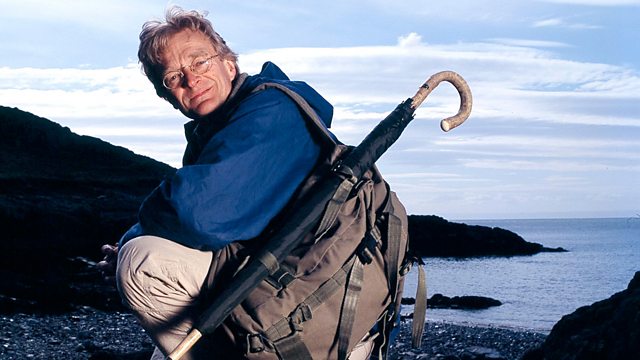
William Mudge's Ordnance Survey Map Man
Similar Content
Browse content similar to William Mudge's Ordnance Survey. Check below for episodes and series from the same categories and more!
Transcript
| Line | From | To | |
|---|---|---|---|
Mist, bogs, | 0:00:08 | 0:00:10 | |
no trees, no tracks, hardly a recognisable feature on the landscape. | 0:00:10 | 0:00:16 | |
This is Dartmoor, the most difficult place to navigate in the whole of Britain. | 0:00:16 | 0:00:22 | |
But imagine trying to cross this place without any maps. | 0:00:22 | 0:00:26 | |
A few hundred years ago, that was the challenge facing an intrepid team of | 0:00:33 | 0:00:37 | |
map makers who laid the foundations for today's Ordnance Survey maps. | 0:00:37 | 0:00:42 | |
One of their earliest surveys took place here in Devon, and the reason for it was war. | 0:00:45 | 0:00:50 | |
In 1793, France had declared war and invasion seemed imminent. | 0:00:50 | 0:00:55 | |
The Army desperately needed maps to plan for the nation's defence, so who would take on a that massive task? | 0:00:55 | 0:01:02 | |
Step into the breach, Lieutenant Colonel William Mudge, | 0:01:05 | 0:01:09 | |
the man who would lead the Ordnance Survey to greatness. | 0:01:09 | 0:01:12 | |
What I want to know is, are Mudge's maps truly accurate? | 0:01:14 | 0:01:20 | |
Was defence really their only purpose? | 0:01:20 | 0:01:23 | |
And can these classic maps be used to navigate across the modern British landscape? | 0:01:23 | 0:01:28 | |
The first edition of the Ordnance Survey | 0:01:56 | 0:01:59 | |
was the product of the most complete mapping exercise of Britain since the Tudors. | 0:01:59 | 0:02:03 | |
For the first time in our history, there were maps linking county to county which covered the entire land | 0:02:03 | 0:02:10 | |
based on a scale of one inch to the mile. | 0:02:10 | 0:02:12 | |
The OS as we know it was the creation of Devonian William Mudge, | 0:02:14 | 0:02:19 | |
who in 1791, was a 29 year-old lieutenant put in charge of this epic mapping survey. | 0:02:19 | 0:02:24 | |
The end of the 18th century was a bad time for Britain. | 0:02:27 | 0:02:31 | |
The American colonies had just been lost and Napoleon's forces were sweeping across Europe. | 0:02:31 | 0:02:36 | |
French spies had already surveyed southern England's vulnerable beaches | 0:02:36 | 0:02:40 | |
and harbours and Napoleon's fleet was on standby to attack Britain's red-coated troops. | 0:02:40 | 0:02:46 | |
One unlikely landing point - Ilfracombe, on Devon's north coast. | 0:02:46 | 0:02:53 | |
The story goes that the women of the town took matters into their own hands. | 0:02:53 | 0:02:56 | |
Removing their red petticoats, they draped them around their shoulders | 0:02:56 | 0:03:00 | |
and paraded on that hill over there and on the fields around the harbour. | 0:03:00 | 0:03:04 | |
These British femme fatale hoped that by creating cliffs of crimson, | 0:03:04 | 0:03:08 | |
the French Navy would think they were facing the British Redcoats. And it worked. | 0:03:08 | 0:03:14 | |
The French sank a couple of Ilfracombe boats. | 0:03:16 | 0:03:19 | |
But faced with what seemed to be the vanguard of the Redcoat Army, | 0:03:19 | 0:03:23 | |
they thought better of landing and sailed away. | 0:03:23 | 0:03:26 | |
Quite a force to be reckoned with, those Ilfracombe ladies! | 0:03:26 | 0:03:29 | |
This near miss was an alarming wake-up call and so, two centuries ago, | 0:03:31 | 0:03:36 | |
mapping Britain's invasion coasts became a top priority. | 0:03:36 | 0:03:42 | |
I'm going to make a journey all the way across Devon | 0:03:47 | 0:03:50 | |
from Ilfracombe on the north coast to Start Point on the south coast. | 0:03:50 | 0:03:53 | |
I'll be following in the footsteps of Mudge's surveyors, crossing treacherous sea channels, dealing | 0:03:53 | 0:03:59 | |
with a maze of lanes and confusing countryside and navigating my way across the bleak heights of Dartmoor. | 0:03:59 | 0:04:06 | |
And my journey's end, Devon's invasion beaches. | 0:04:06 | 0:04:10 | |
Responsibility for mapping the entire country fell to the Board of | 0:04:22 | 0:04:25 | |
Ordnance, set up to supply the Army and maintain national defences. | 0:04:25 | 0:04:30 | |
Their map survey began by accurately measuring a single line, then plotting two | 0:04:32 | 0:04:37 | |
more lines to make a triangle, then using these three lines to be the basis for three more triangles. | 0:04:37 | 0:04:43 | |
And so on. Once Mudge had created this network of huge interconnecting | 0:04:43 | 0:04:47 | |
triangles, the second and third surveys filled in the grid. | 0:04:47 | 0:04:51 | |
Then, after this third stage, the finer features like roads, rivers | 0:04:51 | 0:04:55 | |
and bays were mapped and added to the triangulated grid. | 0:04:55 | 0:04:58 | |
I'm going to follow in Mudge's footsteps by surveying the strategic Skerne Bay at Appledore. | 0:05:01 | 0:05:08 | |
I'll be assisted by the Royal Engineers, whose predecessors helped on the original survey. | 0:05:08 | 0:05:13 | |
We'll be using equipment from that era. | 0:05:13 | 0:05:16 | |
No modern gadgets like GPS or laser sights for us. | 0:05:16 | 0:05:19 | |
First, we need to establish where we are in the bigger picture in relation to one of Mudge's known trig points. | 0:05:41 | 0:05:47 | |
I'm going to conduct what's called a closed traverse survey and it works like this. | 0:05:50 | 0:05:53 | |
I'm standing at Appledore right here and I can see a bay curving around | 0:05:53 | 0:05:58 | |
roughly like this to a headland over here. | 0:05:58 | 0:06:01 | |
With the help of the Royal Engineers, I'm going to place a series of staffs | 0:06:01 | 0:06:06 | |
at intervals around the edge of the bay. I'm going to measure the distances between those staffs | 0:06:06 | 0:06:10 | |
and the angles between them until I get to the very end of the bay here where the headland is. | 0:06:10 | 0:06:16 | |
From there, I take a final angle reading back across the bay | 0:06:16 | 0:06:19 | |
to my first staff here and close the traverse. I can then draw my map. | 0:06:19 | 0:06:24 | |
Let's put this theodolite together. | 0:06:24 | 0:06:26 | |
Lance Corporal Anderson is dispatching his men. | 0:06:28 | 0:06:32 | |
First, staff bearer John, to move from position A, to position B. | 0:06:32 | 0:06:37 | |
Then, the measuring team to determine the distances between the sightingstaffs | 0:06:37 | 0:06:42 | |
with an antique set of precision chains. | 0:06:42 | 0:06:45 | |
If you walk along it every 10ft or so, | 0:06:45 | 0:06:49 | |
there will be a marker telling you the actual distance from the end. | 0:06:49 | 0:06:53 | |
But you've got to pull it tight first? | 0:06:53 | 0:06:55 | |
-Yes, it's got to be mega tight. -I'm using a 200 year-old theodolite | 0:06:55 | 0:06:59 | |
and the first angle I'm taking is from north round to Mudge's trig point | 0:06:59 | 0:07:04 | |
at the telegraph pole on Fort Hill. | 0:07:04 | 0:07:06 | |
And the reading of that... | 0:07:08 | 0:07:12 | |
283. | 0:07:12 | 0:07:14 | |
Now, to take our second reading. | 0:07:17 | 0:07:19 | |
These first two positions are critical | 0:07:19 | 0:07:21 | |
to fix and lock all our readings to fit in with Mudge's original grid. | 0:07:21 | 0:07:26 | |
And that is 113. | 0:07:27 | 0:07:29 | |
We've got to move the theodolite to where the staff man is on point B. | 0:07:29 | 0:07:35 | |
But leaving the staff man here | 0:07:35 | 0:07:38 | |
-and then we'll move John further on. -It sounds complicated, but it's dead simple really, isn't it? | 0:07:38 | 0:07:43 | |
If you're not completely accurate, then nothing will tie in. | 0:07:43 | 0:07:46 | |
So you've just got a load of maps that are just basically drawings. No use to man nor beast. | 0:07:46 | 0:07:51 | |
-So a map becomes a drawing if you've got a mistake in it? -Yes, exactly. | 0:07:51 | 0:07:54 | |
The task facing Mudge's men on the detailed survey | 0:07:57 | 0:08:00 | |
to map every feature of the landscape, seems impossibly daunting. | 0:08:00 | 0:08:04 | |
Finally, to close the traverse across the other side of the bay. | 0:08:21 | 0:08:24 | |
This time, I turn around and measure back to where we started. | 0:08:24 | 0:08:29 | |
-Is John still there? -Look at the left-hand side window | 0:08:29 | 0:08:33 | |
and just come down from the left-hand side edge of that window. | 0:08:33 | 0:08:37 | |
Got him. | 0:08:37 | 0:08:38 | |
Final reading, back to our very first staff is 75. | 0:08:38 | 0:08:43 | |
That's it. Closed a traverse. | 0:08:43 | 0:08:47 | |
We've now surveyed the entire bay, double-checked the first and last positions. | 0:08:47 | 0:08:51 | |
It's taken hours. | 0:08:51 | 0:08:53 | |
Just imagine what it was like doing the entire coast. | 0:08:53 | 0:08:58 | |
A nice cup of tea. | 0:08:58 | 0:08:59 | |
The scale of Mudge's surveying achievement is mind-boggling. | 0:09:02 | 0:09:06 | |
Once finished, Mudge's priority was to get the maps published and distributed as fast as possible. | 0:09:06 | 0:09:13 | |
This is not a pretty map. | 0:09:17 | 0:09:19 | |
It's undecorated, uncoloured and it doesn't even have a border on it. | 0:09:19 | 0:09:24 | |
It's entirely a practical and totally utilitarian, functional military map. | 0:09:24 | 0:09:30 | |
It's drawn to a scale of one inch to the mile. | 0:09:30 | 0:09:34 | |
It's the optimum scale for the human eye to absorb a vast expanse of landscape. | 0:09:34 | 0:09:41 | |
The most important thing a military man needs to know | 0:09:41 | 0:09:45 | |
is the relief - the hills, valleys and after that the communications. | 0:09:45 | 0:09:50 | |
The hills are very, very clearly shown by hashers. | 0:09:50 | 0:09:53 | |
These hashers might look like ordinary black lines but they're not. | 0:09:53 | 0:09:58 | |
They're thinner at each end and thicker in the middle. They're also wiggly. | 0:09:58 | 0:10:02 | |
It's to give an impression of a hill starting on a gentle gradient, | 0:10:02 | 0:10:06 | |
steepening and then flattening out on top of the hill. | 0:10:06 | 0:10:08 | |
The rivers between them are very clearly marked and the river valleys, so you get an immediate | 0:10:08 | 0:10:12 | |
impression of what bits of landscape are going to be easy to march across, | 0:10:12 | 0:10:15 | |
where you could set an ambush, where you might expect enemy troops to approach in from the coast. | 0:10:15 | 0:10:22 | |
This is primarily a road map. | 0:10:22 | 0:10:24 | |
The turnpike roads are shown with a thicker black line on one side of the other. | 0:10:24 | 0:10:29 | |
The ordinary country roads are shown as a pair of parallel lines, the same density of ink on both sides. | 0:10:29 | 0:10:34 | |
The smallest roads of all, the unfenced ones, are shown with a very thin pecked line along each side. | 0:10:34 | 0:10:41 | |
Although this is, of course, a military map, the surveyors | 0:10:41 | 0:10:44 | |
who made it couldn't resist including some non-military features. | 0:10:44 | 0:10:48 | |
Down here in the southern part of Dartmoor, we've got some Bronze Age hut circles here. | 0:10:48 | 0:10:55 | |
An ancient cross up here. | 0:10:55 | 0:10:58 | |
Down here, there's some Bronze Age barrows - it's a chink in the armour | 0:10:58 | 0:11:03 | |
of this relentlessly military survey - a hint at what this map would eventually become. | 0:11:03 | 0:11:08 | |
In the long run, the OS map would become the standard for military and civilian alike. | 0:11:10 | 0:11:15 | |
Tomorrow, I plan to test out just how accurate the surveying team were back | 0:11:15 | 0:11:20 | |
in the early 1800s, before I take on a really difficult challenge. | 0:11:20 | 0:11:25 | |
Crossing Dartmoor. | 0:11:25 | 0:11:27 | |
I'm climbing Codden Hill. | 0:11:45 | 0:11:47 | |
It's the most dramatic viewpoint in this part of North Devon. | 0:11:47 | 0:11:51 | |
It was also one of the triangulation points used by Mudge during his survey. | 0:11:51 | 0:11:55 | |
It's easy to see why. | 0:11:55 | 0:11:57 | |
I can see all the way south, over the Taw valley to the heights of Dartmoor, 25 miles away. | 0:11:57 | 0:12:04 | |
I'm going to try and stay as close as possible to this long red straight line on Mudge's map. | 0:12:06 | 0:12:12 | |
On the way, I'm going to try and locate a number of small and fairly obscure features. | 0:12:12 | 0:12:17 | |
It's going to be a real test of Mudge and a real test for me. | 0:12:17 | 0:12:21 | |
Before setting off, I've arranged to meet archaeologist Candy Hatherley | 0:12:24 | 0:12:28 | |
to help me look for clues in interpreting Mudge's map. | 0:12:28 | 0:12:31 | |
If I was going to make a journey across this map, | 0:12:31 | 0:12:34 | |
and I wanted to pick up particular features marked on it which may have disappeared over the last 200 years, | 0:12:34 | 0:12:39 | |
what are the kind of clues I'd be looking for? | 0:12:39 | 0:12:42 | |
For structures, for example, something like a mill. | 0:12:42 | 0:12:45 | |
If you went to the river, you may see a dam or a weir running to the mill. | 0:12:45 | 0:12:49 | |
When you've got to the structure itself, there would be a mill or farmhouse. | 0:12:49 | 0:12:53 | |
There may be stones left, the stone walls may be remaining. | 0:12:53 | 0:12:57 | |
If not, there may be a lump in the ground. A piece of raised ground. | 0:12:57 | 0:13:01 | |
So if you see an anomaly in the landscape, a path to nowhere, something like that, | 0:13:01 | 0:13:06 | |
then you know that there could be a feature there that's disappeared. | 0:13:06 | 0:13:10 | |
Potentially. Looking from the map, the map evidence shows something on site and then you go there | 0:13:10 | 0:13:15 | |
and there's nothing remaining, but you have these clues. | 0:13:15 | 0:13:18 | |
The evidence that's leading towards the structure that's actually no longer there on the ground. | 0:13:18 | 0:13:23 | |
Mudge's map was a snapshot of the landscape of the time. | 0:13:36 | 0:13:40 | |
But 200 years later, lots will have changed. | 0:13:40 | 0:13:43 | |
Buildings will have crumbled, forests expanded or contracted, | 0:13:43 | 0:13:46 | |
all conspiring to make my task more difficult. | 0:13:46 | 0:13:51 | |
But not as difficult as Mudge's men found their part in the surveying project. | 0:13:51 | 0:13:55 | |
Armed with the latest surveying equipment they stood out in the sleepy part of the country. | 0:13:55 | 0:14:00 | |
They were challenged and threatened by locals who mistook them for French spies. | 0:14:00 | 0:14:04 | |
Unfortunately, their outfitters had made their uniforms the same shade of blue as the French Army. | 0:14:04 | 0:14:10 | |
So the surveyors were obliged to carry warrants that explained who they were and what they were doing. | 0:14:10 | 0:14:15 | |
But my mission is to spot-check the features on the red line | 0:14:17 | 0:14:21 | |
which crosses a track running through a wood. | 0:14:21 | 0:14:23 | |
Inside the wood, the line meets a water mill which sits by a river. | 0:14:23 | 0:14:28 | |
First real test of this map, and I'm not sure whether it's going to pass or not, | 0:14:34 | 0:14:39 | |
is whether I can find the track running beside this small wood and field. | 0:14:39 | 0:14:44 | |
The field I think I'm in right now. | 0:14:44 | 0:14:46 | |
The trouble is this is a very large wood. | 0:14:46 | 0:14:48 | |
It might have got much bigger over the last two centuries and I can see | 0:14:48 | 0:14:51 | |
absolutely no sign whatsoever of a track. | 0:14:51 | 0:14:54 | |
I think I'm going to have to take a closer look. | 0:14:54 | 0:14:58 | |
Well, now I'm in this wood, things are starting to look up for the map. | 0:15:03 | 0:15:08 | |
These trees are youngish conifers | 0:15:08 | 0:15:11 | |
and they haven't been here for that many years. | 0:15:11 | 0:15:13 | |
The wood has clearly got much, much bigger since 1809. | 0:15:13 | 0:15:16 | |
This looks good. | 0:15:19 | 0:15:21 | |
This is what looks like | 0:15:21 | 0:15:23 | |
an old track and also the woods change. | 0:15:23 | 0:15:26 | |
This is a broadleaf wood and, look at this, there's a stump here of an old broadleaf tree. | 0:15:26 | 0:15:31 | |
So this is a very old wood. The trackway is very clear. | 0:15:31 | 0:15:35 | |
We've got an embankment on this side. | 0:15:35 | 0:15:38 | |
High bank on that side, and just over there, is the field that it should be running beside. | 0:15:38 | 0:15:44 | |
And a track, so that's right. | 0:15:44 | 0:15:46 | |
Now for that mill which should be near a river. | 0:15:49 | 0:15:52 | |
I've been in this wood for ages. | 0:15:57 | 0:15:59 | |
But I'm starting to think that I must have wandered off course. | 0:15:59 | 0:16:03 | |
What's this? Look at this. | 0:16:05 | 0:16:07 | |
There's a ford. This ford is on the map. | 0:16:07 | 0:16:11 | |
So now I know where I am. | 0:16:11 | 0:16:13 | |
So, having overshot and gone slightly off course, | 0:16:13 | 0:16:17 | |
I've turned around to head back up the valley. | 0:16:17 | 0:16:20 | |
If I go back up the valley and here's the mill leat, | 0:16:20 | 0:16:24 | |
the mill leat should be a channel full of water that fed the mill. | 0:16:24 | 0:16:29 | |
The key to finding the mill, which may not have withstood the ravages of time, is finding the leat. | 0:16:29 | 0:16:35 | |
A man-made channel which would have fed it with water. | 0:16:35 | 0:16:38 | |
Eureka, water. | 0:16:49 | 0:16:51 | |
This might look like a woodland stream, but it isn't, it's man-made. | 0:16:53 | 0:16:56 | |
It's an old canal running parallel with the contours along the hillside. | 0:16:56 | 0:17:01 | |
I'll eat my umbrella if there's not a mill up there. | 0:17:01 | 0:17:04 | |
I can't believe it. There's a wall crossing the mill leat here. | 0:17:14 | 0:17:19 | |
Look. | 0:17:19 | 0:17:20 | |
Why is that wall crossing the mill leat if it's not part of the mill? | 0:17:24 | 0:17:28 | |
This part of the leat's trebled in size, it's massive. | 0:17:28 | 0:17:31 | |
There's a huge pool here, or was. | 0:17:31 | 0:17:33 | |
This is the mill. You can't see much now. | 0:17:33 | 0:17:36 | |
It looks just like a boggy puddle, but this is definitely the mill. Just where the map said it would be. | 0:17:36 | 0:17:41 | |
It doesn't do to doubt Mudge, it really doesn't. | 0:17:43 | 0:17:46 | |
So, Mudge has delivered among the thickly wooded hills of North Devon. | 0:17:49 | 0:17:54 | |
But tomorrow is another day. | 0:17:54 | 0:17:56 | |
And a much more daunting and dangerous one for his map and for me. | 0:17:56 | 0:18:01 | |
I'll be facing the ultimate test - alone on the featureless and expansive wilderness of Dartmoor. | 0:18:01 | 0:18:08 | |
This is Dartmoor. | 0:18:24 | 0:18:27 | |
Yesterday was a successful day for my straight line test of the map, but Dartmoor is a bleak and testing | 0:18:27 | 0:18:33 | |
landscape, dotted by occasional granite outcrops called tors. | 0:18:33 | 0:18:38 | |
It's a notoriously unfriendly training ground for Britain's fighting forces. | 0:18:38 | 0:18:44 | |
So how well was it mapped by Mudge? | 0:18:44 | 0:18:47 | |
There's something gone wrong with the map up here. | 0:18:49 | 0:18:53 | |
The tor's in the right place but the moor each side doesn't correspond with the map. | 0:18:53 | 0:19:00 | |
I can't believe that much is wrong, but something's not right. | 0:19:00 | 0:19:05 | |
I'm going to have to go and take a closer look at the moor. | 0:19:05 | 0:19:08 | |
The problem on the map is that | 0:19:13 | 0:19:16 | |
it shows a stream that seems to circle the whole of High Willows, turning it into an island. | 0:19:16 | 0:19:22 | |
There's no such thing of a river that goes in a full circle ahead of a river that joins its own tail. | 0:19:22 | 0:19:27 | |
Well I've reached the bed of the river valley on the east side of the tor. | 0:19:40 | 0:19:47 | |
Not much water to be seen, but there is a line of reeds flowing down the valley in that direction. | 0:19:47 | 0:19:54 | |
You can clearly see the two slopes of the valley, just as the map says. | 0:19:54 | 0:19:59 | |
No sign of water. | 0:19:59 | 0:20:01 | |
I can hear water though. | 0:20:01 | 0:20:03 | |
Yes, down here. | 0:20:05 | 0:20:07 | |
There's water under the ground. | 0:20:12 | 0:20:14 | |
I can feel it. It's quite deep water. | 0:20:14 | 0:20:17 | |
Its fast-flowing. Look at that, | 0:20:17 | 0:20:19 | |
flowing that way. | 0:20:19 | 0:20:21 | |
So, if I follow the reeds in that direction against the flow of the water, | 0:20:21 | 0:20:27 | |
with a bit of luck, I'll find out what the problem is with this map. | 0:20:27 | 0:20:31 | |
I've followed the river bed for as far as I can. | 0:20:44 | 0:20:47 | |
But it's just run out. | 0:20:47 | 0:20:50 | |
Instead of a river, there's a great mountain of moorland in the way. | 0:20:50 | 0:20:54 | |
If that river really existed, there'd have to be a 100ft deep ravine right where I'm standing. But there isn't. | 0:20:54 | 0:21:01 | |
There's just this huge ridge of moorland. | 0:21:01 | 0:21:04 | |
I've never, ever seen such a huge mistake on an Ordnance Survey map. | 0:21:04 | 0:21:11 | |
Mudge's surveyors got it really badly wrong. | 0:21:11 | 0:21:15 | |
It was hardly surprising. | 0:21:15 | 0:21:18 | |
Dartmoor's landscape is riddled with bogs, peat swamps and false summits. | 0:21:18 | 0:21:24 | |
On top of that, the moor can play strange tricks on the relative | 0:21:24 | 0:21:27 | |
heights of large features, or where the horizon is, or even which way's up. | 0:21:27 | 0:21:33 | |
Oh, and then there's the weather. | 0:21:33 | 0:21:35 | |
Before I go any further, I've arranged to meet Colonel Tony Clark, | 0:21:44 | 0:21:48 | |
Commandant of Okehampton Camp here on Dartmoor. | 0:21:48 | 0:21:52 | |
He's trained forces personnel on the moor for over 20 years. | 0:21:52 | 0:21:56 | |
So if anyone can tell me what's going on up here, it should be him. | 0:21:56 | 0:22:00 | |
Why is it that Dartmoor has such a terrible reputation for navigation? | 0:22:03 | 0:22:07 | |
Well when they produced this map, the points on which they did | 0:22:07 | 0:22:11 | |
their surveying were quite a long distance apart. | 0:22:11 | 0:22:15 | |
I think there was one over here on Cosden Beacon | 0:22:15 | 0:22:17 | |
and the next one was right over here on the far side of the moor. | 0:22:17 | 0:22:21 | |
So in between, the room for mathematical area was quite great. | 0:22:21 | 0:22:24 | |
When they were doing the trigometrical surveys, if they found an error, they shoved it into a big | 0:22:24 | 0:22:29 | |
open space and Dartmoor is mapped at a lower scale than the surrounding area because there's nothing to see. | 0:22:29 | 0:22:38 | |
So this is to do with the lowest level of accuracy up here than there | 0:22:38 | 0:22:42 | |
-would be for the farmland around the edge of the moor. -Absolutely right. | 0:22:42 | 0:22:45 | |
The town and country planning maps are of a greater accuracy than the | 0:22:45 | 0:22:48 | |
ones you get here or indeed in the Highlands of Scotland. | 0:22:48 | 0:22:51 | |
How do you recommend I travel using this old map? | 0:22:53 | 0:22:57 | |
Use a compass because at least if you're using a compass, you're going to be roughly on the right bearing. | 0:22:57 | 0:23:04 | |
But, that's also going to give you probably the worst route. | 0:23:04 | 0:23:06 | |
So, you're going to want to have your compass as a back-up and follow around the shape of the land. | 0:23:06 | 0:23:13 | |
That way, you will find it by far the easiest way to get through. | 0:23:13 | 0:23:16 | |
You can get into some difficulties here - the bogs, the mires as we call them. | 0:23:16 | 0:23:22 | |
If your first footstep goes up to your ankle | 0:23:22 | 0:23:24 | |
and your second footstep's up to your knee, then make sure your third step's backwards. | 0:23:24 | 0:23:28 | |
Right. I'll remember that. | 0:23:28 | 0:23:30 | |
Colonel, thank you very much. I feel cautiously optimistic. | 0:23:30 | 0:23:33 | |
Any final word of advice before I set off into the murk? | 0:23:33 | 0:23:37 | |
Pray. | 0:23:37 | 0:23:40 | |
Thank you very much. Colonel Clarke is sure that we can | 0:23:40 | 0:23:42 | |
trust the accuracy of the high points on the map. | 0:23:42 | 0:23:45 | |
So I'm going to use the hilltops as markers on a route across this wasteland. | 0:23:45 | 0:23:50 | |
From the summit of Dartmoor, High Willows to Lints Tor to Great Nieset | 0:23:54 | 0:23:59 | |
and thence to Cranmere Pool. | 0:23:59 | 0:24:02 | |
Cranmere Pool is the most remote point on Dartmoor. | 0:24:04 | 0:24:07 | |
The isolation of Cranmere Pool has given it almost mythical status and as it means, | 0:24:12 | 0:24:17 | |
the pool frequented by cranes, I feel particularly drawn to it. | 0:24:17 | 0:24:22 | |
Let's hope that I can frequent it myself well before nightfall. | 0:24:22 | 0:24:26 | |
Now, the distance from where I am now to Lints Tor is... | 0:24:26 | 0:24:30 | |
..one-and-a-quarter inches, | 0:24:33 | 0:24:35 | |
so at this scale of map, that makes it one-and-a-quarter miles. | 0:24:35 | 0:24:39 | |
The direction is pretty much due south. So if I use my antique compass | 0:24:39 | 0:24:45 | |
I can find that | 0:24:45 | 0:24:47 | |
Lints Tor | 0:24:47 | 0:24:49 | |
must be that black outcrop sticking up on the crest of the hill down there. | 0:24:49 | 0:24:55 | |
You're not just timing yourself over a measured distance to make sure you don't overshoot, but you're also | 0:24:57 | 0:25:04 | |
trying not to deviate from your bearing which means going straight through bogs like this one here. | 0:25:04 | 0:25:11 | |
If the bog's too deep or wide, you can make a detour around the outside of it. | 0:25:11 | 0:25:15 | |
But then you've got to somehow regain your bearing on the far side | 0:25:15 | 0:25:19 | |
and the risk is that you miss your landmark at the far end. | 0:25:19 | 0:25:24 | |
This is Great Niset. | 0:25:27 | 0:25:30 | |
I've got nine-tenths of a mile to go to get to Cranmere Pool across | 0:25:30 | 0:25:33 | |
the huge undulating, boggy plateau. Cranmere Pool's just a tiny puddle. | 0:25:33 | 0:25:38 | |
My navigation's going to have to be spot on if I'm not going to get lost. | 0:25:38 | 0:25:42 | |
It's going to take about 28 minutes. | 0:25:42 | 0:25:44 | |
The weather's closing in, it's cold, windy and it'll be dark soon. | 0:25:44 | 0:25:48 | |
I really don't want to spend a night out. | 0:25:48 | 0:25:51 | |
I'm continually being | 0:25:59 | 0:26:02 | |
thrown off course and so as I'm walking along, I'm trying to compute | 0:26:02 | 0:26:08 | |
how many minutes to add on | 0:26:08 | 0:26:11 | |
to my...the 28 minutes I'd estimated to cover the... | 0:26:11 | 0:26:15 | |
nine-tenths of a mile. | 0:26:15 | 0:26:18 | |
Well, my watch says... | 0:26:23 | 0:26:26 | |
two and a half minutes. Well, that's so close now that I ought to start looking | 0:26:26 | 0:26:31 | |
around here for Cranmere Pool. | 0:26:31 | 0:26:33 | |
I think I can see a little glint of light. | 0:26:33 | 0:26:38 | |
I'm hoping this might be it. | 0:26:38 | 0:26:40 | |
It is. | 0:26:44 | 0:26:46 | |
This, believe it or not, is Cranmere Pool. | 0:26:46 | 0:26:50 | |
The pool frequented by cranes. | 0:26:53 | 0:26:55 | |
It's not a lake, | 0:26:55 | 0:26:58 | |
it's not even a pool. | 0:26:58 | 0:26:59 | |
You couldn't even have a bath in it. | 0:26:59 | 0:27:03 | |
That's Cranmere Pool. | 0:27:03 | 0:27:04 | |
What an amazing place! | 0:27:07 | 0:27:10 | |
Mudge's map brought me safely across this desolate landscape here to Cranmere Pool. | 0:27:10 | 0:27:16 | |
Wilderness like this is almost unknown in England. | 0:27:16 | 0:27:19 | |
But let's not forget that Mudge's main mission was a military one and that included our vulnerable | 0:27:24 | 0:27:30 | |
invasion beaches so that we could defend ourselves from the French. | 0:27:30 | 0:27:34 | |
Made it! Start Point! | 0:27:39 | 0:27:41 | |
There's the English Channel, France is over there and that | 0:27:41 | 0:27:45 | |
great sweeping arc of sheltered water is Start Bay, the soft underbelly of South West England. | 0:27:45 | 0:27:52 | |
Start Bay has a series of the most perfect invasion beaches in the South West. | 0:27:52 | 0:27:58 | |
Mudge's pioneering work meant that the British could at last | 0:27:58 | 0:28:01 | |
face the threat of foreign invasion from a position of strength. | 0:28:01 | 0:28:05 | |
Secure in the knowledge of finally knowing their own backyard. | 0:28:05 | 0:28:10 | |
And it was only by knowing every nook and cranny of the land, that England could be defended. Thanks to Mudge. | 0:28:10 | 0:28:17 | |
The French never did invade. | 0:28:17 | 0:28:20 | |
Mudge's military maps went on to open up the countryside for the people. | 0:28:20 | 0:28:24 | |
Our modern Ordnance Survey maps are direct descendants of Mudge's vision. | 0:28:24 | 0:28:28 | |
Britain mapped in its entirety - a legacy to the nation. | 0:28:28 | 0:28:33 | |
E-mail us at [email protected] | 0:28:38 | 0:28:42 |